Lynchburg Topo Map South Carolina
To zoom in, hover over the map of Lynchburg
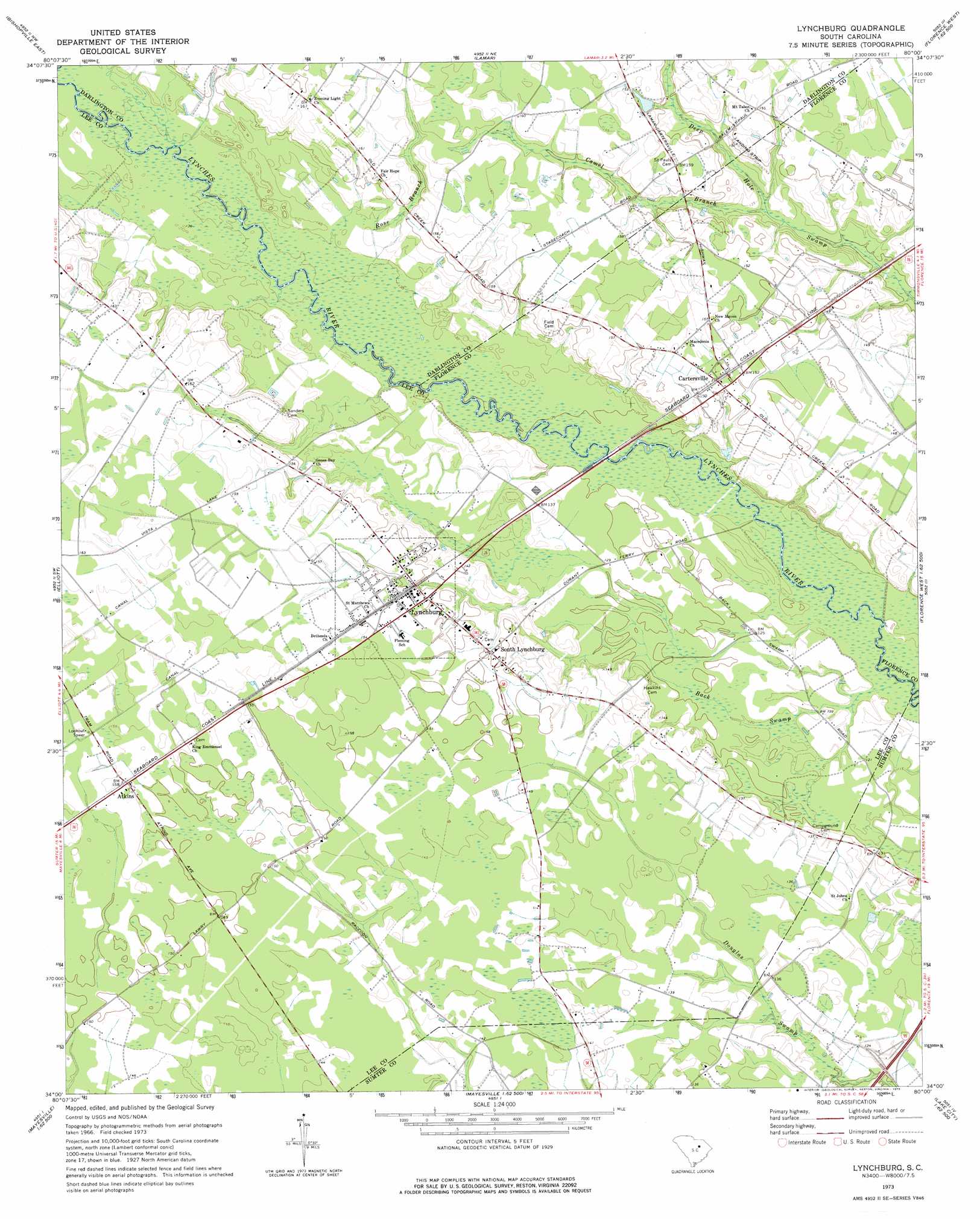
USGS Topo Quad 34080a1 - 1:24,000 scale
| Topo Map Name: | Lynchburg |
| USGS Topo Quad ID: | 34080a1 |
| Print Size: | ca. 21 1/4" wide x 27" high |
| Southeast Coordinates: | 34° N latitude / 80° W longitude |
| Map Center Coordinates: | 34.0625° N latitude / 80.0625° W longitude |
| U.S. State: | SC |
| Filename: | o34080a1.jpg |
| Download Map JPG Image: | Lynchburg topo map 1:24,000 scale |
| Map Type: | Topographic |
| Topo Series: | 7.5´ |
| Map Scale: | 1:24,000 |
| Source of Map Images: | United States Geological Survey (USGS) |
| Alternate Map Versions: |
Lynchburg SC 2011 Download PDF Buy paper map Lynchburg SC 2014 Download PDF Buy paper map |
1:24,000 Topo Quads surrounding Lynchburg
Lucknow |
Kellytown |
Hartsville South |
Darlington West |
Darlington East |
Bishopville West |
Bishopville East |
Lamar |
Timmonsville |
Florence West |
Oswego |
Elliott |
Lynchburg |
Sardis |
Effingham |
Sumter East |
Mayesville |
Turbeville |
Olanta |
Mill Bay |
Brogdon |
Tearcoat Branch |
Sardinia |
Hebron Crossroads |
Lake City West |
> Back to 34080a1 at 1:100,000 scale
> Back to 34080a1 at 1:250,000 scale
> Back to U.S. Topo Maps home
Lynchburg topo map: Gazetteer
Lynchburg: Bridges
Sanders Bridge (historical) elevation 38m 124′Lynchburg: Crossings
Byrds Ferry (historical) elevation 38m 124′Durants Ferry (historical) elevation 36m 118′
Lynchburg: Populated Places
Atkins elevation 47m 154′Cartersville elevation 47m 154′
Lynchburg elevation 46m 150′
South Lynchburg elevation 45m 147′
Lynchburg: Streams
Back Swamp elevation 35m 114′Camel Branch elevation 39m 127′
Rose Branch elevation 40m 131′
Lynchburg digital topo map on disk
Buy this Lynchburg topo map showing relief, roads, GPS coordinates and other geographical features, as a high-resolution digital map file on DVD:
South Carolina, Western North Carolina & Northeastern Georgia
Buy digital topo maps: South Carolina, Western North Carolina & Northeastern Georgia