Wilkinsville Topo Map South Carolina
To zoom in, hover over the map of Wilkinsville
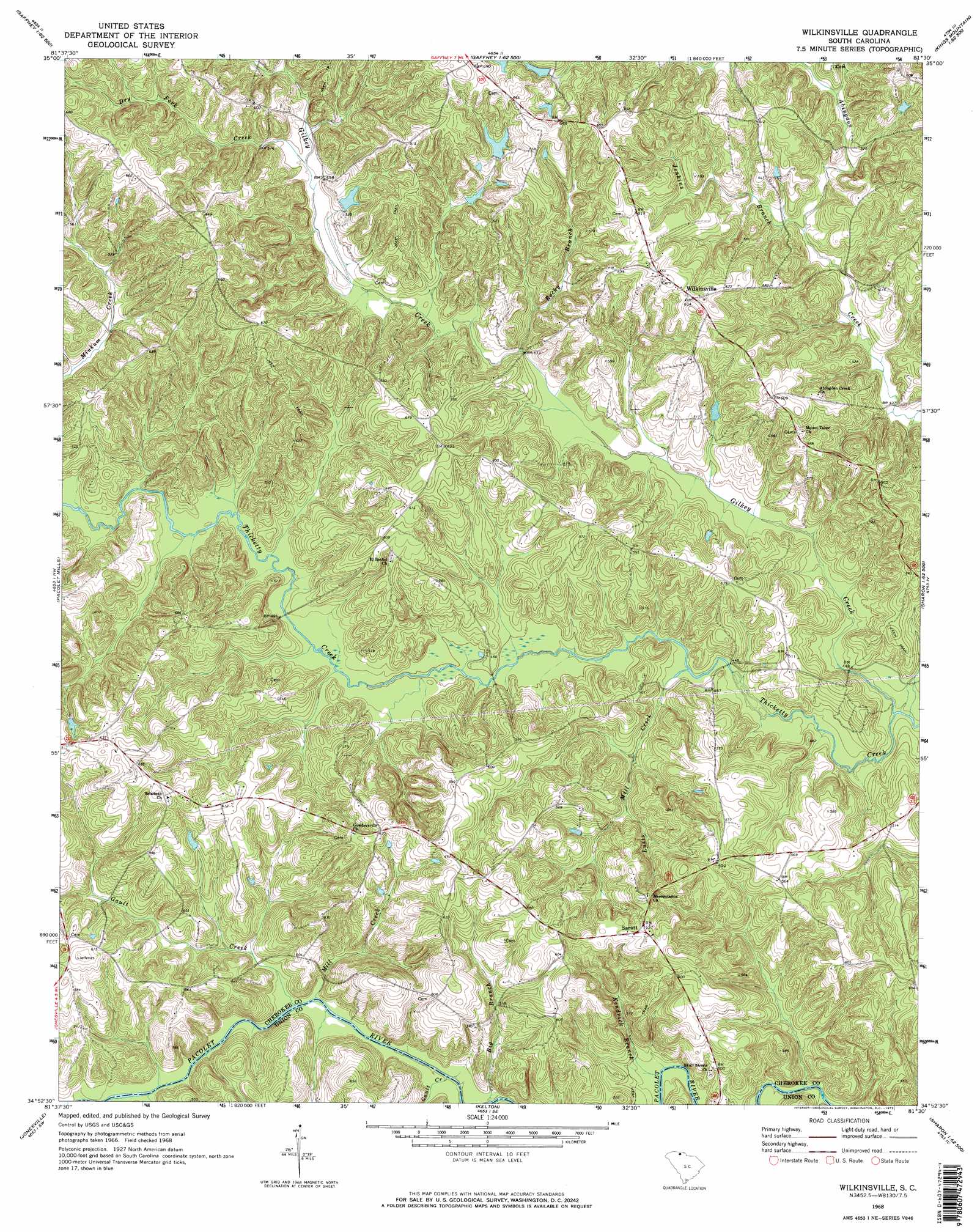
USGS Topo Quad 34081h5 - 1:24,000 scale
| Topo Map Name: | Wilkinsville |
| USGS Topo Quad ID: | 34081h5 |
| Print Size: | ca. 21 1/4" wide x 27" high |
| Southeast Coordinates: | 34.875° N latitude / 81.5° W longitude |
| Map Center Coordinates: | 34.9375° N latitude / 81.5625° W longitude |
| U.S. State: | SC |
| Filename: | o34081h5.jpg |
| Download Map JPG Image: | Wilkinsville topo map 1:24,000 scale |
| Map Type: | Topographic |
| Topo Series: | 7.5´ |
| Map Scale: | 1:24,000 |
| Source of Map Images: | United States Geological Survey (USGS) |
| Alternate Map Versions: |
Wilkinsville SC 1968, updated 1973 Download PDF Buy paper map Wilkinsville SC 1968, updated 1973 Download PDF Buy paper map Wilkinsville SC 2011 Download PDF Buy paper map Wilkinsville SC 2014 Download PDF Buy paper map |
1:24,000 Topo Quads surrounding Wilkinsville
Chesnee |
Boiling Springs South |
Blacksburg North |
Grover |
Kings Mountain |
Cowpens |
Gaffney |
Blacksburg South |
Kings Creek |
Filbert |
Pacolet |
Pacolet Mills |
Wilkinsville |
Hickory Grove |
Sharon |
Glenn Springs |
Jonesville |
Kelton |
Lockhart |
Armenia |
Cross Anchor |
Union West |
Union East |
Leeds |
Baton Rouge |
> Back to 34081e1 at 1:100,000 scale
> Back to 34080a1 at 1:250,000 scale
> Back to U.S. Topo Maps home
Wilkinsville topo map: Gazetteer
Wilkinsville: Dams
South Carolina Noname 11016 D-3419 Dam elevation 179m 587′South Carolina Noname 11020 D-1431 Dam elevation 191m 626′
South Carolina Noname 11021 D-1432 Dam elevation 203m 666′
Wilkinsville: Populated Places
Gowdeysville (historical) elevation 199m 652′Saratt elevation 192m 629′
Wilkinsville elevation 193m 633′
Wilkinsville: Post Offices
Sunny Side Post Office (historical) elevation 163m 534′Wilkinsville: Streams
Big Branch elevation 131m 429′Cartum Branch elevation 155m 508′
Dry Fork Creek elevation 149m 488′
Gault Creek elevation 131m 429′
Gault Creek elevation 132m 433′
Gilkey Creek elevation 127m 416′
Jenkins Branch elevation 136m 446′
Kendrick Branch elevation 129m 423′
Lusts Mill Creek elevation 133m 436′
Mill Creek elevation 133m 436′
Peter Hawk Creek elevation 132m 433′
Rocky Branch elevation 140m 459′
Wilkinsville digital topo map on disk
Buy this Wilkinsville topo map showing relief, roads, GPS coordinates and other geographical features, as a high-resolution digital map file on DVD:
South Carolina, Western North Carolina & Northeastern Georgia
Buy digital topo maps: South Carolina, Western North Carolina & Northeastern Georgia