Snow Topo Map Oklahoma
To zoom in, hover over the map of Snow
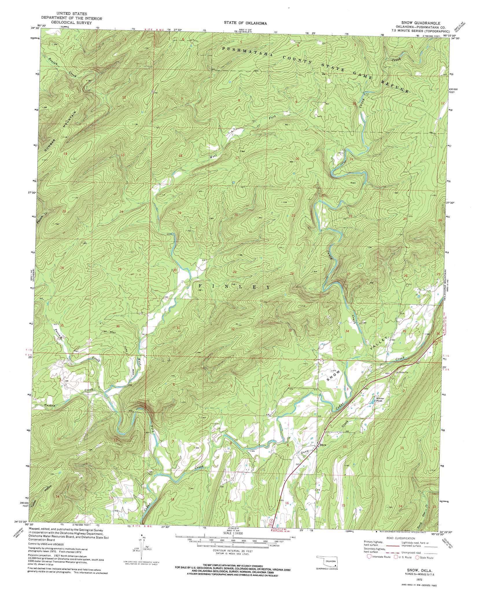
USGS Topo Quad 34095d4 - 1:24,000 scale
| Topo Map Name: | Snow |
| USGS Topo Quad ID: | 34095d4 |
| Print Size: | ca. 21 1/4" wide x 27" high |
| Southeast Coordinates: | 34.375° N latitude / 95.375° W longitude |
| Map Center Coordinates: | 34.4375° N latitude / 95.4375° W longitude |
| U.S. State: | OK |
| Filename: | o34095d4.jpg |
| Download Map JPG Image: | Snow topo map 1:24,000 scale |
| Map Type: | Topographic |
| Topo Series: | 7.5´ |
| Map Scale: | 1:24,000 |
| Source of Map Images: | United States Geological Survey (USGS) |
| Alternate Map Versions: |
Snow OK 1972, updated 1973 Download PDF Buy paper map Snow OK 2010 Download PDF Buy paper map Snow OK 2012 Download PDF Buy paper map Snow OK 2016 Download PDF Buy paper map |
1:24,000 Topo Quads surrounding Snow
Ti |
Counts |
Sardis |
Yanush |
Kiamichi |
Daisy |
Adel |
Stanley |
Clayton |
Albion Sw |
Jumbo |
Dunbar |
Snow |
Wildhorse Mountain |
Nashoba |
Moyers |
Kosoma |
Finley |
Cloudy |
Caney Mountain |
Antlers West |
Antlers East |
Rattan |
Spencerville |
Sobol |
> Back to 34095a1 at 1:100,000 scale
> Back to 34094a1 at 1:250,000 scale
> Back to U.S. Topo Maps home
Snow topo map: Gazetteer
Snow: Populated Places
Snow elevation 166m 544′Snow: Streams
Caney Creek elevation 164m 538′Possum Creek elevation 165m 541′
Snow Creek elevation 152m 498′
Turkey Creek elevation 165m 541′
West Fork elevation 146m 479′
Snow: Summits
Dunbar Mountain elevation 368m 1207′Snow: Valleys
Snow Valley elevation 152m 498′Snow digital topo map on disk
Buy this Snow topo map showing relief, roads, GPS coordinates and other geographical features, as a high-resolution digital map file on DVD: