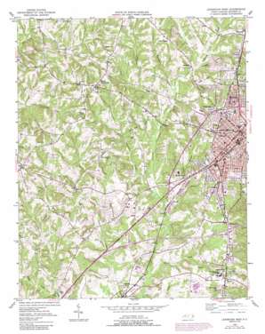
Lexington West Topo Map North Carolina
To zoom in, hover over the map of Lexington West
USGS Topo Quad 35080g3 - 1:24,000 scale
| Topo Map Name: | Lexington West |
| USGS Topo Quad ID: | 35080g3 |
| Print Size: | ca. 21 1/4" wide x 27" high |
| Southeast Coordinates: | 35.75° N latitude / 80.25° W longitude |
| Map Center Coordinates: | 35.8125° N latitude / 80.3125° W longitude |
| U.S. State: | NC |
| Filename: | o35080g3.jpg |
| Download Map JPG Image: | Lexington West topo map 1:24,000 scale |
| Map Type: | Topographic |
| Topo Series: | 7.5´ |
| Map Scale: | 1:24,000 |
| Source of Map Images: | United States Geological Survey (USGS) |
| Alternate Map Versions: |
Lexington West NC 1950, updated 1969 Download PDF Buy paper map Lexington West NC 1950, updated 1987 Download PDF Buy paper map Lexington West NC 1950, updated 1994 Download PDF Buy paper map Lexington West NC 1951 Download PDF Buy paper map Lexington West NC 1977, updated 1979 Download PDF Buy paper map Lexington West NC 2010 Download PDF Buy paper map Lexington West NC 2013 Download PDF Buy paper map Lexington West NC 2016 Download PDF Buy paper map |
1:24,000 Topo Quads surrounding Lexington West
> Back to 35080e1 at 1:100,000 scale
> Back to 35080a1 at 1:250,000 scale
> Back to U.S. Topo Maps home
Lexington West topo map: Gazetteer
Lexington West: Airports
Lexington Municipal Airport elevation 213m 698′Lexington West: Dams
Glossens Lake Number Three Dam elevation 221m 725′Glossons Lake Dam Number One elevation 213m 698′
Glossons Lake Number One Dam elevation 217m 711′
Glossons Lake Number Two Dam elevation 218m 715′
Lingle Lake Dam elevation 217m 711′
Lexington West: Lakes
Craver Lake elevation 242m 793′Lexington West: Parks
Beverly Street Park elevation 227m 744′Childers Park elevation 228m 748′
East Street Park elevation 227m 744′
Fox Avenue Park elevation 229m 751′
Holt-Moffitt Park elevation 232m 761′
J C Park elevation 229m 751′
Northside Park elevation 245m 803′
Radcliff Park elevation 225m 738′
Smith Street Park elevation 225m 738′
Washington Park elevation 218m 715′
West Ninth Avenue Park elevation 234m 767′
Lexington West: Populated Places
Carolina Pines elevation 232m 761′Choyce Acres elevation 237m 777′
Dickerson Estates elevation 242m 793′
Erlanger elevation 243m 797′
Freewood Acres elevation 226m 741′
Georgetown Condominiums elevation 222m 728′
Glenwood elevation 228m 748′
Green Needles elevation 210m 688′
Hillcrest elevation 234m 767′
Jakesville elevation 221m 725′
Kentwood elevation 251m 823′
Lexington elevation 246m 807′
Lineberger Acres elevation 228m 748′
Linwood elevation 200m 656′
Meadowview elevation 227m 744′
Meredith Square elevation 241m 790′
Montclair elevation 227m 744′
Northside elevation 230m 754′
Northside Gardens elevation 226m 741′
Pinecrest elevation 236m 774′
Pleasant Hills elevation 241m 790′
Random Woods elevation 251m 823′
Reeds Crossroads elevation 257m 843′
Rolling Park elevation 219m 718′
Royal Park elevation 226m 741′
Sapona elevation 219m 718′
Sapona Lakes elevation 221m 725′
Tyro elevation 251m 823′
Washington Park elevation 213m 698′
Wescliff elevation 236m 774′
Western Heights elevation 238m 780′
Westover elevation 231m 757′
Westwood elevation 224m 734′
Whitesmith elevation 237m 777′
Woodcrest elevation 239m 784′
Lexington West: Reservoirs
Glossens Lake Number Three elevation 221m 725′Glossons Lake Number One elevation 217m 711′
Glossons Lake Number One elevation 213m 698′
Lingle Lake elevation 217m 711′
Lexington West: Ridges
Knob Hill elevation 237m 777′Lexington West: Streams
Beaverdam Creek elevation 201m 659′Dunkers Creek elevation 205m 672′
Indian Grave Creek elevation 206m 675′
Michael Branch elevation 201m 659′
Rat Spring Branch elevation 200m 656′
Rocky Spring Branch elevation 211m 692′
Tar Creek elevation 195m 639′
Weightman Creek elevation 211m 692′
Lexington West digital topo map on disk
Buy this Lexington West topo map showing relief, roads, GPS coordinates and other geographical features, as a high-resolution digital map file on DVD:
South Carolina, Western North Carolina & Northeastern Georgia
Buy digital topo maps: South Carolina, Western North Carolina & Northeastern Georgia


