Quinton North Topo Map Oklahoma
To zoom in, hover over the map of Quinton North
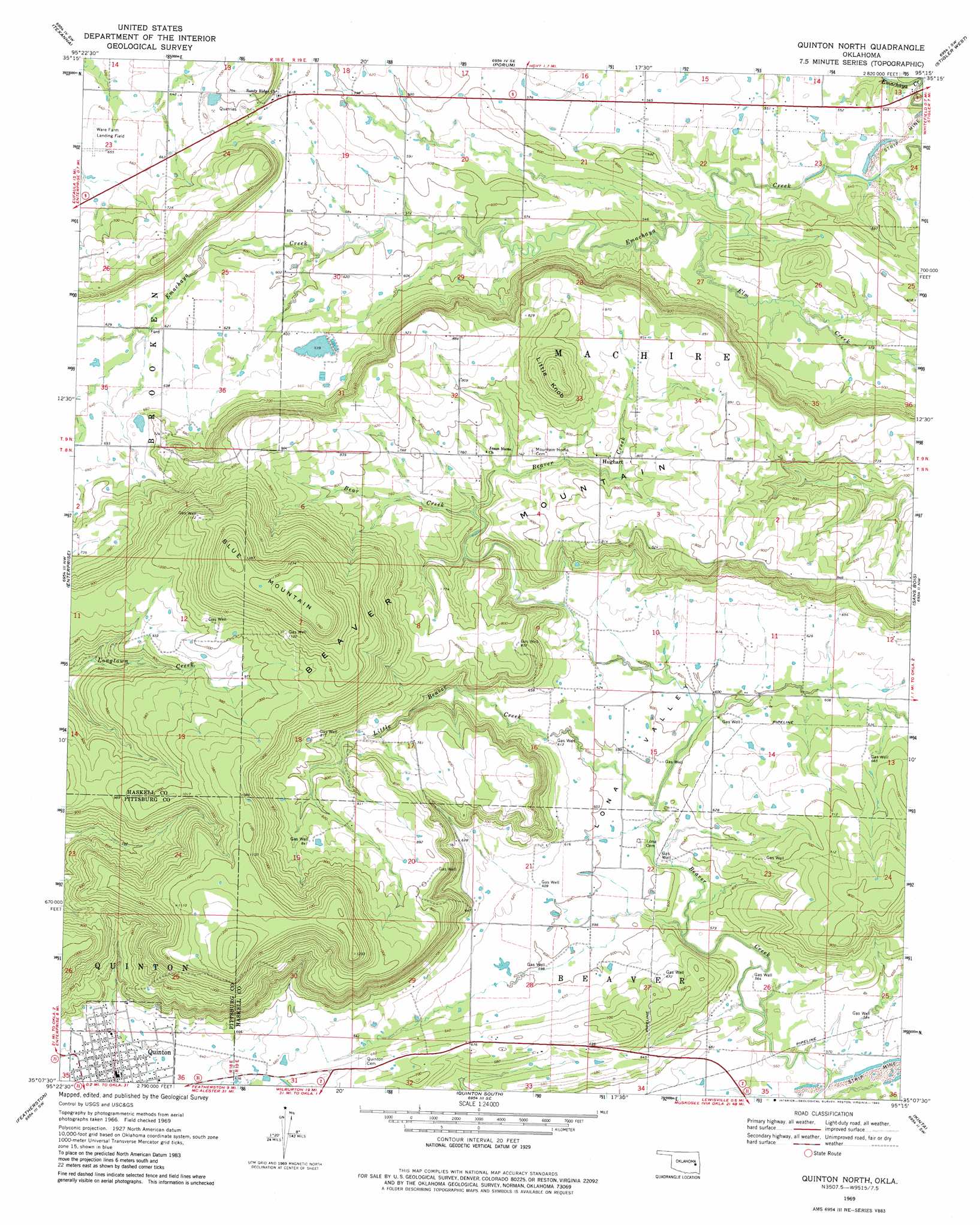
USGS Topo Quad 35095b3 - 1:24,000 scale
| Topo Map Name: | Quinton North |
| USGS Topo Quad ID: | 35095b3 |
| Print Size: | ca. 21 1/4" wide x 27" high |
| Southeast Coordinates: | 35.125° N latitude / 95.25° W longitude |
| Map Center Coordinates: | 35.1875° N latitude / 95.3125° W longitude |
| U.S. State: | OK |
| Filename: | o35095b3.jpg |
| Download Map JPG Image: | Quinton North topo map 1:24,000 scale |
| Map Type: | Topographic |
| Topo Series: | 7.5´ |
| Map Scale: | 1:24,000 |
| Source of Map Images: | United States Geological Survey (USGS) |
| Alternate Map Versions: |
Quinton North OK 1969, updated 1971 Download PDF Buy paper map Quinton North OK 1969, updated 1982 Download PDF Buy paper map Quinton North OK 2010 Download PDF Buy paper map Quinton North OK 2012 Download PDF Buy paper map Quinton North OK 2016 Download PDF Buy paper map |
1:24,000 Topo Quads surrounding Quinton North
Checotah |
Warner Nw |
Warner |
Holt Mountain |
Stigler Ne |
Eufaula |
Texanna |
Porum |
Stigler West |
Stigler East |
Longtown |
Enterprise |
Quinton North |
Sans Bois |
Lafayette |
Blocker |
Featherston |
Quinton South |
Kinta |
Lequire |
Adamson |
Gowen |
Wilburton |
Panola |
Red Oak |
> Back to 35095a1 at 1:100,000 scale
> Back to 35094a1 at 1:250,000 scale
> Back to U.S. Topo Maps home
Quinton North topo map: Gazetteer
Quinton North: Populated Places
Hughart elevation 242m 793′Quinton North: Streams
Bear Creek elevation 213m 698′Elm Creek elevation 177m 580′
Little Beaver Creek elevation 177m 580′
Quinton North: Summits
Beaver Mountain elevation 418m 1371′Blu Mountain elevation 418m 1371′
Little Knob elevation 318m 1043′
Quinton North: Valleys
Lona Valley elevation 174m 570′Quinton North digital topo map on disk
Buy this Quinton North topo map showing relief, roads, GPS coordinates and other geographical features, as a high-resolution digital map file on DVD: