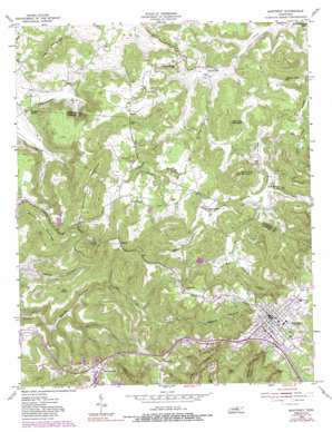
Monterey Topo Map Tennessee
To zoom in, hover over the map of Monterey
USGS Topo Quad 36085b3 - 1:24,000 scale
| Topo Map Name: | Monterey |
| USGS Topo Quad ID: | 36085b3 |
| Print Size: | ca. 21 1/4" wide x 27" high |
| Southeast Coordinates: | 36.125° N latitude / 85.25° W longitude |
| Map Center Coordinates: | 36.1875° N latitude / 85.3125° W longitude |
| U.S. State: | TN |
| Filename: | o36085b3.jpg |
| Download Map JPG Image: | Monterey topo map 1:24,000 scale |
| Map Type: | Topographic |
| Topo Series: | 7.5´ |
| Map Scale: | 1:24,000 |
| Source of Map Images: | United States Geological Survey (USGS) |
| Alternate Map Versions: |
Monterey TN 1955, updated 1973 Download PDF Buy paper map Monterey TN 1955, updated 1980 Download PDF Buy paper map Monterey TN 1955, updated 1988 Download PDF Buy paper map Monterey TN 2010 Download PDF Buy paper map Monterey TN 2013 Download PDF Buy paper map Monterey TN 2016 Download PDF Buy paper map |
1:24,000 Topo Quads surrounding Monterey
> Back to 36085a1 at 1:100,000 scale
> Back to 36084a1 at 1:250,000 scale
> Back to U.S. Topo Maps home
Monterey topo map: Gazetteer
Monterey: Crossings
Interchange 300 elevation 562m 1843′Interchange 301 elevation 561m 1840′
Monterey: Dams
Gordan Hunter Dam elevation 428m 1404′Monterey: Gaps
Thorn Gap elevation 439m 1440′Monterey: Parks
Whitaker Park elevation 565m 1853′Monterey: Populated Places
Beaver Hill elevation 340m 1115′Bilbrey elevation 559m 1833′
Bushing (historical) elevation 392m 1286′
Cedar Spring elevation 409m 1341′
Ford Estates elevation 562m 1843′
Monterey elevation 574m 1883′
Phillips Subdivision elevation 579m 1899′
Pinhook elevation 561m 1840′
Rays elevation 427m 1400′
Sand Springs elevation 571m 1873′
Shady Grove elevation 418m 1371′
Standingstone elevation 550m 1804′
Monterey: Post Offices
Monterey Post Office elevation 573m 1879′Monterey: Reservoirs
Gordan Hunter Lake elevation 428m 1404′Monterey: Summits
Bee Rock elevation 574m 1883′Blaylock Mountain elevation 593m 1945′
Kitty Ray Mountain elevation 504m 1653′
Lee Knob elevation 525m 1722′
Potato Hill Mountain elevation 557m 1827′
Table Rock Mountain elevation 542m 1778′
Turkey Mountain elevation 447m 1466′
Willet Mountain elevation 560m 1837′
Monterey: Valleys
Buckner Hollow elevation 368m 1207′Cannon Hollow elevation 351m 1151′
Sinking Cane Hollow elevation 347m 1138′
Stamps Cove elevation 366m 1200′
Walker Hollow elevation 382m 1253′
Monterey digital topo map on disk
Buy this Monterey topo map showing relief, roads, GPS coordinates and other geographical features, as a high-resolution digital map file on DVD:


