Portageville Topo Map Missouri
To zoom in, hover over the map of Portageville
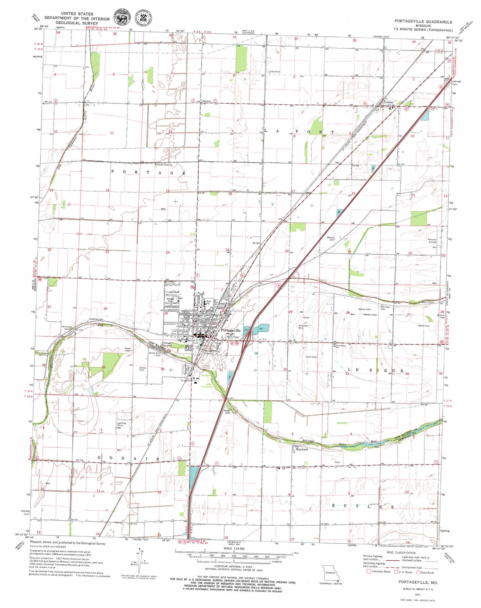
USGS Topo Quad 36089d6 - 1:24,000 scale
| Topo Map Name: | Portageville |
| USGS Topo Quad ID: | 36089d6 |
| Print Size: | ca. 21 1/4" wide x 27" high |
| Southeast Coordinates: | 36.375° N latitude / 89.625° W longitude |
| Map Center Coordinates: | 36.4375° N latitude / 89.6875° W longitude |
| U.S. State: | MO |
| Filename: | o36089d6.jpg |
| Download Map JPG Image: | Portageville topo map 1:24,000 scale |
| Map Type: | Topographic |
| Topo Series: | 7.5´ |
| Map Scale: | 1:24,000 |
| Source of Map Images: | United States Geological Survey (USGS) |
| Alternate Map Versions: |
Portageville MO 1971, updated 1973 Download PDF Buy paper map Portageville MO 1971, updated 1979 Download PDF Buy paper map Portageville MO 2012 Download PDF Buy paper map Portageville MO 2015 Download PDF Buy paper map |
1:24,000 Topo Quads surrounding Portageville
Bernie |
Hills Store |
Charter Oak |
Kewanee |
Henderson Mound |
Malden |
Parma |
Catron |
New Madrid |
Hubbard Lake |
Gideon |
Boekerton |
Portageville |
Point Pleasant |
Tiptonville |
Bragg City |
Wardell |
Stanley |
Mooring |
Ridgely |
Deering |
Hayti Heights |
Caruthersville |
Tennemo |
Miston |
> Back to 36089a1 at 1:100,000 scale
> Back to 36088a1 at 1:250,000 scale
> Back to U.S. Topo Maps home
Portageville topo map: Gazetteer
Portageville: Airports
Penman Airport elevation 87m 285′Wood Airport elevation 88m 288′
Portageville: Canals
Portage Bayou elevation 82m 269′Portageville: Parks
Meatte Park elevation 86m 282′Portageville: Populated Places
Conran elevation 88m 288′De Lisle elevation 85m 278′
Hayward elevation 86m 282′
Jaywye elevation 85m 278′
Portageville elevation 87m 285′
Portageville digital topo map on disk
Buy this Portageville topo map showing relief, roads, GPS coordinates and other geographical features, as a high-resolution digital map file on DVD: