Indian Springs Nw Topo Map Nevada
To zoom in, hover over the map of Indian Springs Nw
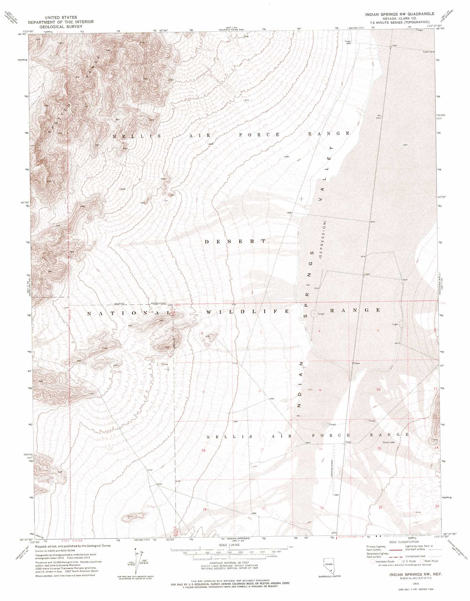
USGS Topo Quad 36115f6 - 1:24,000 scale
| Topo Map Name: | Indian Springs Nw |
| USGS Topo Quad ID: | 36115f6 |
| Print Size: | ca. 21 1/4" wide x 27" high |
| Southeast Coordinates: | 36.625° N latitude / 115.625° W longitude |
| Map Center Coordinates: | 36.6875° N latitude / 115.6875° W longitude |
| U.S. State: | NV |
| Filename: | o36115f6.jpg |
| Download Map JPG Image: | Indian Springs Nw topo map 1:24,000 scale |
| Map Type: | Topographic |
| Topo Series: | 7.5´ |
| Map Scale: | 1:24,000 |
| Source of Map Images: | United States Geological Survey (USGS) |
| Alternate Map Versions: |
Indian Springs NW NV 1973, updated 1976 Download PDF Buy paper map |
1:24,000 Topo Quads surrounding Indian Springs Nw
Plutonium Valley |
Aysees Peak |
Quartz Peak Nw |
Quartz Peak |
Dog Bone Lake North |
Frenchman Lake |
Frenchman Lake Se |
Quartz Peak Sw |
Tim Spring |
Dog Bone Lake South |
Mercury |
Mercury Ne |
Indian Springs Nw |
Heavens Well |
Black Hills Nw |
Niavi Wash |
Mercury Se |
Indian Springs |
Indian Springs Se |
Black Hills Sw |
Mount Stirling |
Willow Peak |
Cold Creek |
Charleston Peak Ne |
Corn Creek Springs Nw |
> Back to 36115e1 at 1:100,000 scale
> Back to 36114a1 at 1:250,000 scale
> Back to U.S. Topo Maps home
No gazetteer data is available for the Indian Springs Nw topo map sheet.
Indian Springs Nw digital topo map on disk
Buy this Indian Springs Nw topo map showing relief, roads, GPS coordinates and other geographical features, as a high-resolution digital map file on DVD:
Southern Sierra Nevada, California & Southern Nevada
Buy digital topo maps: Southern Sierra Nevada, California & Southern Nevada