Cold Creek Topo Map Nevada
To zoom in, hover over the map of Cold Creek
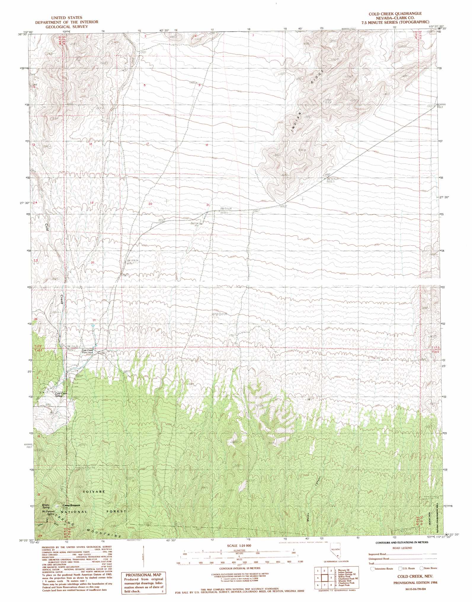
USGS Topo Quad 36115d6 - 1:24,000 scale
| Topo Map Name: | Cold Creek |
| USGS Topo Quad ID: | 36115d6 |
| Print Size: | ca. 21 1/4" wide x 27" high |
| Southeast Coordinates: | 36.375° N latitude / 115.625° W longitude |
| Map Center Coordinates: | 36.4375° N latitude / 115.6875° W longitude |
| U.S. State: | NV |
| Filename: | o36115d6.jpg |
| Download Map JPG Image: | Cold Creek topo map 1:24,000 scale |
| Map Type: | Topographic |
| Topo Series: | 7.5´ |
| Map Scale: | 1:24,000 |
| Source of Map Images: | United States Geological Survey (USGS) |
| Alternate Map Versions: |
Cold Creek NV 1984, updated 1984 Download PDF Buy paper map Cold Creek NV 1984, updated 1984 Download PDF Buy paper map Cold Creek NV 2012 Download PDF Buy paper map Cold Creek NV 2014 Download PDF Buy paper map |
| FStopo: | US Forest Service topo Cold Creek is available: Download FStopo PDF Download FStopo TIF |
1:24,000 Topo Quads surrounding Cold Creek
Mercury |
Mercury Ne |
Indian Springs Nw |
Heavens Well |
Black Hills Nw |
Niavi Wash |
Mercury Se |
Indian Springs |
Indian Springs Se |
Black Hills Sw |
Mount Stirling |
Willow Peak |
Cold Creek |
Charleston Peak Ne |
Corn Creek Springs Nw |
Horse Springs |
Wheeler Well |
Charleston Peak |
Angel Peak |
Grapevine Spring |
Pahrump |
Pahrump Ne |
Griffith Peak |
La Madre Spring |
La Madre Mountain |
> Back to 36115a1 at 1:100,000 scale
> Back to 36114a1 at 1:250,000 scale
> Back to U.S. Topo Maps home
Cold Creek topo map: Gazetteer
Cold Creek: Springs
Cold Creek Spring elevation 1893m 6210′McFarland Spring elevation 2315m 7595′
Whisky Spring elevation 2332m 7650′
Cold Creek: Valleys
Macks Canyon elevation 1965m 6446′McFarland Canyon elevation 1832m 6010′
Cold Creek digital topo map on disk
Buy this Cold Creek topo map showing relief, roads, GPS coordinates and other geographical features, as a high-resolution digital map file on DVD:
Southern Sierra Nevada, California & Southern Nevada
Buy digital topo maps: Southern Sierra Nevada, California & Southern Nevada