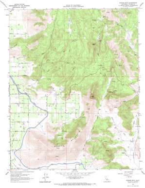
Stokes Mountain Topo Map California
To zoom in, hover over the map of Stokes Mountain
USGS Topo Quad 36119e2 - 1:24,000 scale
| Topo Map Name: | Stokes Mountain |
| USGS Topo Quad ID: | 36119e2 |
| Print Size: | ca. 21 1/4" wide x 27" high |
| Southeast Coordinates: | 36.5° N latitude / 119.125° W longitude |
| Map Center Coordinates: | 36.5625° N latitude / 119.1875° W longitude |
| U.S. State: | CA |
| Filename: | o36119e2.jpg |
| Download Map JPG Image: | Stokes Mountain topo map 1:24,000 scale |
| Map Type: | Topographic |
| Topo Series: | 7.5´ |
| Map Scale: | 1:24,000 |
| Source of Map Images: | United States Geological Survey (USGS) |
| Alternate Map Versions: |
Stokes Mountain CA 1921, updated 1957 Download PDF Buy paper map Stokes Mtn. CA 1966, updated 1968 Download PDF Buy paper map Stokes Mountain CA 2012 Download PDF Buy paper map Stokes Mountain CA 2015 Download PDF Buy paper map |
1:24,000 Topo Quads surrounding Stokes Mountain
> Back to 36119e1 at 1:100,000 scale
> Back to 36118a1 at 1:250,000 scale
> Back to U.S. Topo Maps home
Stokes Mountain topo map: Gazetteer
Stokes Mountain: Flats
Fisher Flat elevation 600m 1968′Mankins Flat elevation 523m 1715′
Woodlake Valley elevation 171m 561′
Stokes Mountain: Populated Places
Wimp elevation 110m 360′Stokes Mountain: Springs
Arnett Spring elevation 580m 1902′Mankins Spring elevation 507m 1663′
Rattlesnake Spring elevation 615m 2017′
Stokes Mountain: Streams
Grapevine Creek elevation 208m 682′Long Creek elevation 134m 439′
Moore Creek elevation 217m 711′
Negro Creek elevation 141m 462′
Story Creek elevation 141m 462′
Wilcox Creek elevation 169m 554′
Stokes Mountain: Summits
Cliff Peak elevation 580m 1902′Sawyer Peak elevation 726m 2381′
Stokes Mountain elevation 606m 1988′
Stokes Mountain: Valleys
Long Valley elevation 448m 1469′Stone Corral Canyon elevation 152m 498′
Wilcox Canyon elevation 220m 721′
Stokes Mountain digital topo map on disk
Buy this Stokes Mountain topo map showing relief, roads, GPS coordinates and other geographical features, as a high-resolution digital map file on DVD:
Southern Sierra Nevada, California & Southern Nevada
Buy digital topo maps: Southern Sierra Nevada, California & Southern Nevada


