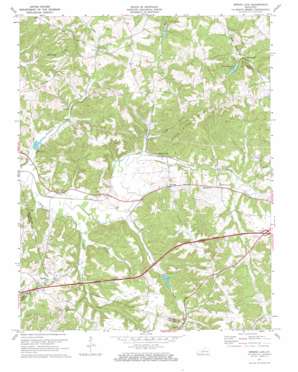
Spring Lick Topo Map Kentucky
To zoom in, hover over the map of Spring Lick
USGS Topo Quad 37086d5 - 1:24,000 scale
| Topo Map Name: | Spring Lick |
| USGS Topo Quad ID: | 37086d5 |
| Print Size: | ca. 21 1/4" wide x 27" high |
| Southeast Coordinates: | 37.375° N latitude / 86.5° W longitude |
| Map Center Coordinates: | 37.4375° N latitude / 86.5625° W longitude |
| U.S. State: | KY |
| Filename: | o37086d5.jpg |
| Download Map JPG Image: | Spring Lick topo map 1:24,000 scale |
| Map Type: | Topographic |
| Topo Series: | 7.5´ |
| Map Scale: | 1:24,000 |
| Source of Map Images: | United States Geological Survey (USGS) |
| Alternate Map Versions: |
Spring Lick KY 1954, updated 1955 Download PDF Buy paper map Spring Lick KY 1971, updated 1973 Download PDF Buy paper map Spring Lick KY 2010 Download PDF Buy paper map Spring Lick KY 2013 Download PDF Buy paper map Spring Lick KY 2016 Download PDF Buy paper map |
1:24,000 Topo Quads surrounding Spring Lick
> Back to 37086a1 at 1:100,000 scale
> Back to 37086a1 at 1:250,000 scale
> Back to U.S. Topo Maps home
Spring Lick topo map: Gazetteer
Spring Lick: Dams
Dam Number 12 elevation 140m 459′Dam Number 9 elevation 148m 485′
Spring Lick: Populated Places
Do Stop elevation 152m 498′Jugville elevation 154m 505′
Neafus elevation 191m 626′
Pine Knob elevation 160m 524′
Smithview elevation 170m 557′
Spring Lick elevation 145m 475′
Steff elevation 134m 439′
Spring Lick: Reservoirs
Pine Knob Lake elevation 161m 528′Spring Lick: Ridges
Peach Orchard Ridge elevation 190m 623′Spring Lick: Streams
Browns Branch elevation 137m 449′Brushy Pond Creek elevation 133m 436′
Buck Creek elevation 137m 449′
Cane Run elevation 137m 449′
Dog Creek elevation 134m 439′
Jarrett Fork elevation 137m 449′
Spring Creek elevation 137m 449′
Spring Lick: Summits
Pine Knob elevation 234m 767′Spring Lick: Valleys
Kiper Hollow elevation 141m 462′Spring Lick digital topo map on disk
Buy this Spring Lick topo map showing relief, roads, GPS coordinates and other geographical features, as a high-resolution digital map file on DVD:


