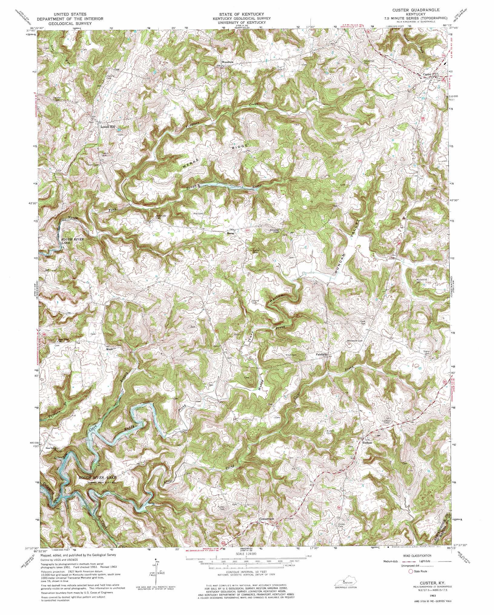
Custer Topo Map Kentucky
To zoom in, hover over the map of Custer
USGS Topo Quad 37086f3 - 1:24,000 scale
| Topo Map Name: | Custer |
| USGS Topo Quad ID: | 37086f3 |
| Print Size: | ca. 21 1/4" wide x 27" high |
| Southeast Coordinates: | 37.625° N latitude / 86.25° W longitude |
| Map Center Coordinates: | 37.6875° N latitude / 86.3125° W longitude |
| U.S. State: | KY |
| Filename: | o37086f3.jpg |
| Download Map JPG Image: | Custer topo map 1:24,000 scale |
| Map Type: | Topographic |
| Topo Series: | 7.5´ |
| Map Scale: | 1:24,000 |
| Source of Map Images: | United States Geological Survey (USGS) |
| Alternate Map Versions: |
Custer KY 1953, updated 1954 Download PDF Buy paper map Custer KY 1963, updated 1965 Download PDF Buy paper map Custer KY 1963, updated 1977 Download PDF Buy paper map Custer KY 2010 Download PDF Buy paper map Custer KY 2013 Download PDF Buy paper map Custer KY 2016 Download PDF Buy paper map |
1:24,000 Topo Quads surrounding Custer
Rome |
Lodiburg |
Irvington |
Guston |
Rock Haven |
Mattingly |
Hardinsburg |
Garfield |
Big Spring |
Flaherty |
Glen Dean |
Kingswood |
Custer |
Constantine |
Howe Valley |
Falls Of Rough |
Mcdaniels |
Madrid |
Big Clifty |
Summit |
Spring Lick |
Caneyville |
Leitchfield |
Clarkson |
Millerstown |
> Back to 37086e1 at 1:100,000 scale
> Back to 37086a1 at 1:250,000 scale
> Back to U.S. Topo Maps home
Custer topo map: Gazetteer
Custer: Populated Places
Buras elevation 231m 757′Centerview elevation 249m 816′
Custer elevation 250m 820′
Fairfield elevation 232m 761′
Hudson elevation 239m 784′
Locust Hill elevation 187m 613′
Mook elevation 233m 764′
Woodrow elevation 254m 833′
Custer: Ridges
Marks Ridge elevation 230m 754′Custer: Streams
Ben Clark Branch elevation 150m 492′Clear Prong elevation 152m 498′
Fiddlers Creek elevation 166m 544′
Muddy Prong elevation 158m 518′
Custer: Valleys
Duncan Valley elevation 180m 590′Ivory Hollow elevation 163m 534′
Custer digital topo map on disk
Buy this Custer topo map showing relief, roads, GPS coordinates and other geographical features, as a high-resolution digital map file on DVD: