Utica Topo Map Kentucky
To zoom in, hover over the map of Utica
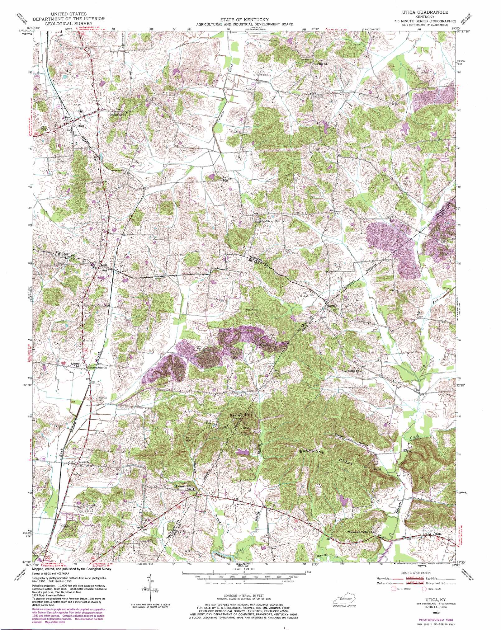
USGS Topo Quad 37087e1 - 1:24,000 scale
| Topo Map Name: | Utica |
| USGS Topo Quad ID: | 37087e1 |
| Print Size: | ca. 21 1/4" wide x 27" high |
| Southeast Coordinates: | 37.5° N latitude / 87° W longitude |
| Map Center Coordinates: | 37.5625° N latitude / 87.0625° W longitude |
| U.S. State: | KY |
| Filename: | o37087e1.jpg |
| Download Map JPG Image: | Utica topo map 1:24,000 scale |
| Map Type: | Topographic |
| Topo Series: | 7.5´ |
| Map Scale: | 1:24,000 |
| Source of Map Images: | United States Geological Survey (USGS) |
| Alternate Map Versions: |
Utica KY 1953, updated 1954 Download PDF Buy paper map Utica KY 1953, updated 1973 Download PDF Buy paper map Utica KY 1953, updated 1983 Download PDF Buy paper map Utica KY 2010 Download PDF Buy paper map Utica KY 2013 Download PDF Buy paper map Utica KY 2016 Download PDF Buy paper map |
1:24,000 Topo Quads surrounding Utica
Reed |
Owensboro West |
Owensboro East |
Maceo |
Pellville |
Curdsville |
Panther |
Sutherland |
Philpot |
Whitesville |
Calhoun |
Glenville |
Utica |
Pleasant Ridge |
Dundee |
Sacramento |
Livermore |
Equality |
Hartford |
Horton |
Millport |
Central City West |
Central City East |
Paradise |
Cromwell |
> Back to 37087e1 at 1:100,000 scale
> Back to 37086a1 at 1:250,000 scale
> Back to U.S. Topo Maps home
Utica topo map: Gazetteer
Utica: Airports
Bigger Stolport elevation 124m 406′Cambron Field elevation 131m 429′
Utica: Populated Places
Heflin elevation 126m 413′Livia elevation 143m 469′
Maxwell elevation 130m 426′
Nuckols elevation 123m 403′
Red Hill elevation 144m 472′
Utica elevation 127m 416′
Utica: Ridges
Backbone Ridge elevation 175m 574′Utica: Streams
Hanley Branch elevation 116m 380′North Fork Barnett Creek elevation 117m 383′
Stillhouse Branch elevation 112m 367′
Utica: Summits
Barrett Hill elevation 201m 659′Utica: Valleys
Tucker Hollow elevation 120m 393′Utica digital topo map on disk
Buy this Utica topo map showing relief, roads, GPS coordinates and other geographical features, as a high-resolution digital map file on DVD: