Sutherland Topo Map Kentucky
To zoom in, hover over the map of Sutherland
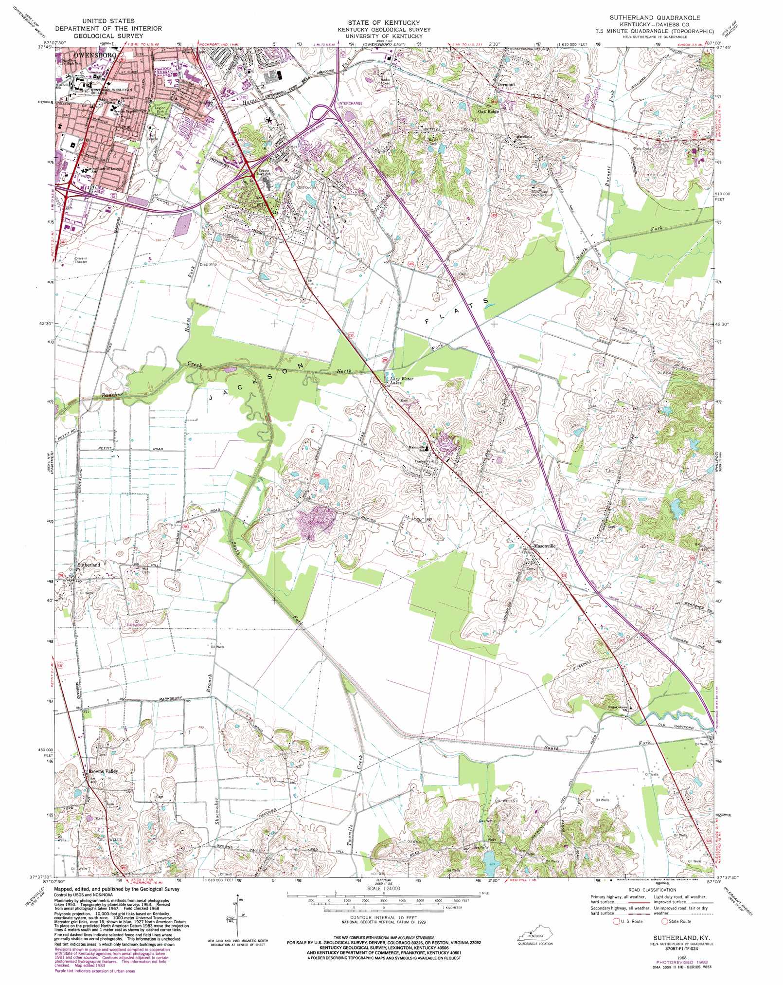
USGS Topo Quad 37087f1 - 1:24,000 scale
| Topo Map Name: | Sutherland |
| USGS Topo Quad ID: | 37087f1 |
| Print Size: | ca. 21 1/4" wide x 27" high |
| Southeast Coordinates: | 37.625° N latitude / 87° W longitude |
| Map Center Coordinates: | 37.6875° N latitude / 87.0625° W longitude |
| U.S. State: | KY |
| Filename: | o37087f1.jpg |
| Download Map JPG Image: | Sutherland topo map 1:24,000 scale |
| Map Type: | Topographic |
| Topo Series: | 7.5´ |
| Map Scale: | 1:24,000 |
| Source of Map Images: | United States Geological Survey (USGS) |
| Alternate Map Versions: |
Sutherland KY 1953, updated 1954 Download PDF Buy paper map Sutherland KY 1956, updated 1957 Download PDF Buy paper map Sutherland KY 1956, updated 1966 Download PDF Buy paper map Sutherland KY 1968, updated 1969 Download PDF Buy paper map Sutherland KY 1968, updated 1970 Download PDF Buy paper map Sutherland KY 1968, updated 1984 Download PDF Buy paper map Sutherland KY 2010 Download PDF Buy paper map Sutherland KY 2013 Download PDF Buy paper map Sutherland KY 2016 Download PDF Buy paper map |
1:24,000 Topo Quads surrounding Sutherland
Yankeetown |
Richland City |
Rockport |
Lewisport |
Tell City |
Reed |
Owensboro West |
Owensboro East |
Maceo |
Pellville |
Curdsville |
Panther |
Sutherland |
Philpot |
Whitesville |
Calhoun |
Glenville |
Utica |
Pleasant Ridge |
Dundee |
Sacramento |
Livermore |
Equality |
Hartford |
Horton |
> Back to 37087e1 at 1:100,000 scale
> Back to 37086a1 at 1:250,000 scale
> Back to U.S. Topo Maps home
Sutherland topo map: Gazetteer
Sutherland: Flats
Jackson Flats elevation 116m 380′Sutherland: Parks
Legion Park elevation 121m 396′Sutherland: Populated Places
Browns Valley elevation 121m 396′Dermont elevation 147m 482′
Masonville elevation 129m 423′
Oak Ridge elevation 144m 472′
Sutherland elevation 122m 400′
Sutherland: Streams
Burnett Fork elevation 117m 383′Horse Fork elevation 116m 380′
North Fork Panther Creek elevation 116m 380′
Shoemaker Branch elevation 117m 383′
South Fork Panther Creek elevation 117m 383′
Twomile Creek elevation 116m 380′
Sutherland digital topo map on disk
Buy this Sutherland topo map showing relief, roads, GPS coordinates and other geographical features, as a high-resolution digital map file on DVD: