Aukum Topo Map California
To zoom in, hover over the map of Aukum
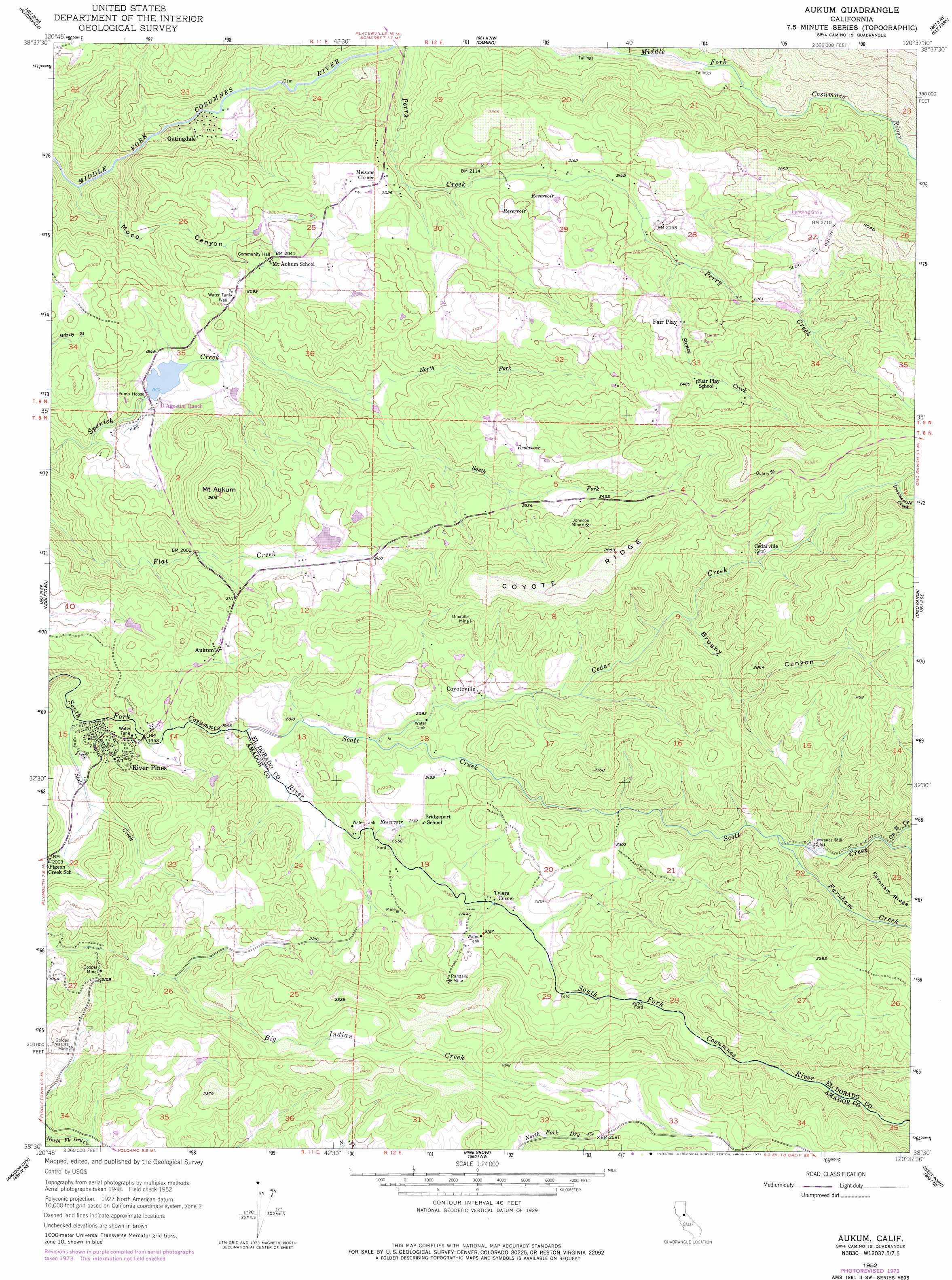
USGS Topo Quad 38120e6 - 1:24,000 scale
| Topo Map Name: | Aukum |
| USGS Topo Quad ID: | 38120e6 |
| Print Size: | ca. 21 1/4" wide x 27" high |
| Southeast Coordinates: | 38.5° N latitude / 120.625° W longitude |
| Map Center Coordinates: | 38.5625° N latitude / 120.6875° W longitude |
| U.S. State: | CA |
| Filename: | o38120e6.jpg |
| Download Map JPG Image: | Aukum topo map 1:24,000 scale |
| Map Type: | Topographic |
| Topo Series: | 7.5´ |
| Map Scale: | 1:24,000 |
| Source of Map Images: | United States Geological Survey (USGS) |
| Alternate Map Versions: |
Aukum CA 1952, updated 1954 Download PDF Buy paper map Aukum CA 1952, updated 1957 Download PDF Buy paper map Aukum CA 1952, updated 1957 Download PDF Buy paper map Aukum CA 1952, updated 1977 Download PDF Buy paper map Aukum CA 1952, updated 1977 Download PDF Buy paper map Aukum CA 2012 Download PDF Buy paper map Aukum CA 2015 Download PDF Buy paper map |
1:24,000 Topo Quads surrounding Aukum
Coloma |
Garden Valley |
Slate Mountain |
Pollock Pines |
Riverton |
Shingle Springs |
Placerville |
Camino |
Sly Park |
Old Iron Mountain |
Latrobe |
Fiddletown |
Aukum |
Omo Ranch |
Caldor |
Irish Hill |
Amador City |
Pine Grove |
West Point |
Devils Nose |
Ione |
Jackson |
Mokelumne Hill |
Rail Road Flat |
Fort Mountain |
> Back to 38120e1 at 1:100,000 scale
> Back to 38120a1 at 1:250,000 scale
> Back to U.S. Topo Maps home
Aukum topo map: Gazetteer
Aukum: Dams
Aukum View 3461 Dam elevation 662m 2171′D'Agostini 466 Dam elevation 550m 1804′
Aukum: Mines
Cooper Mine elevation 624m 2047′Golden Treasure Mine elevation 589m 1932′
Johnson Mine elevation 789m 2588′
Randalls Mine elevation 692m 2270′
Umatilla Mine elevation 741m 2431′
Aukum: Populated Places
Aukum elevation 657m 2155′Coyoteville elevation 659m 2162′
Fair Play elevation 710m 2329′
Melsons Corner elevation 636m 2086′
Outingdale elevation 495m 1624′
River Pines elevation 604m 1981′
Tylers Corner elevation 644m 2112′
Aukum: Post Offices
Aukum Post Office elevation 642m 2106′Aukum: Reservoirs
D'Agostini Reservoir elevation 553m 1814′Perry Reservoir elevation 656m 2152′
Aukum: Ridges
Coyote Ridge elevation 867m 2844′Aukum: Streams
Brownsville Creek elevation 830m 2723′Cedar Creek elevation 620m 2034′
Farnham Creek elevation 712m 2335′
North Fork Spanish Creek elevation 596m 1955′
On It Creek elevation 731m 2398′
Scott Creek elevation 607m 1991′
Slate Creek elevation 561m 1840′
South Fork Spanish Creek elevation 596m 1955′
Stoney Creek elevation 671m 2201′
Aukum: Summits
Mount Aukum elevation 797m 2614′Aukum: Valleys
Brushy Canyon elevation 707m 2319′Moco Canyon elevation 434m 1423′
Aukum digital topo map on disk
Buy this Aukum topo map showing relief, roads, GPS coordinates and other geographical features, as a high-resolution digital map file on DVD: