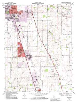
Greenwood Topo Map Indiana
To zoom in, hover over the map of Greenwood
USGS Topo Quad 39086e1 - 1:24,000 scale
| Topo Map Name: | Greenwood |
| USGS Topo Quad ID: | 39086e1 |
| Print Size: | ca. 21 1/4" wide x 27" high |
| Southeast Coordinates: | 39.5° N latitude / 86° W longitude |
| Map Center Coordinates: | 39.5625° N latitude / 86.0625° W longitude |
| U.S. State: | IN |
| Filename: | o39086e1.jpg |
| Download Map JPG Image: | Greenwood topo map 1:24,000 scale |
| Map Type: | Topographic |
| Topo Series: | 7.5´ |
| Map Scale: | 1:24,000 |
| Source of Map Images: | United States Geological Survey (USGS) |
| Alternate Map Versions: |
Greenwood IN 1953, updated 1954 Download PDF Buy paper map Greenwood IN 1959, updated 1960 Download PDF Buy paper map Greenwood IN 1973, updated 1975 Download PDF Buy paper map Greenwood IN 1973, updated 1980 Download PDF Buy paper map Greenwood IN 1973, updated 1990 Download PDF Buy paper map Greenwood IN 1992, updated 1995 Download PDF Buy paper map Greenwood IN 2010 Download PDF Buy paper map Greenwood IN 2013 Download PDF Buy paper map Greenwood IN 2016 Download PDF Buy paper map |
1:24,000 Topo Quads surrounding Greenwood
> Back to 39086e1 at 1:100,000 scale
> Back to 39086a1 at 1:250,000 scale
> Back to U.S. Topo Maps home
Greenwood topo map: Gazetteer
Greenwood: Airports
Canarys Airport elevation 235m 770′Greenwood: Canals
Brewer Ditch elevation 235m 770′Canary Ditch elevation 229m 751′
Graham Ditch elevation 234m 767′
Powell Ditch elevation 231m 757′
Tracy Ditch elevation 241m 790′
Greenwood: Crossings
Interchange 95 elevation 243m 797′Interchange 99 elevation 261m 856′
Greenwood: Parks
Childrens Garden Park elevation 244m 800′Craig Park elevation 250m 820′
East Park elevation 242m 793′
Old City Park elevation 242m 793′
Pool Park elevation 240m 787′
Tot Park elevation 245m 803′
West Park elevation 242m 793′
Westside Park elevation 232m 761′
Greenwood: Populated Places
Greenwood elevation 245m 803′New Whiteland elevation 246m 807′
Rocklane elevation 248m 813′
Southwood Trailer Court elevation 246m 807′
Spring Hill elevation 240m 787′
West Whiteland elevation 245m 803′
Whiteland elevation 242m 793′
Greenwood: Post Offices
Whiteland Post Office elevation 242m 793′Greenwood: Streams
East Grassy Creek elevation 236m 774′Grassy Creek elevation 232m 761′
Pleasant Creek elevation 232m 761′
Ransdell Run elevation 228m 748′
Rocklane Creek elevation 235m 770′
Short Run elevation 240m 787′
Greenwood: Summits
Donalds Knoll elevation 240m 787′Kelly Hill elevation 258m 846′
Polk Hill elevation 259m 849′
Greenwood digital topo map on disk
Buy this Greenwood topo map showing relief, roads, GPS coordinates and other geographical features, as a high-resolution digital map file on DVD:
Northern Illinois, Northern Indiana & Southwestern Michigan
Buy digital topo maps: Northern Illinois, Northern Indiana & Southwestern Michigan


