Lynndyl Nw Topo Map Utah
To zoom in, hover over the map of Lynndyl Nw
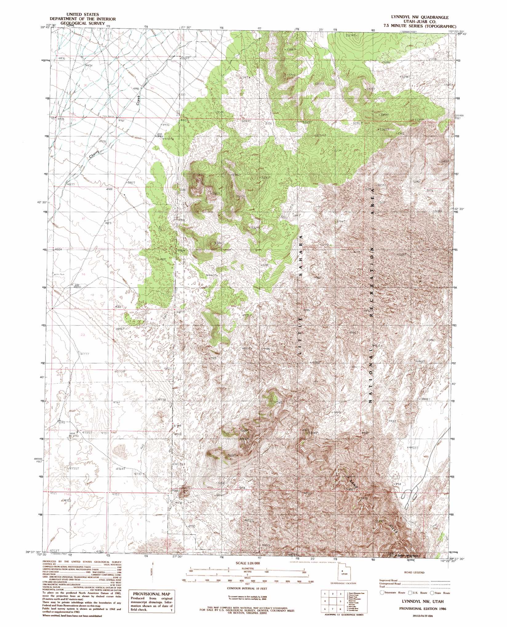
USGS Topo Quad 39112f4 - 1:24,000 scale
| Topo Map Name: | Lynndyl Nw |
| USGS Topo Quad ID: | 39112f4 |
| Print Size: | ca. 21 1/4" wide x 27" high |
| Southeast Coordinates: | 39.625° N latitude / 112.375° W longitude |
| Map Center Coordinates: | 39.6875° N latitude / 112.4375° W longitude |
| U.S. State: | UT |
| Filename: | o39112f4.jpg |
| Download Map JPG Image: | Lynndyl Nw topo map 1:24,000 scale |
| Map Type: | Topographic |
| Topo Series: | 7.5´ |
| Map Scale: | 1:24,000 |
| Source of Map Images: | United States Geological Survey (USGS) |
| Alternate Map Versions: |
Lynndyl NW UT 1986, updated 1986 Download PDF Buy paper map Lynndyl NW UT 2010 Download PDF Buy paper map Lynndyl NW UT 2014 Download PDF Buy paper map |
1:24,000 Topo Quads surrounding Lynndyl Nw
Indian Springs |
Erickson Knoll |
Dutch Peak |
Sabie Mountain |
Tintic Junction |
Erickson Wash Sw |
Desert Mountain Pass |
Cherry Creek |
Maple Peak |
Mcintyre |
Crater Bench Reservoir |
Desert Mountain Reservoir |
Lynndyl Nw |
Tanner Creek Narrows |
Jericho |
Baker Hot Springs |
Rain Lake |
Lynndyl West |
Lynndyl East |
Champlin Peak |
Sutherland |
Delta Ne |
Strong |
Oak City North |
Fool Creek Peak |
> Back to 39112e1 at 1:100,000 scale
> Back to 39112a1 at 1:250,000 scale
> Back to U.S. Topo Maps home
Lynndyl Nw topo map: Gazetteer
Lynndyl Nw: Areas
White Sand Dunes elevation 1510m 4954′Lynndyl Nw: Summits
Sand Hills elevation 1649m 5410′Sand Mountain elevation 1722m 5649′
Lynndyl Nw digital topo map on disk
Buy this Lynndyl Nw topo map showing relief, roads, GPS coordinates and other geographical features, as a high-resolution digital map file on DVD: