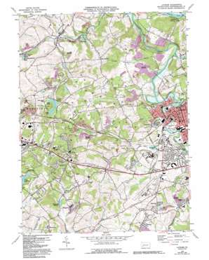
Latrobe Topo Map Pennsylvania
To zoom in, hover over the map of Latrobe
USGS Topo Quad 40079c4 - 1:24,000 scale
| Topo Map Name: | Latrobe |
| USGS Topo Quad ID: | 40079c4 |
| Print Size: | ca. 21 1/4" wide x 27" high |
| Southeast Coordinates: | 40.25° N latitude / 79.375° W longitude |
| Map Center Coordinates: | 40.3125° N latitude / 79.4375° W longitude |
| U.S. State: | PA |
| Filename: | o40079c4.jpg |
| Download Map JPG Image: | Latrobe topo map 1:24,000 scale |
| Map Type: | Topographic |
| Topo Series: | 7.5´ |
| Map Scale: | 1:24,000 |
| Source of Map Images: | United States Geological Survey (USGS) |
| Alternate Map Versions: |
Latrobe PA 1964, updated 1965 Download PDF Buy paper map Latrobe PA 1964, updated 1973 Download PDF Buy paper map Latrobe PA 1964, updated 1979 Download PDF Buy paper map Latrobe PA 1964, updated 1979 Download PDF Buy paper map Latrobe PA 1964, updated 1993 Download PDF Buy paper map Latrobe PA 2010 Download PDF Buy paper map Latrobe PA 2013 Download PDF Buy paper map Latrobe PA 2016 Download PDF Buy paper map |
1:24,000 Topo Quads surrounding Latrobe
> Back to 40079a1 at 1:100,000 scale
> Back to 40078a1 at 1:250,000 scale
> Back to U.S. Topo Maps home
Latrobe topo map: Gazetteer
Latrobe: Airports
Latrobe Airport elevation 340m 1115′Latrobe: Dams
Greenwalt Dam elevation 298m 977′Marguerite Dam elevation 330m 1082′
Twin Lakes Number One Dam elevation 332m 1089′
Upper Donohoe Dam elevation 339m 1112′
Latrobe: Lakes
Lake Dom elevation 296m 971′Latrobe: Parks
Keystone State Park elevation 334m 1095′Legion-Kenner Park elevation 302m 990′
Twin Lakes Park elevation 383m 1256′
Latrobe: Populated Places
Beatty elevation 336m 1102′Carney elevation 334m 1095′
Crabtree elevation 309m 1013′
Denison elevation 409m 1341′
Donohoe elevation 360m 1181′
Dorothy elevation 309m 1013′
Georges Station elevation 380m 1246′
Greenwald elevation 331m 1085′
Hannastown elevation 319m 1046′
Hostetter elevation 355m 1164′
Latrobe elevation 304m 997′
Lawson Heights elevation 360m 1181′
Lloydsville elevation 330m 1082′
Luxor elevation 337m 1105′
Manito elevation 376m 1233′
Marguerite elevation 331m 1085′
McClarran elevation 350m 1148′
Old Crabtree elevation 341m 1118′
Palmers elevation 370m 1213′
Saint Vincent Shaft elevation 331m 1085′
Sowash elevation 343m 1125′
West Latrobe elevation 305m 1000′
Whitney elevation 340m 1115′
Latrobe: Reservoirs
Jamison Reservoir elevation 335m 1099′Lake Dom elevation 298m 977′
Marguerite Reservoir elevation 341m 1118′
Saint Vincent Lake elevation 310m 1017′
Twin Lakes Number One Reservoir elevation 332m 1089′
Twin Lakes Number Two Reservoir elevation 339m 1112′
Unity Reservoir elevation 386m 1266′
Latrobe: Ridges
Dry Ridge elevation 421m 1381′Latrobe: Streams
Davis Run elevation 322m 1056′Fourmile Run elevation 302m 990′
Little Crabtree Creek elevation 311m 1020′
Monastery Run elevation 298m 977′
Saxman Run elevation 303m 994′
Union Run elevation 300m 984′
Unity Run elevation 306m 1003′
Latrobe digital topo map on disk
Buy this Latrobe topo map showing relief, roads, GPS coordinates and other geographical features, as a high-resolution digital map file on DVD:


