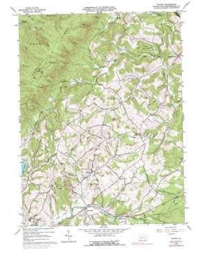
Wilpen Topo Map Pennsylvania
To zoom in, hover over the map of Wilpen
USGS Topo Quad 40079c2 - 1:24,000 scale
| Topo Map Name: | Wilpen |
| USGS Topo Quad ID: | 40079c2 |
| Print Size: | ca. 21 1/4" wide x 27" high |
| Southeast Coordinates: | 40.25° N latitude / 79.125° W longitude |
| Map Center Coordinates: | 40.3125° N latitude / 79.1875° W longitude |
| U.S. State: | PA |
| Filename: | o40079c2.jpg |
| Download Map JPG Image: | Wilpen topo map 1:24,000 scale |
| Map Type: | Topographic |
| Topo Series: | 7.5´ |
| Map Scale: | 1:24,000 |
| Source of Map Images: | United States Geological Survey (USGS) |
| Alternate Map Versions: |
Wilpen PA 1964, updated 1966 Download PDF Buy paper map Wilpen PA 1964, updated 1973 Download PDF Buy paper map Wilpen PA 1964, updated 1979 Download PDF Buy paper map Wilpen PA 1964, updated 1979 Download PDF Buy paper map Wilpen PA 2010 Download PDF Buy paper map Wilpen PA 2013 Download PDF Buy paper map Wilpen PA 2016 Download PDF Buy paper map |
1:24,000 Topo Quads surrounding Wilpen
> Back to 40079a1 at 1:100,000 scale
> Back to 40078a1 at 1:250,000 scale
> Back to U.S. Topo Maps home
Wilpen topo map: Gazetteer
Wilpen: Airports
Flying H Airport elevation 384m 1259′Wilpen: Lakes
Griff Lake elevation 355m 1164′Wilpen: Populated Places
Hillsview elevation 442m 1450′Oak Grove elevation 369m 1210′
Waterford elevation 402m 1318′
West Fairfield elevation 430m 1410′
Wilpen elevation 374m 1227′
Wilpen: Reservoirs
Blairsville Reservoir elevation 398m 1305′Bolivar Reservoir elevation 368m 1207′
Wilpen: Streams
Dry Run elevation 571m 1873′Hannas Run elevation 359m 1177′
Hendricks Creek elevation 325m 1066′
Hess Run elevation 475m 1558′
Hypocrite Creek elevation 340m 1115′
Macks Run elevation 396m 1299′
North Fork Mill Creek elevation 432m 1417′
Snyders Run elevation 335m 1099′
South Fork Mill Creek elevation 449m 1473′
Wilpen: Summits
McCalvy Hill elevation 505m 1656′Wilpen: Valleys
Bear Pond Hollow elevation 404m 1325′Covode Hollow elevation 371m 1217′
Death Valley elevation 456m 1496′
Dyke Hollow elevation 410m 1345′
Loves Hollow elevation 357m 1171′
Pine Hollow elevation 451m 1479′
Wilpen digital topo map on disk
Buy this Wilpen topo map showing relief, roads, GPS coordinates and other geographical features, as a high-resolution digital map file on DVD:


