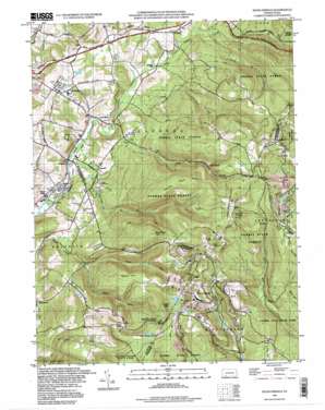
Seven Springs Topo Map Pennsylvania
To zoom in, hover over the map of Seven Springs
USGS Topo Quad 40079a3 - 1:24,000 scale
| Topo Map Name: | Seven Springs |
| USGS Topo Quad ID: | 40079a3 |
| Print Size: | ca. 21 1/4" wide x 27" high |
| Southeast Coordinates: | 40° N latitude / 79.25° W longitude |
| Map Center Coordinates: | 40.0625° N latitude / 79.3125° W longitude |
| U.S. State: | PA |
| Filename: | o40079a3.jpg |
| Download Map JPG Image: | Seven Springs topo map 1:24,000 scale |
| Map Type: | Topographic |
| Topo Series: | 7.5´ |
| Map Scale: | 1:24,000 |
| Source of Map Images: | United States Geological Survey (USGS) |
| Alternate Map Versions: |
Seven Springs PA 1967, updated 1971 Download PDF Buy paper map Seven Springs PA 1967, updated 1973 Download PDF Buy paper map Seven Springs PA 1967, updated 1982 Download PDF Buy paper map Seven Springs PA 1967, updated 1993 Download PDF Buy paper map Seven Springs PA 1977, updated 1979 Download PDF Buy paper map Seven Springs PA 1993, updated 1998 Download PDF Buy paper map Seven Springs PA 2010 Download PDF Buy paper map Seven Springs PA 2013 Download PDF Buy paper map Seven Springs PA 2016 Download PDF Buy paper map |
1:24,000 Topo Quads surrounding Seven Springs
> Back to 40079a1 at 1:100,000 scale
> Back to 40078a1 at 1:250,000 scale
> Back to U.S. Topo Maps home
Seven Springs topo map: Gazetteer
Seven Springs: Airports
Seven Springs Airport elevation 877m 2877′Seven Springs: Dams
Kooser Run Dam elevation 780m 2559′Seven Springs: Lakes
Turquois Lakes elevation 638m 2093′Seven Springs: Parks
Laurel Hill State Park elevation 706m 2316′Roaring Run Natural Area elevation 848m 2782′
Seven Springs: Populated Places
Champion elevation 453m 1486′Hopewell elevation 479m 1571′
Horners Mill elevation 484m 1587′
Jones Mills elevation 475m 1558′
Kregar elevation 536m 1758′
Maple Grove elevation 447m 1466′
Myersbrook elevation 694m 2276′
Nebo elevation 444m 1456′
Seven Springs elevation 768m 2519′
Seven Springs: Springs
Beck Springs elevation 765m 2509′Kooser Spring elevation 756m 2480′
Seven Springs: Streams
Camp Run elevation 472m 1548′Little Run elevation 542m 1778′
Neals Run elevation 535m 1755′
Pike Run elevation 480m 1574′
Roaring Run elevation 449m 1473′
Trout Run elevation 535m 1755′
Seven Springs: Summits
Birch Rock Hill elevation 891m 2923′Painter Rock Hill elevation 893m 2929′
Spook Hill elevation 770m 2526′
Seven Springs digital topo map on disk
Buy this Seven Springs topo map showing relief, roads, GPS coordinates and other geographical features, as a high-resolution digital map file on DVD:


