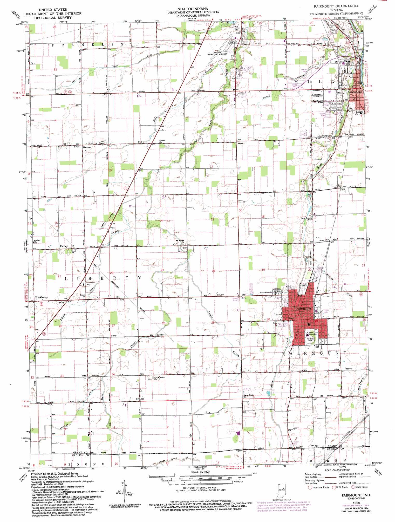
Fairmount Topo Map Indiana
To zoom in, hover over the map of Fairmount
USGS Topo Quad 40085d6 - 1:24,000 scale
| Topo Map Name: | Fairmount |
| USGS Topo Quad ID: | 40085d6 |
| Print Size: | ca. 21 1/4" wide x 27" high |
| Southeast Coordinates: | 40.375° N latitude / 85.625° W longitude |
| Map Center Coordinates: | 40.4375° N latitude / 85.6875° W longitude |
| U.S. State: | IN |
| Filename: | o40085d6.jpg |
| Download Map JPG Image: | Fairmount topo map 1:24,000 scale |
| Map Type: | Topographic |
| Topo Series: | 7.5´ |
| Map Scale: | 1:24,000 |
| Source of Map Images: | United States Geological Survey (USGS) |
| Alternate Map Versions: |
Fairmount IN 1960, updated 1961 Download PDF Buy paper map Fairmount IN 1960, updated 1982 Download PDF Buy paper map Fairmount IN 1960, updated 1994 Download PDF Buy paper map Fairmount IN 2010 Download PDF Buy paper map Fairmount IN 2013 Download PDF Buy paper map Fairmount IN 2016 Download PDF Buy paper map |
1:24,000 Topo Quads surrounding Fairmount
Peoria |
Somerset |
La Fontaine |
Mount Etna |
Warren |
Amboy |
Sweetser |
Marion |
Van Buren |
Roll |
Greentown |
Point Isabel |
Fairmount |
Gas City |
Hartford City West |
Windfall |
Elwood |
Alexandria |
Gaston |
Wheeling |
Omega |
Frankton |
Anderson North |
Gilman |
Muncie West |
> Back to 40085a1 at 1:100,000 scale
> Back to 40084a1 at 1:250,000 scale
> Back to U.S. Topo Maps home
Fairmount topo map: Gazetteer
Fairmount: Airports
Marion Municipal Airport elevation 261m 856′Fairmount: Canals
Dry Fork Ditch elevation 261m 856′Little Newby Ditch elevation 259m 849′
Stuckey Ditch elevation 268m 879′
Tappin Ditch elevation 264m 866′
Winslow Ditch elevation 264m 866′
Fairmount: Populated Places
Fairmount elevation 266m 872′Hackleman elevation 269m 882′
Jonesboro elevation 260m 853′
Radley elevation 270m 885′
Weaver elevation 266m 872′
Fairmount: Streams
Back Creek elevation 244m 800′Barren Creek elevation 267m 875′
Bell Creek elevation 254m 833′
Little Creek elevation 264m 866′
Little Deer Creek elevation 261m 856′
Fairmount digital topo map on disk
Buy this Fairmount topo map showing relief, roads, GPS coordinates and other geographical features, as a high-resolution digital map file on DVD:
Northern Illinois, Northern Indiana & Southwestern Michigan
Buy digital topo maps: Northern Illinois, Northern Indiana & Southwestern Michigan