Burrows Topo Map Indiana
To zoom in, hover over the map of Burrows
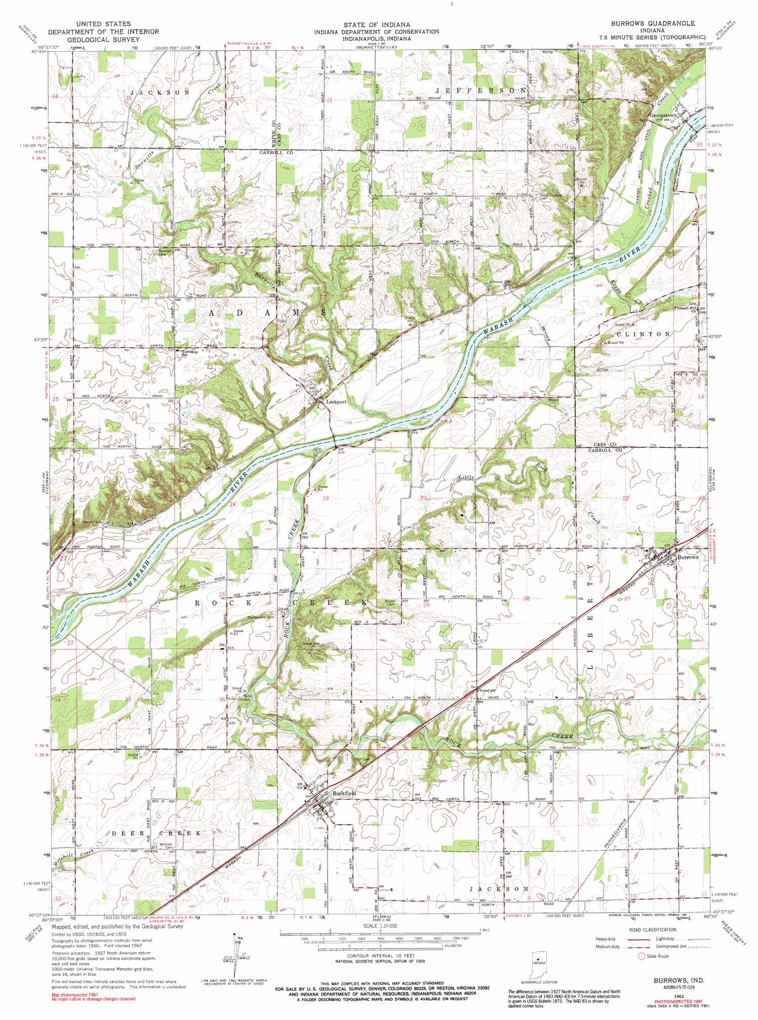
USGS Topo Quad 40086f5 - 1:24,000 scale
| Topo Map Name: | Burrows |
| USGS Topo Quad ID: | 40086f5 |
| Print Size: | ca. 21 1/4" wide x 27" high |
| Southeast Coordinates: | 40.625° N latitude / 86.5° W longitude |
| Map Center Coordinates: | 40.6875° N latitude / 86.5625° W longitude |
| U.S. State: | IN |
| Filename: | o40086f5.jpg |
| Download Map JPG Image: | Burrows topo map 1:24,000 scale |
| Map Type: | Topographic |
| Topo Series: | 7.5´ |
| Map Scale: | 1:24,000 |
| Source of Map Images: | United States Geological Survey (USGS) |
| Alternate Map Versions: |
Burrows IN 1962, updated 1963 Download PDF Buy paper map Burrows IN 1962, updated 1990 Download PDF Buy paper map Burrows IN 1962, updated 1991 Download PDF Buy paper map Burrows IN 2010 Download PDF Buy paper map Burrows IN 2013 Download PDF Buy paper map Burrows IN 2016 Download PDF Buy paper map |
1:24,000 Topo Quads surrounding Burrows
Monon Ne |
Buffalo |
Star City |
Grass Creek |
Fulton |
Monticello North |
Idaville |
Burnettsville |
Lucerne |
Logansport |
Monticello South |
Yeoman |
Burrows |
Clymers |
Anoka |
Brookston |
Delphi |
Flora |
Deer Creek |
Young America |
Lafayette East |
Pyrmont |
Rossville |
Burlington |
Russiaville |
> Back to 40086e1 at 1:100,000 scale
> Back to 40086a1 at 1:250,000 scale
> Back to U.S. Topo Maps home
Burrows topo map: Gazetteer
Burrows: Canals
Benner Ditch elevation 188m 616′Burrows: Populated Places
Burrows elevation 212m 695′Flax elevation 210m 688′
Georgetown elevation 180m 590′
Lockport elevation 174m 570′
Rockfield elevation 213m 698′
Burrows: Streams
Burnetts Creek elevation 167m 547′Crooked Creek elevation 168m 551′
Keeps Creek elevation 169m 554′
Little Rock Creek elevation 166m 544′
Rattlesnake Creek elevation 164m 538′
Rock Creek elevation 168m 551′
Burrows digital topo map on disk
Buy this Burrows topo map showing relief, roads, GPS coordinates and other geographical features, as a high-resolution digital map file on DVD:
Northern Illinois, Northern Indiana & Southwestern Michigan
Buy digital topo maps: Northern Illinois, Northern Indiana & Southwestern Michigan