Mendota Topo Map Missouri
To zoom in, hover over the map of Mendota
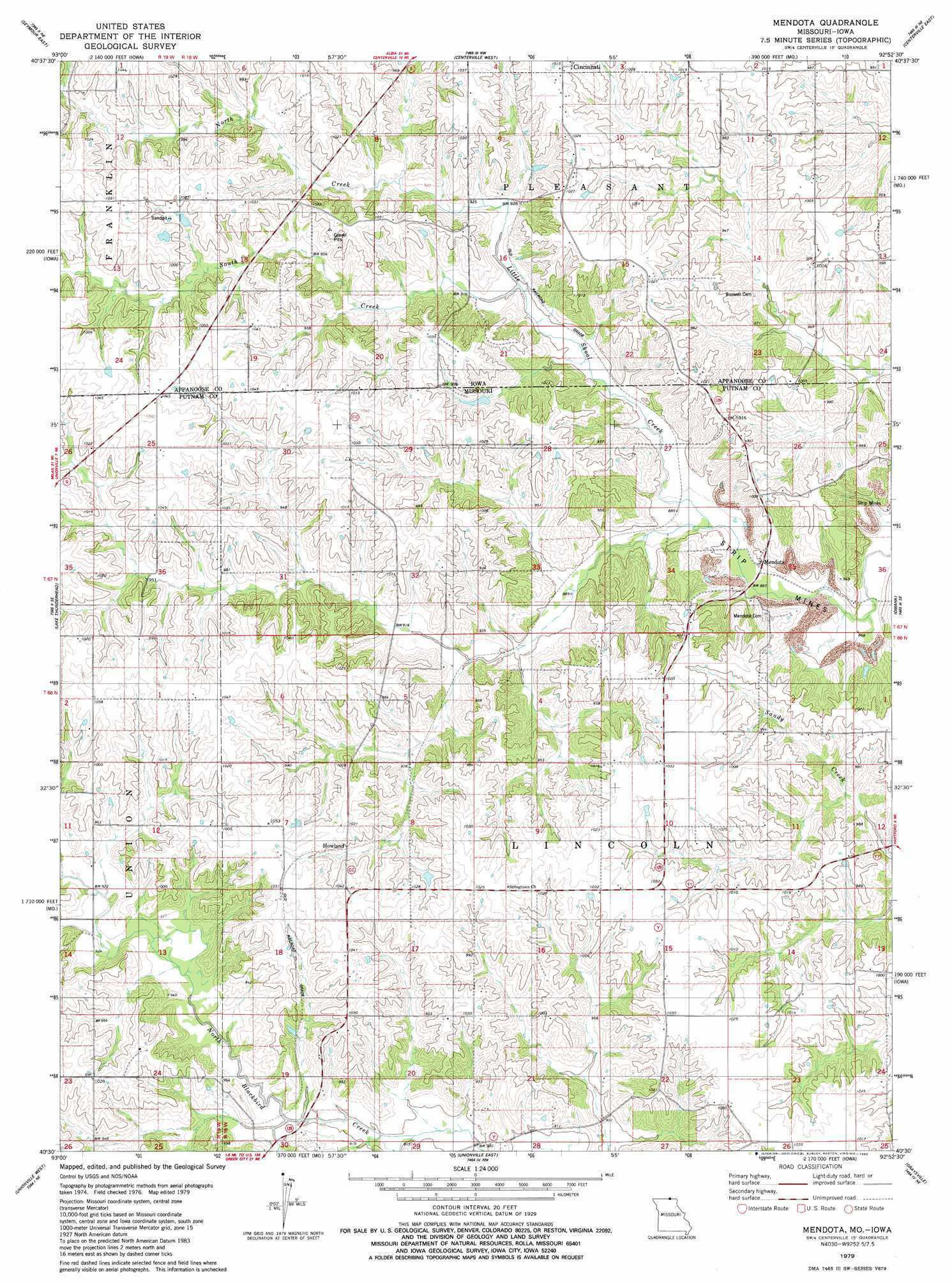
USGS Topo Quad 40092e8 - 1:24,000 scale
| Topo Map Name: | Mendota |
| USGS Topo Quad ID: | 40092e8 |
| Print Size: | ca. 21 1/4" wide x 27" high |
| Southeast Coordinates: | 40.5° N latitude / 92.875° W longitude |
| Map Center Coordinates: | 40.5625° N latitude / 92.9375° W longitude |
| U.S. States: | MO, IA |
| Filename: | o40092e8.jpg |
| Download Map JPG Image: | Mendota topo map 1:24,000 scale |
| Map Type: | Topographic |
| Topo Series: | 7.5´ |
| Map Scale: | 1:24,000 |
| Source of Map Images: | United States Geological Survey (USGS) |
| Alternate Map Versions: |
Mendota MO 1979, updated 1980 Download PDF Buy paper map Mendota MO 2010 Download PDF Buy paper map Mendota MO 2012 Download PDF Buy paper map Mendota MO 2015 Download PDF Buy paper map |
1:24,000 Topo Quads surrounding Mendota
Confidence |
Plano |
Mystic |
Hiattsville |
Unionville |
Seymour West |
Seymour East |
Centerville West |
Centerville East |
Moulton |
Saint John |
Lake Thunderhead |
Mendota |
Omaha |
Coatsville |
Pollock Nw |
Unionville West |
Unionville East |
Graysville |
Livonia |
Pollock Sw |
Pollock |
Green City |
Stahl |
Connelsville |
> Back to 40092e1 at 1:100,000 scale
> Back to 40092a1 at 1:250,000 scale
> Back to U.S. Topo Maps home
Mendota topo map: Gazetteer
Mendota: Dams
Phantom Lake Dam elevation 313m 1026′Mendota: Populated Places
Blackbird (historical) elevation 288m 944′Howland elevation 302m 990′
Mendota elevation 270m 885′
Mendota (historical) elevation 278m 912′
Pearl City elevation 307m 1007′
Mendota: Post Offices
Pearl City Post Office (historical) elevation 302m 990′Mendota: Reservoirs
Phantom Lake elevation 313m 1026′Mendota: Streams
North Creek elevation 277m 908′South Creek elevation 274m 898′
Mendota digital topo map on disk
Buy this Mendota topo map showing relief, roads, GPS coordinates and other geographical features, as a high-resolution digital map file on DVD: