Lincoln Point Topo Map Utah
To zoom in, hover over the map of Lincoln Point
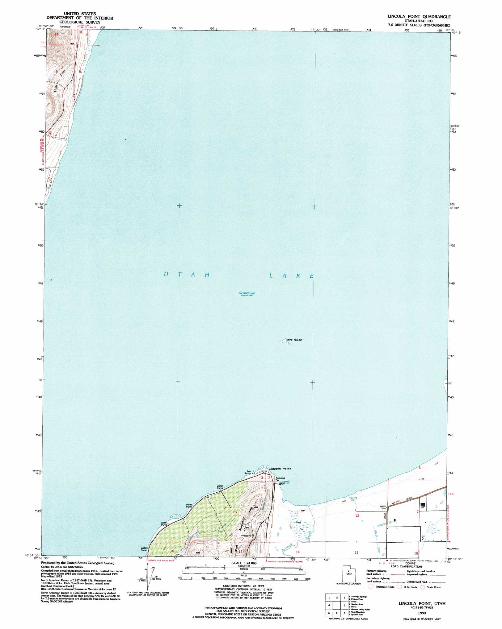
USGS Topo Quad 40111b7 - 1:24,000 scale
| Topo Map Name: | Lincoln Point |
| USGS Topo Quad ID: | 40111b7 |
| Print Size: | ca. 21 1/4" wide x 27" high |
| Southeast Coordinates: | 40.125° N latitude / 111.75° W longitude |
| Map Center Coordinates: | 40.1875° N latitude / 111.8125° W longitude |
| U.S. State: | UT |
| Filename: | o40111b7.jpg |
| Download Map JPG Image: | Lincoln Point topo map 1:24,000 scale |
| Map Type: | Topographic |
| Topo Series: | 7.5´ |
| Map Scale: | 1:24,000 |
| Source of Map Images: | United States Geological Survey (USGS) |
| Alternate Map Versions: |
Lincoln Point UT 1950, updated 1958 Download PDF Buy paper map Lincoln Point UT 1950, updated 1970 Download PDF Buy paper map Lincoln Point UT 1952 Download PDF Buy paper map Lincoln Point UT 1993, updated 1994 Download PDF Buy paper map Lincoln Point UT 1997, updated 2001 Download PDF Buy paper map Lincoln Point UT 2011 Download PDF Buy paper map Lincoln Point UT 2014 Download PDF Buy paper map |
1:24,000 Topo Quads surrounding Lincoln Point
Tickville Spring |
Jordan Narrows |
Lehi |
Timpanogos Cave |
Aspen Grove |
Cedar Fort |
Saratoga Springs |
Pelican Point |
Orem |
Bridal Veil Falls |
Goshen Pass |
Soldiers Pass |
Lincoln Point |
Provo |
Springville |
Allens Ranch |
Goshen Valley North |
West Mountain |
Spanish Fork |
Spanish Fork Peak |
Eureka |
Goshen |
Santaquin |
Payson Lakes |
Birdseye |
> Back to 40111a1 at 1:100,000 scale
> Back to 40110a1 at 1:250,000 scale
> Back to U.S. Topo Maps home
Lincoln Point topo map: Gazetteer
Lincoln Point: Capes
Lincoln Point elevation 1380m 4527′Lincoln Point: Islands
Bird Island elevation 1369m 4491′Lincoln Point: Lakes
Utah Lake elevation 1369m 4491′Lincoln Point: Parks
Rock Island Waterfowl Management Area elevation 1369m 4491′Lincoln Point: Streams
Benjamin Slough elevation 1369m 4491′Lincoln Point: Valleys
Big Cove elevation 1379m 4524′Little Cove elevation 1425m 4675′
Lincoln Point digital topo map on disk
Buy this Lincoln Point topo map showing relief, roads, GPS coordinates and other geographical features, as a high-resolution digital map file on DVD: