Vernon Topo Map Utah
To zoom in, hover over the map of Vernon
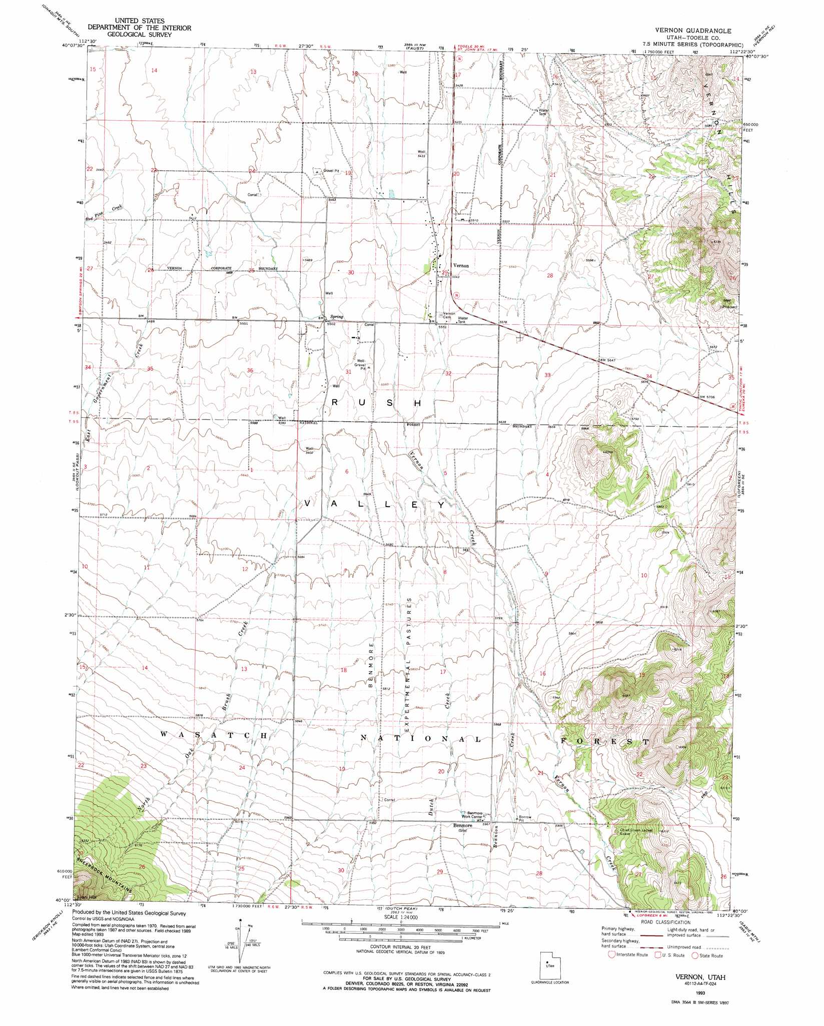
USGS Topo Quad 40112a4 - 1:24,000 scale
| Topo Map Name: | Vernon |
| USGS Topo Quad ID: | 40112a4 |
| Print Size: | ca. 21 1/4" wide x 27" high |
| Southeast Coordinates: | 40° N latitude / 112.375° W longitude |
| Map Center Coordinates: | 40.0625° N latitude / 112.4375° W longitude |
| U.S. State: | UT |
| Filename: | o40112a4.jpg |
| Download Map JPG Image: | Vernon topo map 1:24,000 scale |
| Map Type: | Topographic |
| Topo Series: | 7.5´ |
| Map Scale: | 1:24,000 |
| Source of Map Images: | United States Geological Survey (USGS) |
| Alternate Map Versions: |
Vernon UT 1971, updated 1974 Download PDF Buy paper map Vernon UT 1993, updated 1993 Download PDF Buy paper map Vernon UT 1998, updated 2002 Download PDF Buy paper map Vernon UT 2011 Download PDF Buy paper map Vernon UT 2014 Download PDF Buy paper map |
| FStopo: | US Forest Service topo Vernon is available: Download FStopo PDF Download FStopo TIF |
1:24,000 Topo Quads surrounding Vernon
Terra |
Johnson Pass |
Saint John |
Ophir |
Mercur |
Davis Knolls |
Onaqui Mountains South |
Faust |
Vernon Ne |
Fivemile Pass |
Indian Peaks |
Lookout Pass |
Vernon |
Lofgreen |
Boulter Peak |
Indian Springs |
Erickson Knoll |
Dutch Peak |
Sabie Mountain |
Tintic Junction |
Erickson Wash Sw |
Desert Mountain Pass |
Cherry Creek |
Maple Peak |
Mcintyre |
> Back to 40112a1 at 1:100,000 scale
> Back to 40112a1 at 1:250,000 scale
> Back to U.S. Topo Maps home
Vernon topo map: Gazetteer
Vernon: Airports
Vernon Airstrip elevation 1676m 5498′Vernon: Flats
Benmore Experimental Pastures elevation 1764m 5787′Vernon: Populated Places
Vernon elevation 1681m 5515′Vernon: Streams
Bennion Creek elevation 1763m 5784′Dutch Creek elevation 1714m 5623′
East Government Creek elevation 1669m 5475′
North Oak Brush Creek elevation 1720m 5643′
Red Pine Creek elevation 1659m 5442′
Vernon Creek elevation 1691m 5547′
Vernon digital topo map on disk
Buy this Vernon topo map showing relief, roads, GPS coordinates and other geographical features, as a high-resolution digital map file on DVD: