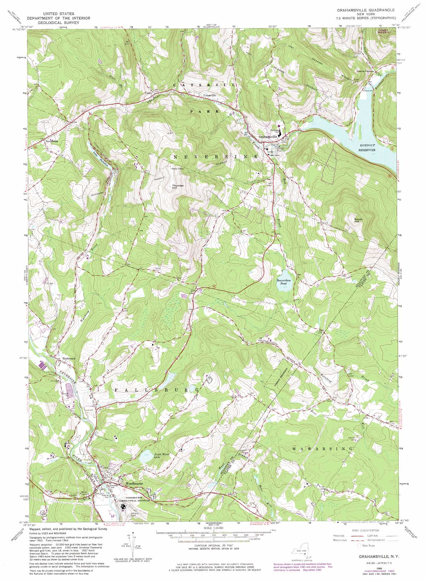
Grahamsville Topo Map New York
To zoom in, hover over the map of Grahamsville
USGS Topo Quad 41074g5 - 1:24,000 scale
| Topo Map Name: | Grahamsville |
| USGS Topo Quad ID: | 41074g5 |
| Print Size: | ca. 21 1/4" wide x 27" high |
| Southeast Coordinates: | 41.75° N latitude / 74.5° W longitude |
| Map Center Coordinates: | 41.8125° N latitude / 74.5625° W longitude |
| U.S. State: | NY |
| Filename: | o41074g5.jpg |
| Download Map JPG Image: | Grahamsville topo map 1:24,000 scale |
| Map Type: | Topographic |
| Topo Series: | 7.5´ |
| Map Scale: | 1:24,000 |
| Source of Map Images: | United States Geological Survey (USGS) |
| Alternate Map Versions: |
Grahamsville NY 1966, updated 1968 Download PDF Buy paper map Grahamsville NY 1982, updated 1982 Download PDF Buy paper map Grahamsville NY 2010 Download PDF Buy paper map Grahamsville NY 2013 Download PDF Buy paper map Grahamsville NY 2016 Download PDF Buy paper map |
1:24,000 Topo Quads surrounding Grahamsville
Lewbeach |
Arena |
Seager |
Shandaken |
Phoenicia |
Livingston Manor |
Willowemoc |
Claryville |
Peekamoose Mountain |
West Shokan |
Liberty West |
Liberty East |
Grahamsville |
Rondout Reservoir |
Kerhonkson |
White Lake |
Monticello |
Woodridge |
Ellenville |
Napanoch |
Highland Lake |
Hartwood |
Yankee Lake |
Wurtsboro |
Pine Bush |
> Back to 41074e1 at 1:100,000 scale
> Back to 41074a1 at 1:250,000 scale
> Back to U.S. Topo Maps home
Grahamsville topo map: Gazetteer
Grahamsville: Canals
Neversink Rondout Aqueduct elevation 586m 1922′Grahamsville: Lakes
Beaverdam Pond elevation 320m 1049′Lake Paradise elevation 410m 1345′
South Wind Lake elevation 382m 1253′
Grahamsville: Populated Places
Curry elevation 354m 1161′Grahamsville elevation 295m 967′
Hasbrouck elevation 377m 1236′
Neversink elevation 498m 1633′
Unionville elevation 318m 1043′
Woodbourne elevation 362m 1187′
Grahamsville: Streams
Chestnut Creek elevation 256m 839′Red Brook elevation 269m 882′
Scott Brook elevation 390m 1279′
Sugarloaf Brook elevation 256m 839′
Wynkoop Brook elevation 374m 1227′
Grahamsville: Summits
South Hill elevation 601m 1971′Thunder Hill elevation 685m 2247′
Grahamsville digital topo map on disk
Buy this Grahamsville topo map showing relief, roads, GPS coordinates and other geographical features, as a high-resolution digital map file on DVD:
New York, Vermont, Connecticut & Western Massachusetts
Buy digital topo maps: New York, Vermont, Connecticut & Western Massachusetts