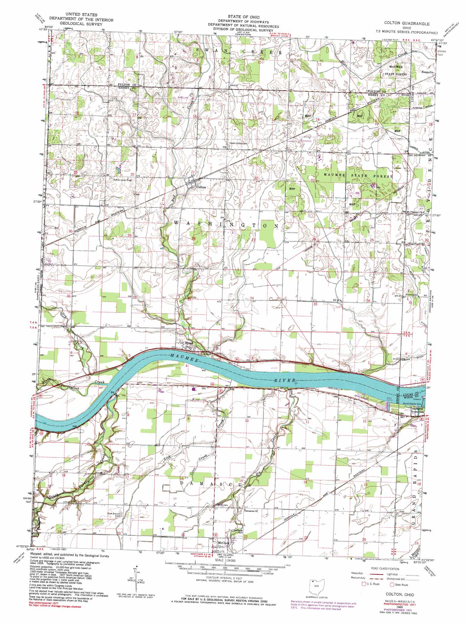
Colton Topo Map Ohio
To zoom in, hover over the map of Colton
USGS Topo Quad 41083d8 - 1:24,000 scale
| Topo Map Name: | Colton |
| USGS Topo Quad ID: | 41083d8 |
| Print Size: | ca. 21 1/4" wide x 27" high |
| Southeast Coordinates: | 41.375° N latitude / 83.875° W longitude |
| Map Center Coordinates: | 41.4375° N latitude / 83.9375° W longitude |
| U.S. State: | OH |
| Filename: | o41083d8.jpg |
| Download Map JPG Image: | Colton topo map 1:24,000 scale |
| Map Type: | Topographic |
| Topo Series: | 7.5´ |
| Map Scale: | 1:24,000 |
| Source of Map Images: | United States Geological Survey (USGS) |
| Alternate Map Versions: |
Colton OH 1960, updated 1961 Download PDF Buy paper map Colton OH 1960, updated 1972 Download PDF Buy paper map Colton OH 1960, updated 1981 Download PDF Buy paper map Colton OH 2010 Download PDF Buy paper map Colton OH 2013 Download PDF Buy paper map Colton OH 2016 Download PDF Buy paper map |
1:24,000 Topo Quads surrounding Colton
Morenci |
Lyons |
Assumption |
Berkey |
Sylvania |
Wauseon |
Delta |
Swanton |
Whitehouse |
Maumee |
Napoleon West |
Napoleon East |
Colton |
Grand Rapids |
Bowling Green North |
Florida |
Malinta |
Mcclure |
Weston |
Bowling Green South |
New Bavaria |
Hamler |
Deshler |
Hoytville |
North Baltimore |
> Back to 41083a1 at 1:100,000 scale
> Back to 41082a1 at 1:250,000 scale
> Back to U.S. Topo Maps home
Colton topo map: Gazetteer
Colton: Canals
Geahlin Ditch elevation 204m 669′Colton: Dams
Grand Rapids Dam elevation 194m 636′Colton: Forests
Maumee State Forest elevation 207m 679′Colton: Parks
North Turkeyfoot State Park elevation 198m 649′Thurston State Park elevation 195m 639′
Colton: Populated Places
Colton elevation 204m 669′Texas elevation 202m 662′
Colton: Post Offices
Colton Post Office elevation 205m 672′Texas Post Office (historical) elevation 202m 662′
Colton: Streams
Bad Creek elevation 195m 639′Big Creek elevation 195m 639′
Coon Creek elevation 201m 659′
Dry Creek elevation 195m 639′
Lick Creek elevation 195m 639′
Little Turkeyfoot Creek elevation 196m 643′
North Turkeyfoot Creek elevation 195m 639′
South Turkeyfoot Creek elevation 196m 643′
Colton digital topo map on disk
Buy this Colton topo map showing relief, roads, GPS coordinates and other geographical features, as a high-resolution digital map file on DVD:
 map DVD")