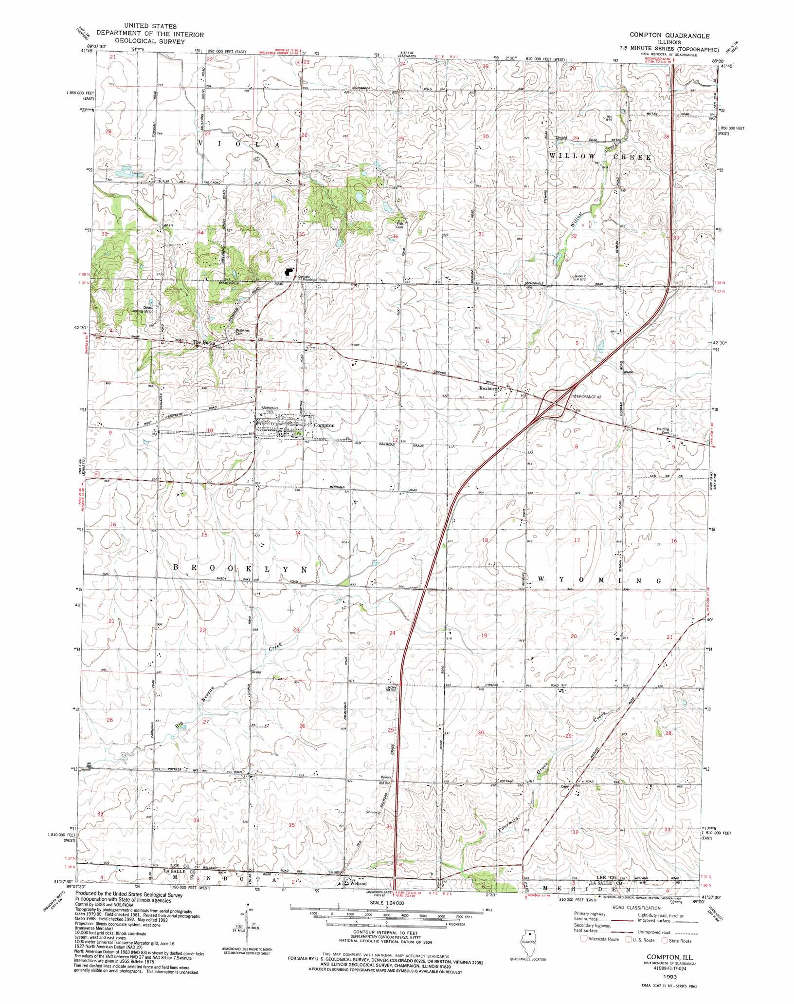
Compton Topo Map Illinois
To zoom in, hover over the map of Compton
USGS Topo Quad 41089f1 - 1:24,000 scale
| Topo Map Name: | Compton |
| USGS Topo Quad ID: | 41089f1 |
| Print Size: | ca. 21 1/4" wide x 27" high |
| Southeast Coordinates: | 41.625° N latitude / 89° W longitude |
| Map Center Coordinates: | 41.6875° N latitude / 89.0625° W longitude |
| U.S. State: | IL |
| Filename: | o41089f1.jpg |
| Download Map JPG Image: | Compton topo map 1:24,000 scale |
| Map Type: | Topographic |
| Topo Series: | 7.5´ |
| Map Scale: | 1:24,000 |
| Source of Map Images: | United States Geological Survey (USGS) |
| Alternate Map Versions: |
Compton IL 1982, updated 1982 Download PDF Buy paper map Compton IL 1993, updated 1993 Download PDF Buy paper map Compton IL 2012 Download PDF Buy paper map Compton IL 2015 Download PDF Buy paper map |
1:24,000 Topo Quads surrounding Compton
Daysville |
Chana |
Rochelle |
Creston |
De Kalb |
Franklin Grove |
Ashton |
Steward |
Lee |
Waterman |
Amboy |
Sublette |
Compton |
Paw Paw |
Shabbona Grove |
Lamoille |
Mendota West |
Mendota East |
Earlville |
Leland |
Malden |
Ladd |
Troy Grove |
Prairie Center |
Wedron |
> Back to 41089e1 at 1:100,000 scale
> Back to 41088a1 at 1:250,000 scale
> Back to U.S. Topo Maps home
Compton topo map: Gazetteer
Compton: Airports
Earl Barnickel Airport elevation 287m 941′W Davis Airport elevation 280m 918′
Walders Farm Airport elevation 265m 869′
Compton: Crossings
Interchange 82 elevation 280m 918′Compton: Parks
Mathesius Park elevation 298m 977′Compton: Populated Places
Compton elevation 296m 971′Melugin Grove (historical) elevation 293m 961′
Roxbury elevation 272m 892′
The Burg elevation 278m 912′
Welland elevation 267m 875′
Compton: Woods
Little Malugin Grove elevation 259m 849′Malugin Grove elevation 259m 849′
Compton digital topo map on disk
Buy this Compton topo map showing relief, roads, GPS coordinates and other geographical features, as a high-resolution digital map file on DVD:
Northern Illinois, Northern Indiana & Southwestern Michigan
Buy digital topo maps: Northern Illinois, Northern Indiana & Southwestern Michigan