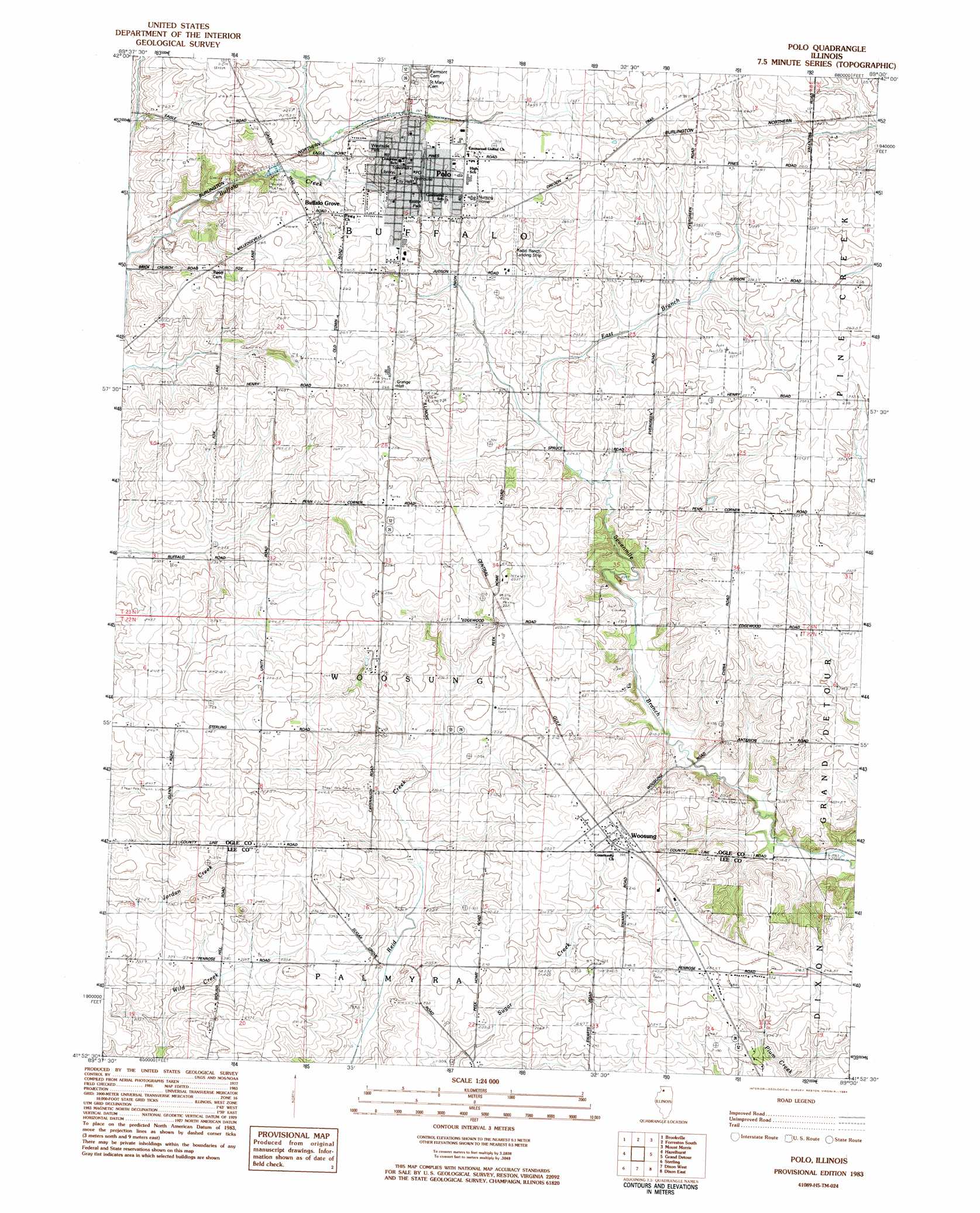
Polo Topo Map Illinois
To zoom in, hover over the map of Polo
USGS Topo Quad 41089h5 - 1:24,000 scale
| Topo Map Name: | Polo |
| USGS Topo Quad ID: | 41089h5 |
| Print Size: | ca. 21 1/4" wide x 27" high |
| Southeast Coordinates: | 41.875° N latitude / 89.5° W longitude |
| Map Center Coordinates: | 41.9375° N latitude / 89.5625° W longitude |
| U.S. State: | IL |
| Filename: | o41089h5.jpg |
| Download Map JPG Image: | Polo topo map 1:24,000 scale |
| Map Type: | Topographic |
| Topo Series: | 7.5´ |
| Map Scale: | 1:24,000 |
| Source of Map Images: | United States Geological Survey (USGS) |
| Alternate Map Versions: |
Polo IL 1983, updated 1984 Download PDF Buy paper map Polo IL 2012 Download PDF Buy paper map Polo IL 2015 Download PDF Buy paper map |
1:24,000 Topo Quads surrounding Polo
Boone Branch |
Shannon |
Forreston North |
German Valley |
Seward |
Lanark |
Brookville |
Forreston South |
Mount Morris |
Oregon |
Milledgeville |
Hazelhurst |
Polo |
Grand Detour |
Daysville |
Como |
Sterling |
Dixon West |
Dixon East |
Franklin Grove |
Tampico |
Hahnaman |
Harmon |
Walton |
Amboy |
> Back to 41089e1 at 1:100,000 scale
> Back to 41088a1 at 1:250,000 scale
> Back to U.S. Topo Maps home
Polo topo map: Gazetteer
Polo: Airports
Gentry Airport elevation 262m 859′Radio Ranch Airport elevation 258m 846′
Polo: Dams
Olsens Lake Dam elevation 253m 830′Polo: Mines
Kemper Quarry elevation 222m 728′Polo: Parks
Keator Park elevation 260m 853′Westside Park elevation 258m 846′
Polo: Populated Places
Buffalo Grove elevation 258m 846′Polo elevation 263m 862′
Woosung elevation 252m 826′
Polo: Post Offices
Polo Post Office elevation 265m 869′Woosung Post Office elevation 252m 826′
Polo: Reservoirs
Olsens Lake elevation 253m 830′Polo digital topo map on disk
Buy this Polo topo map showing relief, roads, GPS coordinates and other geographical features, as a high-resolution digital map file on DVD:
Northern Illinois, Northern Indiana & Southwestern Michigan
Buy digital topo maps: Northern Illinois, Northern Indiana & Southwestern Michigan