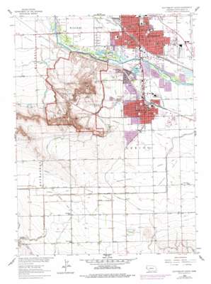
Scottsbluff South Topo Map Nebraska
To zoom in, hover over the map of Scottsbluff South
USGS Topo Quad 41103g6 - 1:24,000 scale
| Topo Map Name: | Scottsbluff South |
| USGS Topo Quad ID: | 41103g6 |
| Print Size: | ca. 21 1/4" wide x 27" high |
| Southeast Coordinates: | 41.75° N latitude / 103.625° W longitude |
| Map Center Coordinates: | 41.8125° N latitude / 103.6875° W longitude |
| U.S. State: | NE |
| Filename: | O41103G6.jpg |
| Download Map JPG Image: | Scottsbluff South topo map 1:24,000 scale |
| Map Type: | Topographic |
| Topo Series: | 7.5´ |
| Map Scale: | 1:24,000 |
| Source of Map Images: | United States Geological Survey (USGS) |
| Alternate Map Versions: |
Scottsbluff South NE 1963, updated 1965 Download PDF Buy paper map Scottsbluff South NE 1963, updated 1977 Download PDF Buy paper map Scottsbluff South NE 2011 Download PDF Buy paper map Scottsbluff South NE 2014 Download PDF Buy paper map |
1:24,000 Topo Quads surrounding Scottsbluff South
> Back to 41103e1 at 1:100,000 scale
> Back to 41102a1 at 1:250,000 scale
> Back to U.S. Topo Maps home
Scottsbluff South topo map: Gazetteer
Scottsbluff South: Bends
Mitchell Bottom elevation 1201m 3940′Scottsbluff South: Canals
Gering Lateral elevation 1273m 4176′Mitchell and Gering Canal elevation 1214m 3982′
Scottsbluff South: Dams
Frank Dam elevation 1233m 4045′Gering Valley Dam H elevation 1274m 4179′
Scottsbluff South: Gaps
Coyote Pass elevation 1320m 4330′Mitchell Pass elevation 1272m 4173′
Scottsbluff South: Islands
Nansen Island elevation 1184m 3884′Scottsbluff South: Oilfields
Cedar Valley Oil Field elevation 1221m 4005′Scottsbluff South: Parks
Bea Lovell Park elevation 1184m 3884′Carl Gray Park elevation 1191m 3907′
Central Park elevation 1184m 3884′
Cleavland Athletic Field elevation 1187m 3894′
Constitution Park elevation 1183m 3881′
Fort Mitchell Historical Marker elevation 1231m 4038′
Gardner Park elevation 1194m 3917′
Gentry Park elevation 1210m 3969′
Gering Municipal Swimming Pool elevation 1199m 3933′
Hampton Park elevation 1184m 3884′
Jaycee Park elevation 1185m 3887′
Johannes Park elevation 1212m 3976′
Lacy Park elevation 1182m 3877′
Legion Park elevation 1196m 3923′
McCaffree Park elevation 1184m 3884′
McLellan Park elevation 1188m 3897′
Neighbor Park elevation 1182m 3877′
Northfield Park elevation 1189m 3900′
Oregon Trail Park elevation 1196m 3923′
Overland Park elevation 1182m 3877′
Pioneer Park elevation 1185m 3887′
Rebecca Winters Historical Marker elevation 1178m 3864′
Riverside Park elevation 1182m 3877′
Riverside Zoo elevation 1183m 3881′
Scotts Bluff National Monument elevation 1301m 4268′
Union Pacific Park elevation 1189m 3900′
Veterans Park elevation 1181m 3874′
Westmoor Park elevation 1185m 3887′
YMCA Park elevation 1180m 3871′
Scottsbluff South: Pillars
Crown Rock elevation 1389m 4557′Dome Rock elevation 1341m 4399′
Eagle Rock elevation 1366m 4481′
Sentinel Rock elevation 1338m 4389′
Scottsbluff South: Populated Places
Costin elevation 1199m 3933′Evergreen Estates Mobile Homes elevation 1185m 3887′
Gering elevation 1192m 3910′
Scottsbluff elevation 1186m 3891′
Sunrise Village Mobile Home Park elevation 1181m 3874′
Terrytown elevation 1181m 3874′
Scottsbluff South: Post Offices
Gering Post Office elevation 1193m 3914′Scottsbluff Post Office elevation 1184m 3884′
Scottsbluff South: Reservoirs
Frank Reservoir elevation 1233m 4045′Gering Valley Reservoir H elevation 1274m 4179′
Scottsbluff South: Ridges
South Bluff elevation 1433m 4701′Scottsbluff South: Springs
Scotts Spring elevation 1267m 4156′Scottsbluff South: Summits
Scotts Bluff elevation 1370m 4494′Scottsbluff South: Trails
Gering - 'U' Street Pathway elevation 1192m 3910′Monument Valley Trail - Scottsbluff elevation 1186m 3891′
Scottsbluff Trails elevation 1186m 3891′
Scottsbluff South: Valleys
Cedar Canyon elevation 1248m 4094′Cedar Valley elevation 1209m 3966′
Scottsbluff South digital topo map on disk
Buy this Scottsbluff South topo map showing relief, roads, GPS coordinates and other geographical features, as a high-resolution digital map file on DVD:
Eastern Wyoming & Western South Dakota
Buy digital topo maps: Eastern Wyoming & Western South Dakota


