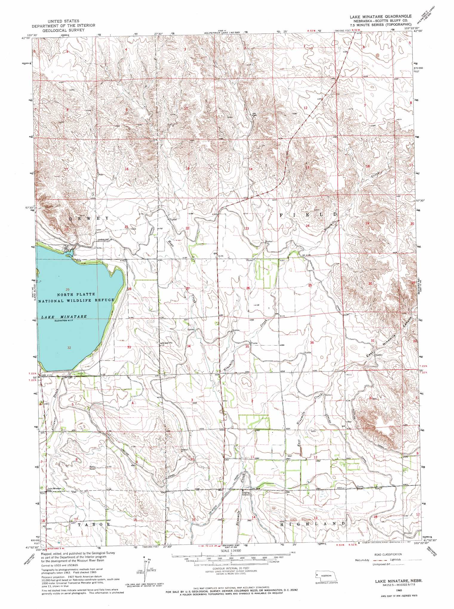
Lake Minatare Topo Map Nebraska
To zoom in, hover over the map of Lake Minatare
USGS Topo Quad 41103h4 - 1:24,000 scale
| Topo Map Name: | Lake Minatare |
| USGS Topo Quad ID: | 41103h4 |
| Print Size: | ca. 21 1/4" wide x 27" high |
| Southeast Coordinates: | 41.875° N latitude / 103.375° W longitude |
| Map Center Coordinates: | 41.9375° N latitude / 103.4375° W longitude |
| U.S. State: | NE |
| Filename: | O41103H4.jpg |
| Download Map JPG Image: | Lake Minatare topo map 1:24,000 scale |
| Map Type: | Topographic |
| Topo Series: | 7.5´ |
| Map Scale: | 1:24,000 |
| Source of Map Images: | United States Geological Survey (USGS) |
| Alternate Map Versions: |
Lake Minatare NE 1965, updated 1967 Download PDF Buy paper map Lake Minatare NE 2011 Download PDF Buy paper map Lake Minatare NE 2014 Download PDF Buy paper map |
1:24,000 Topo Quads surrounding Lake Minatare
University Lake Nw |
University Lake Ne |
Kilpatrick Lake Nw |
Kilpatrick Lake Ne |
Hemingford 4 Nw |
University Lake |
University Lake Se |
Kilpatrick Lake Sw |
Kilpatrick Lake |
Hemingford 4 Sw |
Scottsbluff North |
Lake Alice |
Lake Minatare |
Bayard Ne |
Angora Nw |
Scottsbluff South |
Minatare |
Bayard Sw |
Bayard |
Angora |
Wildcat Mountain |
Wright Gap |
Mcgrew |
South Bayard |
Bridgeport Nw |
> Back to 41103e1 at 1:100,000 scale
> Back to 41102a1 at 1:250,000 scale
> Back to U.S. Topo Maps home
Lake Minatare topo map: Gazetteer
Lake Minatare: Canals
High Line Canal elevation 1271m 4169′Lake Minatare: Parks
Nine Mile Creek State Wildlife Management Area elevation 1213m 3979′North Platte National Wildlife Refuge elevation 1254m 4114′
Lake Minatare: Reservoirs
Lake Minatare elevation 1254m 4114′Lake Minatare: Streams
East Ninemile Creek elevation 1207m 3959′Hope Creek elevation 1225m 4019′
Lake Minatare: Valleys
East Ninemile Canyon elevation 1254m 4114′Lake Minatare digital topo map on disk
Buy this Lake Minatare topo map showing relief, roads, GPS coordinates and other geographical features, as a high-resolution digital map file on DVD:
Eastern Wyoming & Western South Dakota
Buy digital topo maps: Eastern Wyoming & Western South Dakota