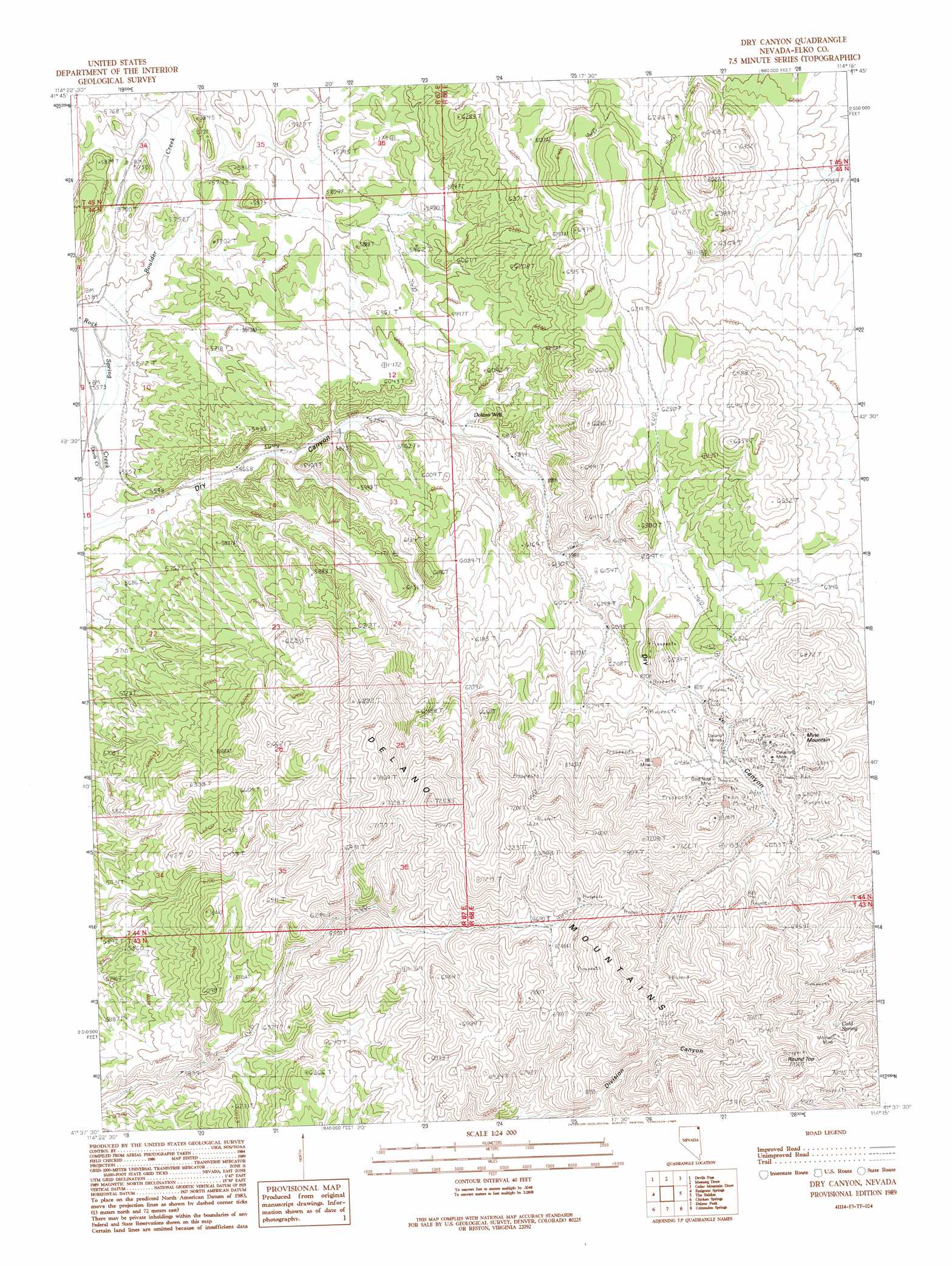
Dry Canyon Topo Map Nevada
To zoom in, hover over the map of Dry Canyon
USGS Topo Quad 41114f3 - 1:24,000 scale
| Topo Map Name: | Dry Canyon |
| USGS Topo Quad ID: | 41114f3 |
| Print Size: | ca. 21 1/4" wide x 27" high |
| Southeast Coordinates: | 41.625° N latitude / 114.25° W longitude |
| Map Center Coordinates: | 41.6875° N latitude / 114.3125° W longitude |
| U.S. State: | NV |
| Filename: | o41114f3.jpg |
| Download Map JPG Image: | Dry Canyon topo map 1:24,000 scale |
| Map Type: | Topographic |
| Topo Series: | 7.5´ |
| Map Scale: | 1:24,000 |
| Source of Map Images: | United States Geological Survey (USGS) |
| Alternate Map Versions: |
Dry Canyon NV 1980, updated 1980 Download PDF Buy paper map Dry Canyon NV 1989, updated 1989 Download PDF Buy paper map Dry Canyon NV 2012 Download PDF Buy paper map Dry Canyon NV 2014 Download PDF Buy paper map |
1:24,000 Topo Quads surrounding Dry Canyon
East Of Jackpot |
Gollaher Mountain |
Stratton Spring |
Fivemile Gulch |
Nile Spring |
Tijuana John Peak |
Devils Pass |
Mustang Draw |
Cedar Mountain Draw |
Judd Mountain |
Texas Spring |
Emigrant Springs |
Dry Canyon |
The Baldies |
Death Creek Reservoir |
Knoll Mountain Se |
Chicken Springs |
Delano Peak |
Crittenden Springs |
Dairy Valley |
Wine Cup Ranch Ne |
Ninemile Mountain |
Ninemile Mountain Ne |
Twelvemile Ranch |
Jackson Spring |
> Back to 41114e1 at 1:100,000 scale
> Back to 41114a1 at 1:250,000 scale
> Back to U.S. Topo Maps home
Dry Canyon topo map: Gazetteer
Dry Canyon: Mines
Cleveland Mine elevation 2047m 6715′Delano Mines elevation 1956m 6417′
Eightysix Mine elevation 2028m 6653′
Gold Note Mine elevation 1996m 6548′
Mitchell Mine elevation 2115m 6938′
Dry Canyon: Populated Places
Delano (historical) elevation 1950m 6397′Dry Canyon: Post Offices
Delno Post Office (historical) elevation 1950m 6397′Dry Canyon: Springs
Cold Spring elevation 2085m 6840′Dry Canyon: Streams
Boulder Creek elevation 1684m 5524′Devils Creek elevation 1686m 5531′
Dry Canyon: Summits
Mine Mountain elevation 2103m 6899′Round Top elevation 2332m 7650′
Dry Canyon: Wells
Boulder Well elevation 1777m 5830′Delano Well elevation 1794m 5885′
Dry Canyon digital topo map on disk
Buy this Dry Canyon topo map showing relief, roads, GPS coordinates and other geographical features, as a high-resolution digital map file on DVD: