Marcellus Topo Map Michigan
To zoom in, hover over the map of Marcellus
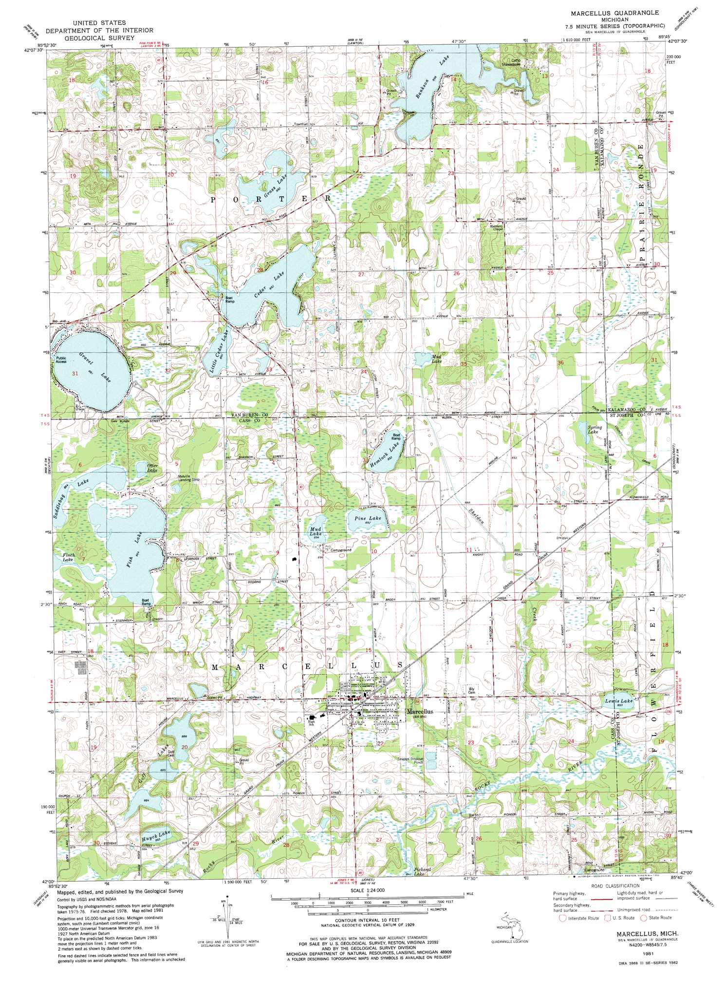
USGS Topo Quad 42085a7 - 1:24,000 scale
| Topo Map Name: | Marcellus |
| USGS Topo Quad ID: | 42085a7 |
| Print Size: | ca. 21 1/4" wide x 27" high |
| Southeast Coordinates: | 42° N latitude / 85.75° W longitude |
| Map Center Coordinates: | 42.0625° N latitude / 85.8125° W longitude |
| U.S. State: | MI |
| Filename: | o42085a7.jpg |
| Download Map JPG Image: | Marcellus topo map 1:24,000 scale |
| Map Type: | Topographic |
| Topo Series: | 7.5´ |
| Map Scale: | 1:24,000 |
| Source of Map Images: | United States Geological Survey (USGS) |
| Alternate Map Versions: |
Marcellus MI 1981, updated 1982 Download PDF Buy paper map Marcellus MI 2011 Download PDF Buy paper map Marcellus MI 2014 Download PDF Buy paper map Marcellus MI 2016 Download PDF Buy paper map |
1:24,000 Topo Quads surrounding Marcellus
Bangor |
Gobles West |
Gobles East |
Kalamazoo Sw |
Kalamazoo |
Lawrence |
Paw Paw |
Lawton |
Schoolcraft Nw |
Portage |
Twin Lakes |
Decatur |
Marcellus |
Schoolcraft |
Vicksburg |
Dowagiac |
Vandalia |
Jones |
Three Rivers West |
Three Rivers East |
Edwardsburg |
Adamsville |
Mottville |
Constantine |
Klinger Lake |
> Back to 42085a1 at 1:100,000 scale
> Back to 42084a1 at 1:250,000 scale
> Back to U.S. Topo Maps home
Marcellus topo map: Gazetteer
Marcellus: Airports
Melville Landing Strip elevation 274m 898′Marcellus: Lakes
Bankson Lake elevation 274m 898′Cedar Lake elevation 272m 892′
Fish Lake elevation 263m 862′
Goff Lakes elevation 270m 885′
Grass Lake elevation 272m 892′
Gravel Lake elevation 268m 879′
Hemlock Lake elevation 272m 892′
Huyck Lake elevation 264m 866′
Lewis Lake elevation 259m 849′
Little Cedar Lake elevation 272m 892′
Mud Lake elevation 271m 889′
Mud Lake elevation 272m 892′
Otter Lake elevation 265m 869′
Pickerel Lake elevation 259m 849′
Pine Lake elevation 273m 895′
Saddlebag Lake elevation 263m 862′
Spring Lake elevation 271m 889′
Marcellus: Populated Places
Beech Grove Trailer Park elevation 274m 898′Marcellus elevation 273m 895′
Marcellus: Post Offices
Marcellus Post Office elevation 273m 895′Marcellus: Streams
Sheldon Creek elevation 256m 839′Marcellus digital topo map on disk
Buy this Marcellus topo map showing relief, roads, GPS coordinates and other geographical features, as a high-resolution digital map file on DVD:
Northern Illinois, Northern Indiana & Southwestern Michigan
Buy digital topo maps: Northern Illinois, Northern Indiana & Southwestern Michigan