Wadena Topo Map Iowa
To zoom in, hover over the map of Wadena
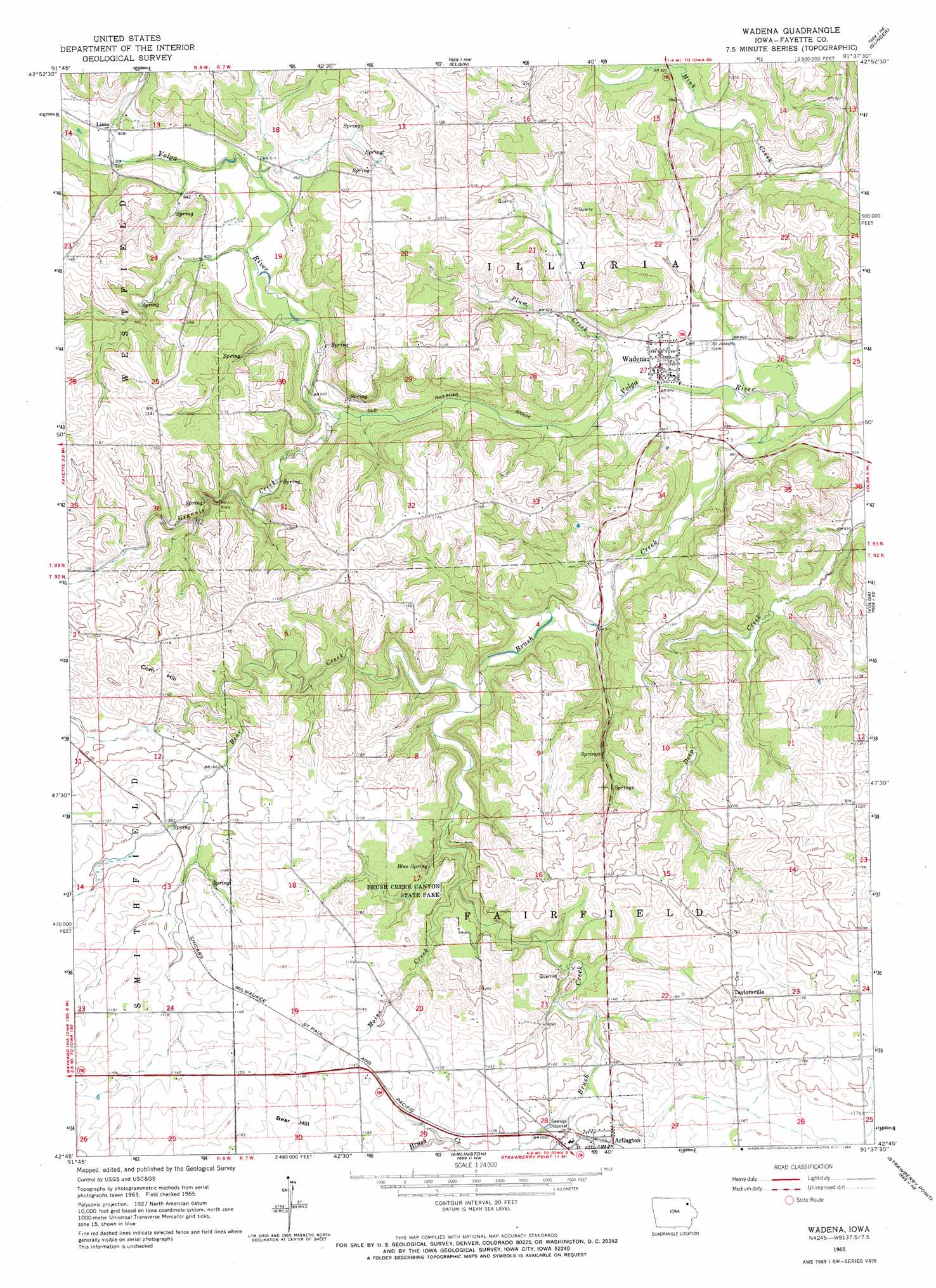
USGS Topo Quad 42091g6 - 1:24,000 scale
| Topo Map Name: | Wadena |
| USGS Topo Quad ID: | 42091g6 |
| Print Size: | ca. 21 1/4" wide x 27" high |
| Southeast Coordinates: | 42.75° N latitude / 91.625° W longitude |
| Map Center Coordinates: | 42.8125° N latitude / 91.6875° W longitude |
| U.S. State: | IA |
| Filename: | o42091g6.jpg |
| Download Map JPG Image: | Wadena topo map 1:24,000 scale |
| Map Type: | Topographic |
| Topo Series: | 7.5´ |
| Map Scale: | 1:24,000 |
| Source of Map Images: | United States Geological Survey (USGS) |
| Alternate Map Versions: |
Wadena IA 1965, updated 1966 Download PDF Buy paper map Wadena IA 2010 Download PDF Buy paper map Wadena IA 2013 Download PDF Buy paper map Wadena IA 2015 Download PDF Buy paper map |
1:24,000 Topo Quads surrounding Wadena
Saint Lucas |
Festina |
Castalia |
Postville |
Monona |
Hawkeye |
West Union |
Elgin |
Gunder |
Saint Olaf |
Maynard |
Fayette |
Wadena |
Volga |
Elkader |
Oelwein |
Stanley |
Arlington |
Strawberry Point |
Edgewood |
Hazleton |
Oelwein Se |
Lamont |
Dundee |
Thorpe |
> Back to 42091e1 at 1:100,000 scale
> Back to 42090a1 at 1:250,000 scale
> Back to U.S. Topo Maps home
Wadena topo map: Gazetteer
Wadena: Parks
Brush Creek Canyon State Park elevation 321m 1053′Grannis Creek Wildlife Management Area elevation 346m 1135′
Wadena: Populated Places
Lima elevation 282m 925′Taylorsville elevation 368m 1207′
Wadena elevation 269m 882′
Wadena: Post Offices
Corn Hill Post Office (historical) elevation 335m 1099′Lima Post Office (historical) elevation 282m 925′
Mill Grove Post Office (historical) elevation 273m 895′
Taylorsville Post Office (historical) elevation 368m 1207′
Wadena Post Office elevation 268m 879′
Wadena: Springs
Blue Spring elevation 300m 984′Wadena: Streams
Bear Creek elevation 283m 928′Brush Creek elevation 256m 839′
Grannis Creek elevation 266m 872′
Moine Creek elevation 303m 994′
Plum Creek elevation 261m 856′
Wadena: Summits
Bear Hill elevation 360m 1181′Corn Hill elevation 364m 1194′
Wadena digital topo map on disk
Buy this Wadena topo map showing relief, roads, GPS coordinates and other geographical features, as a high-resolution digital map file on DVD: