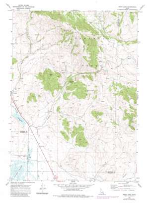
Swan Lake Topo Map Idaho
To zoom in, hover over the map of Swan Lake
USGS Topo Quad 42111c8 - 1:24,000 scale
| Topo Map Name: | Swan Lake |
| USGS Topo Quad ID: | 42111c8 |
| Print Size: | ca. 21 1/4" wide x 27" high |
| Southeast Coordinates: | 42.25° N latitude / 111.875° W longitude |
| Map Center Coordinates: | 42.3125° N latitude / 111.9375° W longitude |
| U.S. State: | ID |
| Filename: | o42111c8.jpg |
| Download Map JPG Image: | Swan Lake topo map 1:24,000 scale |
| Map Type: | Topographic |
| Topo Series: | 7.5´ |
| Map Scale: | 1:24,000 |
| Source of Map Images: | United States Geological Survey (USGS) |
| Alternate Map Versions: |
Swan Lake ID 1969, updated 1973 Download PDF Buy paper map Swan Lake ID 1969, updated 1983 Download PDF Buy paper map Swan Lake ID 2010 Download PDF Buy paper map Swan Lake ID 2013 Download PDF Buy paper map |
1:24,000 Topo Quads surrounding Swan Lake
> Back to 42111a1 at 1:100,000 scale
> Back to 42110a1 at 1:250,000 scale
> Back to U.S. Topo Maps home
Swan Lake topo map: Gazetteer
Swan Lake: Lakes
Swan Lake elevation 1451m 4760′Swan Lake: Populated Places
Swan Lake elevation 1463m 4799′Swan Lake: Springs
Dry Hollow Spring elevation 1960m 6430′Heart Mountain Spring elevation 1621m 5318′
Swan Lake: Streams
Gooseberry Creek elevation 1452m 4763′Stockton Creek elevation 1452m 4763′
Swan Lake Slough elevation 1451m 4760′
Swan Lake: Summits
Cedar Hill elevation 1866m 6122′Dry Hollow Mountain elevation 2172m 7125′
Heart Mountain elevation 1920m 6299′
Swan Lake: Valleys
Coyote Hollow elevation 1591m 5219′Dry Hollow elevation 1566m 5137′
Hutchins Canyon elevation 1599m 5246′
Swan Lake digital topo map on disk
Buy this Swan Lake topo map showing relief, roads, GPS coordinates and other geographical features, as a high-resolution digital map file on DVD:


