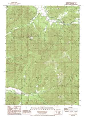
Murphy Mountain Topo Map Oregon
To zoom in, hover over the map of Murphy Mountain
USGS Topo Quad 42123c4 - 1:24,000 scale
| Topo Map Name: | Murphy Mountain |
| USGS Topo Quad ID: | 42123c4 |
| Print Size: | ca. 21 1/4" wide x 27" high |
| Southeast Coordinates: | 42.25° N latitude / 123.375° W longitude |
| Map Center Coordinates: | 42.3125° N latitude / 123.4375° W longitude |
| U.S. State: | OR |
| Filename: | o42123c4.jpg |
| Download Map JPG Image: | Murphy Mountain topo map 1:24,000 scale |
| Map Type: | Topographic |
| Topo Series: | 7.5´ |
| Map Scale: | 1:24,000 |
| Source of Map Images: | United States Geological Survey (USGS) |
| Alternate Map Versions: |
Murphy Mtn OR 1986, updated 1986 Download PDF Buy paper map Murphy Mountain OR 1996, updated 1999 Download PDF Buy paper map Murphy Mountain OR 2011 Download PDF Buy paper map Murphy Mountain OR 2014 Download PDF Buy paper map |
| FStopo: | US Forest Service topo Murphy Mountain is available: Download FStopo PDF Download FStopo TIF |
1:24,000 Topo Quads surrounding Murphy Mountain
> Back to 42123a1 at 1:100,000 scale
> Back to 42122a1 at 1:250,000 scale
> Back to U.S. Topo Maps home
Murphy Mountain topo map: Gazetteer
Murphy Mountain: Parks
Fish Hatchery County Park elevation 297m 974′Murphy Mountain: Streams
Bull Creek elevation 289m 948′Case Creek elevation 504m 1653′
Cedar Creek elevation 471m 1545′
Cheney Creek elevation 296m 971′
Drier Creek elevation 579m 1899′
Dry Creek elevation 526m 1725′
Fowlie Creek elevation 477m 1564′
Harmon Creek elevation 502m 1646′
Jackson Creek elevation 301m 987′
Little Cheney Creek elevation 307m 1007′
North Fork Deer Creek elevation 513m 1683′
South Fork Deer Creek elevation 512m 1679′
Spencer Creek elevation 478m 1568′
Stringer Creek elevation 306m 1003′
White Creek elevation 487m 1597′
Murphy Mountain: Summits
Bolt Mountain elevation 664m 2178′Eagle Mountain elevation 831m 2726′
Marble Mountain elevation 915m 3001′
Mungers Butte elevation 1578m 5177′
Murphy Mountain elevation 1377m 4517′
Roundtop Mountain elevation 1443m 4734′
Murphy Mountain: Valleys
Small Gulch elevation 319m 1046′Murphy Mountain digital topo map on disk
Buy this Murphy Mountain topo map showing relief, roads, GPS coordinates and other geographical features, as a high-resolution digital map file on DVD:


