Rocky Butte Gulch Topo Map Wyoming
To zoom in, hover over the map of Rocky Butte Gulch
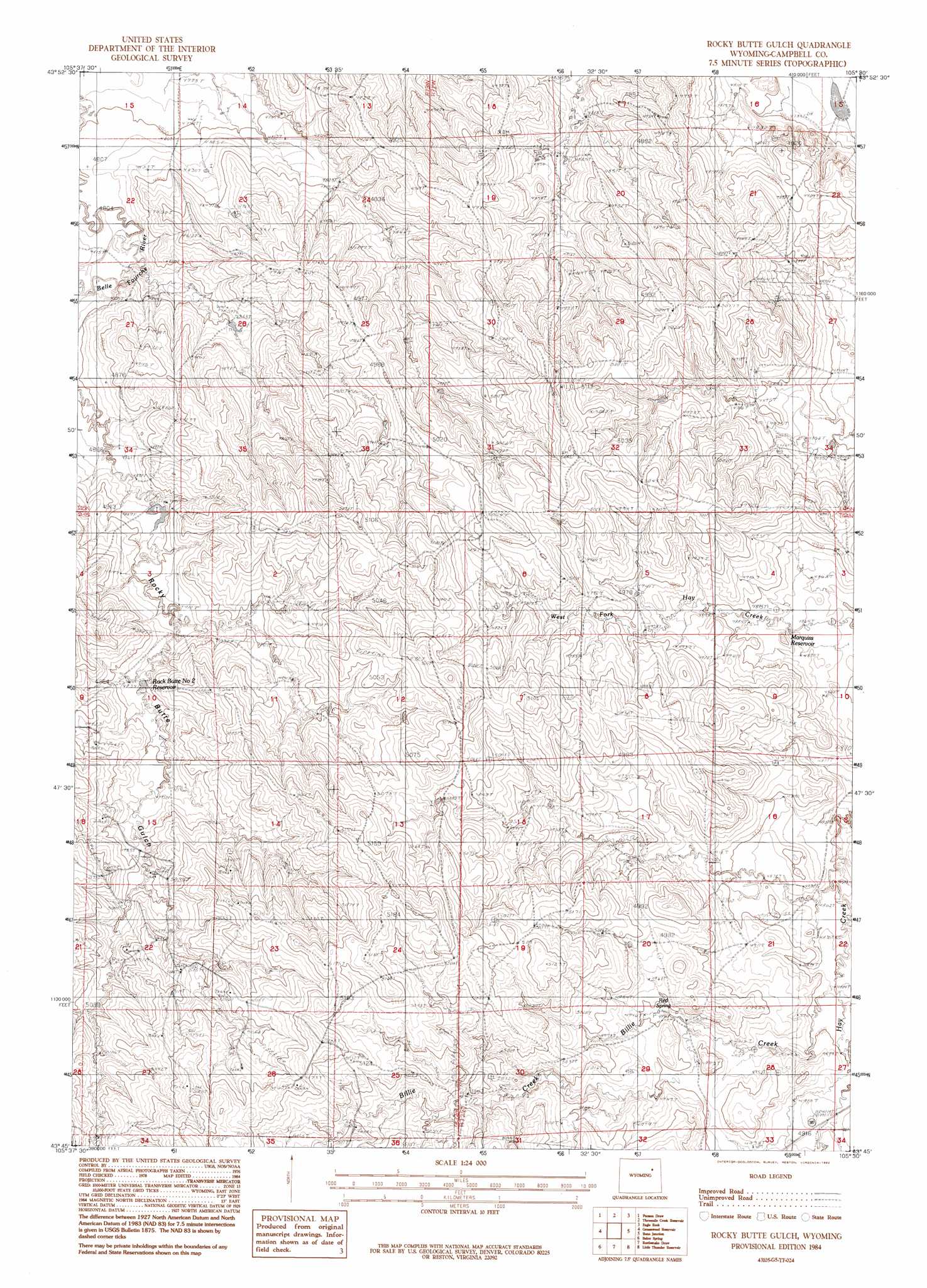
USGS Topo Quad 43105g5 - 1:24,000 scale
| Topo Map Name: | Rocky Butte Gulch |
| USGS Topo Quad ID: | 43105g5 |
| Print Size: | ca. 21 1/4" wide x 27" high |
| Southeast Coordinates: | 43.75° N latitude / 105.5° W longitude |
| Map Center Coordinates: | 43.8125° N latitude / 105.5625° W longitude |
| U.S. State: | WY |
| Filename: | o43105g5.jpg |
| Download Map JPG Image: | Rocky Butte Gulch topo map 1:24,000 scale |
| Map Type: | Topographic |
| Topo Series: | 7.5´ |
| Map Scale: | 1:24,000 |
| Source of Map Images: | United States Geological Survey (USGS) |
| Alternate Map Versions: |
Rocky Butte Gulch WY 1984, updated 1984 Download PDF Buy paper map Rocky Butte Gulch WY 1984, updated 1992 Download PDF Buy paper map Rocky Butte Gulch WY 2012 Download PDF Buy paper map Rocky Butte Gulch WY 2015 Download PDF Buy paper map |
1:24,000 Topo Quads surrounding Rocky Butte Gulch
Double Tanks |
Pleasantdale |
Scaper Reservoir |
The Gap Sw |
Saddle Horse Butte |
Wags Pinnacle |
Pepsson Draw |
Threemile Creek Reservoir |
Eagle Rock |
Neil Butte |
Savageton |
Greasewood Reservoir |
Rocky Butte Gulch |
Reno Junction |
Hilight |
South Butte |
Baker Spring |
Rattlesnake Draw |
Little Thunder Reservoir |
Reno Reservoir |
Pine Tree |
Turnercrest |
Reno Flats |
Teckla Sw |
Teckla |
> Back to 43105e1 at 1:100,000 scale
> Back to 43104a1 at 1:250,000 scale
> Back to U.S. Topo Maps home
Rocky Butte Gulch topo map: Gazetteer
Rocky Butte Gulch: Dams
Rocky Gulch Dam elevation 1492m 4895′Rocky Butte Gulch: Reservoirs
Marquiss Reservoir elevation 1485m 4872′Rock Butte Number 2 Reservoir elevation 1503m 4931′
Rocky Gulch Reservoir elevation 1492m 4895′
Rocky Butte Gulch: Streams
Billie Creek elevation 1490m 4888′Rocky Butte Gulch: Valleys
Dry Draw elevation 1523m 4996′Rocky Butte Gulch digital topo map on disk
Buy this Rocky Butte Gulch topo map showing relief, roads, GPS coordinates and other geographical features, as a high-resolution digital map file on DVD:
Eastern Wyoming & Western South Dakota
Buy digital topo maps: Eastern Wyoming & Western South Dakota