Savageton Topo Map Wyoming
To zoom in, hover over the map of Savageton
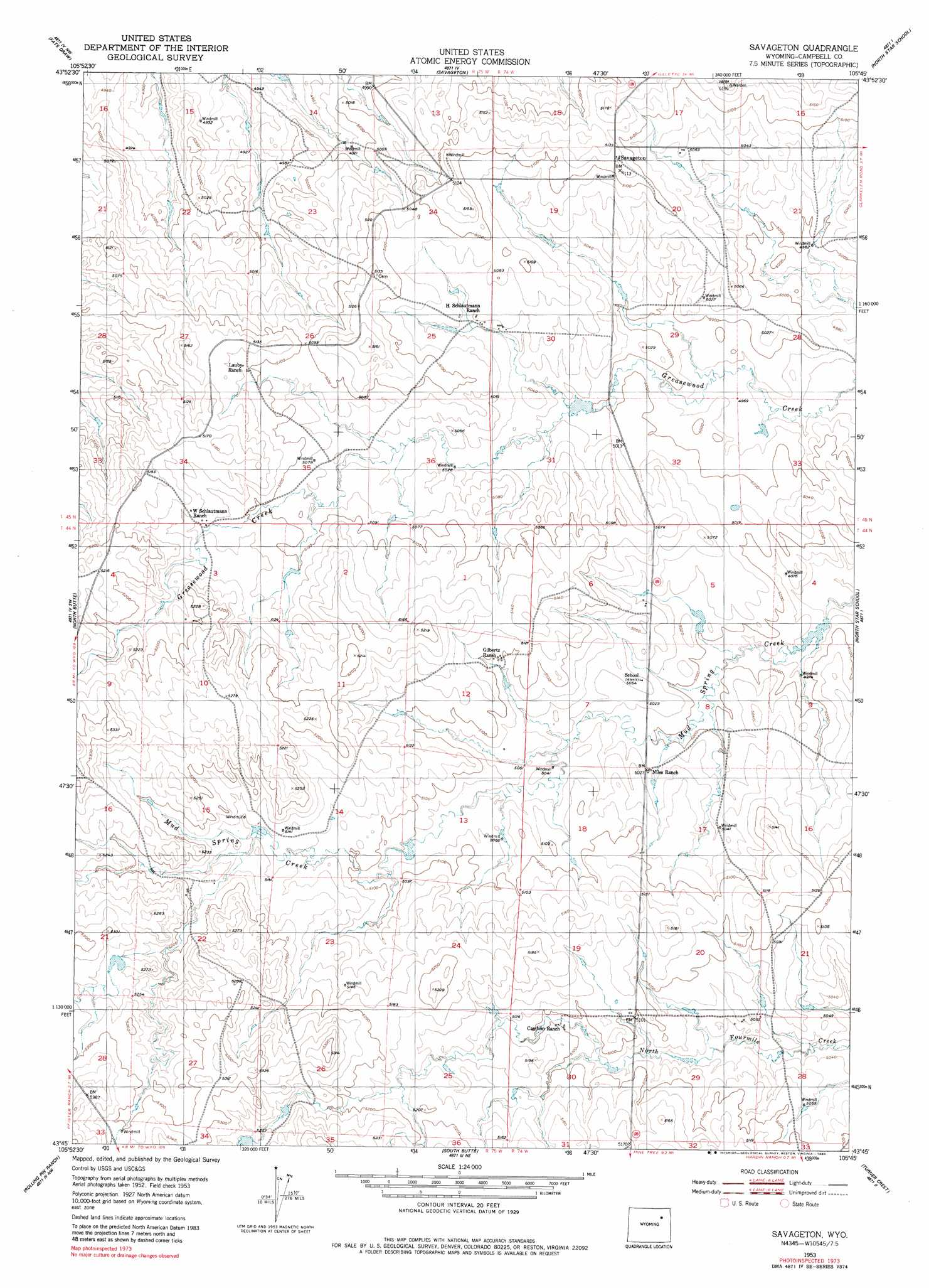
USGS Topo Quad 43105g7 - 1:24,000 scale
| Topo Map Name: | Savageton |
| USGS Topo Quad ID: | 43105g7 |
| Print Size: | ca. 21 1/4" wide x 27" high |
| Southeast Coordinates: | 43.75° N latitude / 105.75° W longitude |
| Map Center Coordinates: | 43.8125° N latitude / 105.8125° W longitude |
| U.S. State: | WY |
| Filename: | o43105g7.jpg |
| Download Map JPG Image: | Savageton topo map 1:24,000 scale |
| Map Type: | Topographic |
| Topo Series: | 7.5´ |
| Map Scale: | 1:24,000 |
| Source of Map Images: | United States Geological Survey (USGS) |
| Alternate Map Versions: |
Savageton WY 1953, updated 1954 Download PDF Buy paper map Savageton WY 1953, updated 1954 Download PDF Buy paper map Savageton WY 1953, updated 1980 Download PDF Buy paper map Savageton WY 2012 Download PDF Buy paper map Savageton WY 2015 Download PDF Buy paper map |
1:24,000 Topo Quads surrounding Savageton
Negro Butte |
Bogie Draw |
Double Tanks |
Pleasantdale |
Scaper Reservoir |
The Nipple |
Fats Draw |
Wags Pinnacle |
Pepsson Draw |
Threemile Creek Reservoir |
Fort Reno Se |
North Butte |
Savageton |
Greasewood Reservoir |
Rocky Butte Gulch |
Dry Fork Ranch |
Rolling Pin Ranch |
South Butte |
Baker Spring |
Rattlesnake Draw |
Taylor Ranch |
Artesian Draw |
Pine Tree |
Turnercrest |
Reno Flats |
> Back to 43105e1 at 1:100,000 scale
> Back to 43104a1 at 1:250,000 scale
> Back to U.S. Topo Maps home
Savageton topo map: Gazetteer
Savageton: Dams
Schlautman Dam elevation 1527m 5009′Savageton: Mines
Black Star Mine elevation 1580m 5183′Blue Star Number One Mine elevation 1562m 5124′
Jeanette Mine elevation 1527m 5009′
Jeanette Number One Mine elevation 1574m 5164′
KM Number One Mine elevation 1512m 4960′
Little Star Mine elevation 1508m 4947′
Mary Mine elevation 1527m 5009′
Paula Number One Mine elevation 1563m 5127′
Queen Number Two Mine elevation 1526m 5006′
Utah Mine elevation 1551m 5088′
Van Eugenum Number One Mine elevation 1604m 5262′
White Mule Mine elevation 1601m 5252′
Savageton: Populated Places
Savageton elevation 1559m 5114′Savageton: Reservoirs
Schlautan Reservoir elevation 1527m 5009′Savageton digital topo map on disk
Buy this Savageton topo map showing relief, roads, GPS coordinates and other geographical features, as a high-resolution digital map file on DVD:
Eastern Wyoming & Western South Dakota
Buy digital topo maps: Eastern Wyoming & Western South Dakota