Bogie Draw Topo Map Wyoming
To zoom in, hover over the map of Bogie Draw
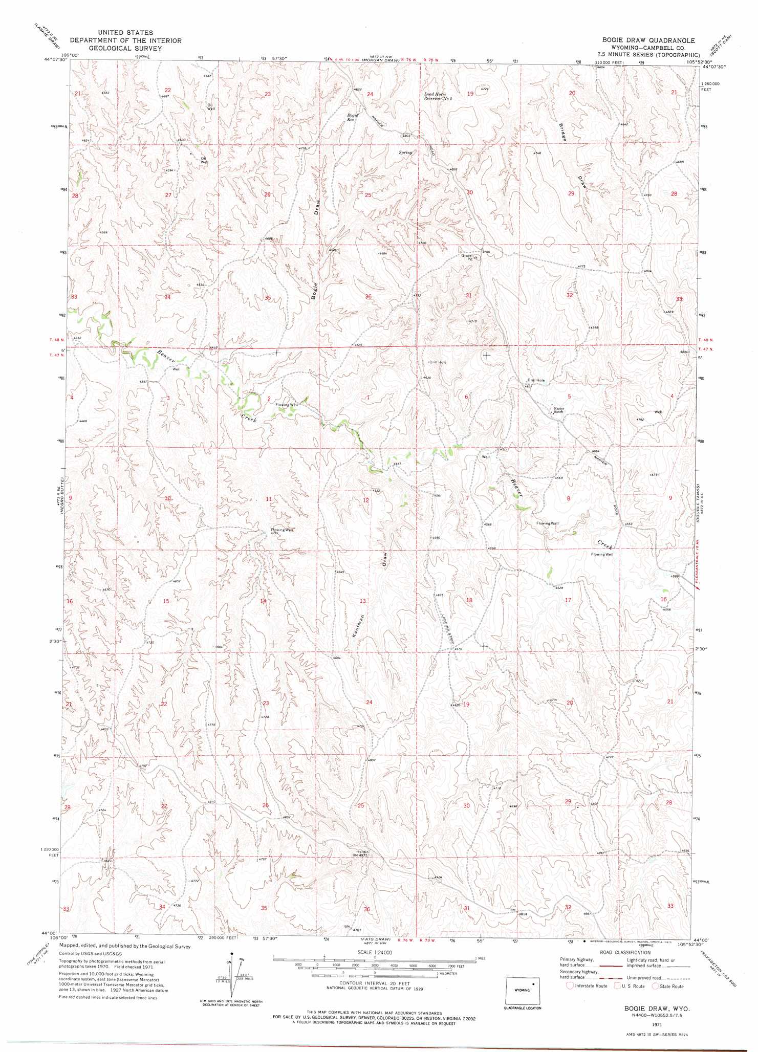
USGS Topo Quad 44105a8 - 1:24,000 scale
| Topo Map Name: | Bogie Draw |
| USGS Topo Quad ID: | 44105a8 |
| Print Size: | ca. 21 1/4" wide x 27" high |
| Southeast Coordinates: | 44° N latitude / 105.875° W longitude |
| Map Center Coordinates: | 44.0625° N latitude / 105.9375° W longitude |
| U.S. State: | WY |
| Filename: | o44105a8.jpg |
| Download Map JPG Image: | Bogie Draw topo map 1:24,000 scale |
| Map Type: | Topographic |
| Topo Series: | 7.5´ |
| Map Scale: | 1:24,000 |
| Source of Map Images: | United States Geological Survey (USGS) |
| Alternate Map Versions: |
Bogie Draw WY 1971, updated 1975 Download PDF Buy paper map Bogie Draw WY 2012 Download PDF Buy paper map Bogie Draw WY 2015 Download PDF Buy paper map |
1:24,000 Topo Quads surrounding Bogie Draw
Somerville Flats West |
Somerville Flats East |
Carr Draw |
Jeffers Draw |
Oriva |
Juniper Draw |
Laskie Draw |
Morgan Draw |
Scott Dam |
Four Bar J Ranch |
Bowman Flat |
Negro Butte |
Bogie Draw |
Double Tanks |
Pleasantdale |
Hoe Ranch |
The Nipple |
Fats Draw |
Wags Pinnacle |
Pepsson Draw |
Fort Reno |
Fort Reno Se |
North Butte |
Savageton |
Greasewood Reservoir |
> Back to 44105a1 at 1:100,000 scale
> Back to 44104a1 at 1:250,000 scale
> Back to U.S. Topo Maps home
Bogie Draw topo map: Gazetteer
Bogie Draw: Reservoirs
Bogie Reservoir elevation 1444m 4737′Dead Horse Reservoir Number 2 elevation 1414m 4639′
Bogie Draw: Valleys
Bogie Draw elevation 1328m 4356′Kaufman Draw elevation 1345m 4412′
Bogie Draw digital topo map on disk
Buy this Bogie Draw topo map showing relief, roads, GPS coordinates and other geographical features, as a high-resolution digital map file on DVD:
Eastern Wyoming & Western South Dakota
Buy digital topo maps: Eastern Wyoming & Western South Dakota