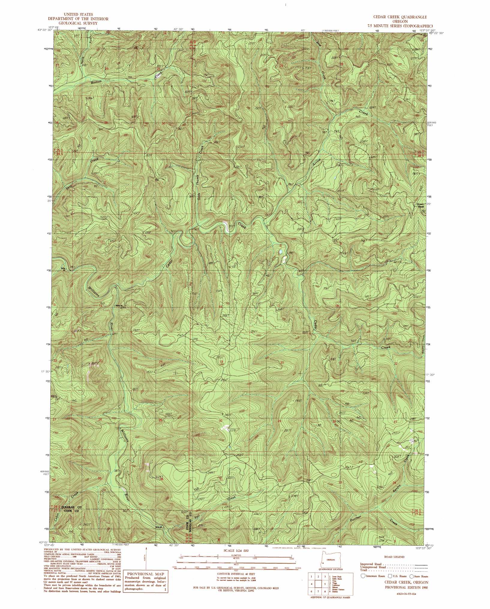
Cedar Creek Topo Map Oregon
To zoom in, hover over the map of Cedar Creek
USGS Topo Quad 43123c6 - 1:24,000 scale
| Topo Map Name: | Cedar Creek |
| USGS Topo Quad ID: | 43123c6 |
| Print Size: | ca. 21 1/4" wide x 27" high |
| Southeast Coordinates: | 43.25° N latitude / 123.625° W longitude |
| Map Center Coordinates: | 43.3125° N latitude / 123.6875° W longitude |
| U.S. State: | OR |
| Filename: | o43123c6.jpg |
| Download Map JPG Image: | Cedar Creek topo map 1:24,000 scale |
| Map Type: | Topographic |
| Topo Series: | 7.5´ |
| Map Scale: | 1:24,000 |
| Source of Map Images: | United States Geological Survey (USGS) |
| Alternate Map Versions: |
Cedar Creek OR 1990, updated 1990 Download PDF Buy paper map Cedar Creek OR 2011 Download PDF Buy paper map Cedar Creek OR 2014 Download PDF Buy paper map |
1:24,000 Topo Quads surrounding Cedar Creek
Eck Peak |
Loon Lake |
Old Blue |
Kellogg |
Yellow Butte |
Golden Falls |
Ivers Peak |
Kelly Butte |
Tyee |
Tyee Mountain |
Coos Mountain |
Tioga |
Cedar Creek |
Callahan |
Garden Valley |
Dora |
Sitkum |
Mount Gurney |
Reston |
Roseburg West |
Remote |
Kenyon Mountain |
Camas Valley |
Tenmile |
Winston |
> Back to 43123a1 at 1:100,000 scale
> Back to 43122a1 at 1:250,000 scale
> Back to U.S. Topo Maps home
Cedar Creek topo map: Gazetteer
Cedar Creek: Streams
Arrow Creek elevation 234m 767′Cabin Creek elevation 236m 774′
Cedar Creek elevation 183m 600′
Fall Creek elevation 243m 797′
Gods Thumb Creek elevation 223m 731′
North Fork Bottom Creek elevation 213m 698′
Renfro Creek elevation 528m 1732′
Sow Creek elevation 278m 912′
Cedar Creek: Summits
Green Peak elevation 744m 2440′Cedar Creek digital topo map on disk
Buy this Cedar Creek topo map showing relief, roads, GPS coordinates and other geographical features, as a high-resolution digital map file on DVD: