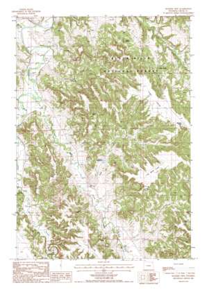
Wonder View Topo Map Wyoming
To zoom in, hover over the map of Wonder View
USGS Topo Quad 44104d6 - 1:24,000 scale
| Topo Map Name: | Wonder View |
| USGS Topo Quad ID: | 44104d6 |
| Print Size: | ca. 21 1/4" wide x 27" high |
| Southeast Coordinates: | 44.375° N latitude / 104.625° W longitude |
| Map Center Coordinates: | 44.4375° N latitude / 104.6875° W longitude |
| U.S. State: | WY |
| Filename: | o44104d6.jpg |
| Download Map JPG Image: | Wonder View topo map 1:24,000 scale |
| Map Type: | Topographic |
| Topo Series: | 7.5´ |
| Map Scale: | 1:24,000 |
| Source of Map Images: | United States Geological Survey (USGS) |
| Alternate Map Versions: |
Sunny Divide WY 1954, updated 1954 Download PDF Buy paper map Wonder View WY 1984, updated 1985 Download PDF Buy paper map Wonder View WY 2012 Download PDF Buy paper map Wonder View WY 2015 Download PDF Buy paper map |
| FStopo: | US Forest Service topo Wonder View is available: Download FStopo PDF Download FStopo TIF |
1:24,000 Topo Quads surrounding Wonder View
> Back to 44104a1 at 1:100,000 scale
> Back to 44104a1 at 1:250,000 scale
> Back to U.S. Topo Maps home
Wonder View topo map: Gazetteer
Wonder View: Dams
Graham Dam elevation 1242m 4074′Wonder View: Flats
The Bank Lake elevation 1436m 4711′Wonder View: Mines
Myers Mine elevation 1317m 4320′Paul Myers Mine elevation 1384m 4540′
Sunny Divide Mine elevation 1317m 4320′
Tony One Mine elevation 1292m 4238′
Wonder View: Reservoirs
Graham Reservoir elevation 1242m 4074′Graham Reservoir elevation 1267m 4156′
Wonder View: Ridges
H K Divide elevation 1337m 4386′Sunny Divide elevation 1473m 4832′
Wonder View: Springs
Huett Spring elevation 1324m 4343′Wonder View: Streams
Cabin Creek elevation 1201m 3940′Corral Creek elevation 1250m 4101′
East Creek elevation 1214m 3982′
Inyan Kara Creek elevation 1212m 3976′
Oak Creek elevation 1294m 4245′
Road Creek elevation 1241m 4071′
Wonder View: Summits
Castle Rocks elevation 1411m 4629′Oudin Hill elevation 1402m 4599′
Wonder View: Valleys
Huett Canyon elevation 1249m 4097′Sawmill Canyon elevation 1251m 4104′
Wonder View digital topo map on disk
Buy this Wonder View topo map showing relief, roads, GPS coordinates and other geographical features, as a high-resolution digital map file on DVD:
Eastern Wyoming & Western South Dakota
Buy digital topo maps: Eastern Wyoming & Western South Dakota


