Rozet Ne Topo Map Wyoming
To zoom in, hover over the map of Rozet Ne
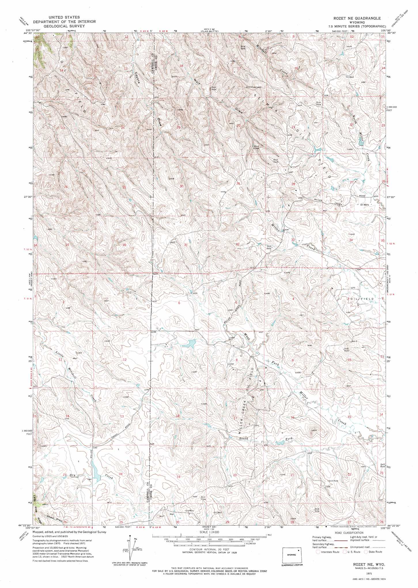
USGS Topo Quad 44105d1 - 1:24,000 scale
| Topo Map Name: | Rozet Ne |
| USGS Topo Quad ID: | 44105d1 |
| Print Size: | ca. 21 1/4" wide x 27" high |
| Southeast Coordinates: | 44.375° N latitude / 105° W longitude |
| Map Center Coordinates: | 44.4375° N latitude / 105.0625° W longitude |
| U.S. State: | WY |
| Filename: | o44105d1.jpg |
| Download Map JPG Image: | Rozet Ne topo map 1:24,000 scale |
| Map Type: | Topographic |
| Topo Series: | 7.5´ |
| Map Scale: | 1:24,000 |
| Source of Map Images: | United States Geological Survey (USGS) |
| Alternate Map Versions: |
Rozet NE WY 1971, updated 1974 Download PDF Buy paper map Rozet NE WY 2012 Download PDF Buy paper map Rozet NE WY 2015 Download PDF Buy paper map |
1:24,000 Topo Quads surrounding Rozet Ne
Weston |
Adon Nw |
Brislawn School |
Garland Hill |
New Haven |
Lone Tree Creek |
Adon |
Flag Butte |
Oshoto |
Missouri Buttes |
Green Hill |
Rozet Nw |
Rozet Ne |
Edith Creek |
Carlile |
Fortin Draw |
Rozet |
Rozet Se |
Moorcroft |
Grasshopper Butte |
Coyote Draw |
Coon Track Creek |
Whitetail Creek Ne |
Spyglass Hill |
Freda Creek |
> Back to 44105a1 at 1:100,000 scale
> Back to 44104a1 at 1:250,000 scale
> Back to U.S. Topo Maps home
Rozet Ne topo map: Gazetteer
Rozet Ne: Oilfields
Miller Creek Oil Field elevation 1362m 4468′Selmek Oil Field elevation 1349m 4425′
Rozet Ne: Streams
South Fork West Fork Miller Creek elevation 1284m 4212′Rozet Ne digital topo map on disk
Buy this Rozet Ne topo map showing relief, roads, GPS coordinates and other geographical features, as a high-resolution digital map file on DVD:
Eastern Wyoming & Western South Dakota
Buy digital topo maps: Eastern Wyoming & Western South Dakota