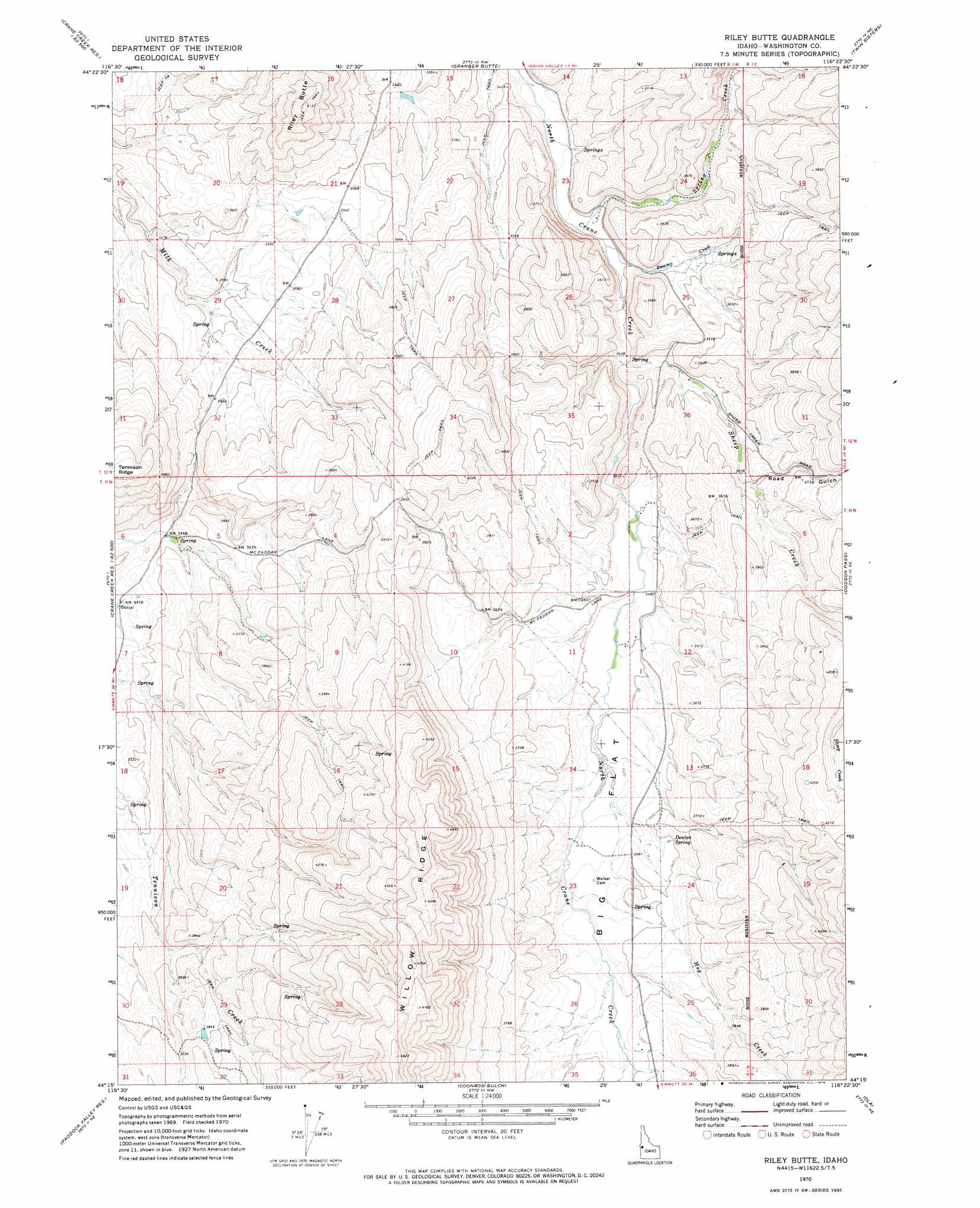
Riley Butte Topo Map Idaho
To zoom in, hover over the map of Riley Butte
USGS Topo Quad 44116c4 - 1:24,000 scale
| Topo Map Name: | Riley Butte |
| USGS Topo Quad ID: | 44116c4 |
| Print Size: | ca. 21 1/4" wide x 27" high |
| Southeast Coordinates: | 44.25° N latitude / 116.375° W longitude |
| Map Center Coordinates: | 44.3125° N latitude / 116.4375° W longitude |
| U.S. State: | ID |
| Filename: | o44116c4.jpg |
| Download Map JPG Image: | Riley Butte topo map 1:24,000 scale |
| Map Type: | Topographic |
| Topo Series: | 7.5´ |
| Map Scale: | 1:24,000 |
| Source of Map Images: | United States Geological Survey (USGS) |
| Alternate Map Versions: |
Riley Butte ID 1970, updated 1974 Download PDF Buy paper map Riley Butte ID 2010 Download PDF Buy paper map Riley Butte ID 2013 Download PDF Buy paper map |
1:24,000 Topo Quads surrounding Riley Butte
Cambridge |
East Of Cambridge |
Indian Valley |
King Hill Creek |
Cold Spring Ridge |
Midvale |
Hog Creek Butte |
Granger Butte |
Twin Sisters |
Tripod Peak |
Nutmeg Flat |
Crane Creek Reservoir |
Riley Butte |
Dodson Pass |
Sage Hen Reservoir |
Holland Gulch |
Paddock Valley Reservoir |
Coonrod Gulch |
Ola |
High Valley |
Sheep Ridge |
Hog Cove Butte |
Squaw Butte |
Webb Creek |
Dry Buck Valley |
> Back to 44116a1 at 1:100,000 scale
> Back to 44116a1 at 1:250,000 scale
> Back to U.S. Topo Maps home
Riley Butte topo map: Gazetteer
Riley Butte: Ridges
Tennison Ridge elevation 1241m 4071′Willow Ridge elevation 1430m 4691′
Riley Butte: Springs
Denton Spring elevation 1099m 3605′Riley Butte: Streams
Hog Creek elevation 1080m 3543′Sheep Creek elevation 1044m 3425′
Spring Creek elevation 1034m 3392′
Swamp Creek elevation 1034m 3392′
Riley Butte: Summits
Riley Butte elevation 1257m 4124′Riley Butte: Valleys
Road Gulch elevation 1095m 3592′Riley Butte digital topo map on disk
Buy this Riley Butte topo map showing relief, roads, GPS coordinates and other geographical features, as a high-resolution digital map file on DVD: