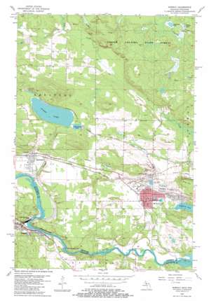
Norway Topo Map Michigan
To zoom in, hover over the map of Norway
USGS Topo Quad 45087g8 - 1:24,000 scale
| Topo Map Name: | Norway |
| USGS Topo Quad ID: | 45087g8 |
| Print Size: | ca. 21 1/4" wide x 27" high |
| Southeast Coordinates: | 45.75° N latitude / 87.875° W longitude |
| Map Center Coordinates: | 45.8125° N latitude / 87.9375° W longitude |
| U.S. States: | MI, WI |
| Filename: | o45087g8.jpg |
| Download Map JPG Image: | Norway topo map 1:24,000 scale |
| Map Type: | Topographic |
| Topo Series: | 7.5´ |
| Map Scale: | 1:24,000 |
| Source of Map Images: | United States Geological Survey (USGS) |
| Alternate Map Versions: |
Norway MI 1955, updated 1957 Download PDF Buy paper map Norway MI 1955, updated 1982 Download PDF Buy paper map Norway MI 1955, updated 1982 Download PDF Buy paper map Norway MI 2011 Download PDF Buy paper map Norway MI 2014 Download PDF Buy paper map Norway MI 2016 Download PDF Buy paper map |
1:24,000 Topo Quads surrounding Norway
> Back to 45087e1 at 1:100,000 scale
> Back to 45086a1 at 1:250,000 scale
> Back to U.S. Topo Maps home
Norway topo map: Gazetteer
Norway: Bridges
Morosini Bridge elevation 253m 830′Morosini Bridge elevation 253m 830′
Norway: Dams
Little Quinnesec Falls Dam elevation 292m 958′Norway: Falls
Fumee Falls elevation 308m 1010′Little Quinnesec Falls elevation 287m 941′
Sand Portage Falls elevation 256m 839′
Sand Portage Falls elevation 256m 839′
Norway: Lakes
Fumee Lake elevation 327m 1072′Gustafson Lake elevation 323m 1059′
Hanbury Lake elevation 278m 912′
Lake Mary elevation 286m 938′
Lake View elevation 283m 928′
Little Fumee Lake elevation 327m 1072′
Miller Lake elevation 321m 1053′
Strawberry Lake elevation 286m 938′
Norway: Mines
Aragon Mine elevation 286m 938′Cundy Mine elevation 318m 1043′
Curry Mine elevation 292m 958′
Cyclops Mine elevation 315m 1033′
Indiana Mine elevation 329m 1079′
Norway Mine elevation 302m 990′
Quinnesec Mine elevation 362m 1187′
West Vulcan Mine elevation 329m 1079′
Norway: Parks
Hanbury Lake Park elevation 282m 925′Marion Park elevation 302m 990′
Menominee Iron Range Historical Marker elevation 317m 1040′
Norway Spring Historical Marker elevation 299m 980′
Quinnesec Park elevation 319m 1046′
Strawberry Lake Park elevation 286m 938′
Norway: Populated Places
Niagara elevation 272m 892′Norway elevation 291m 954′
Quinnesec elevation 317m 1040′
Norway: Post Offices
Norway Post Office elevation 286m 938′Quinnesec Post Office elevation 317m 1040′
Richardsburg Post Office (historical) elevation 343m 1125′
Norway: Reservoirs
Little Quinnesec Falls Flowage 2 elevation 292m 958′Norway: Streams
Fern Creek elevation 280m 918′Fumee Creek elevation 288m 944′
Seiberts Creek elevation 297m 974′
Norway: Summits
Iron Hill elevation 362m 1187′Norway digital topo map on disk
Buy this Norway topo map showing relief, roads, GPS coordinates and other geographical features, as a high-resolution digital map file on DVD:


