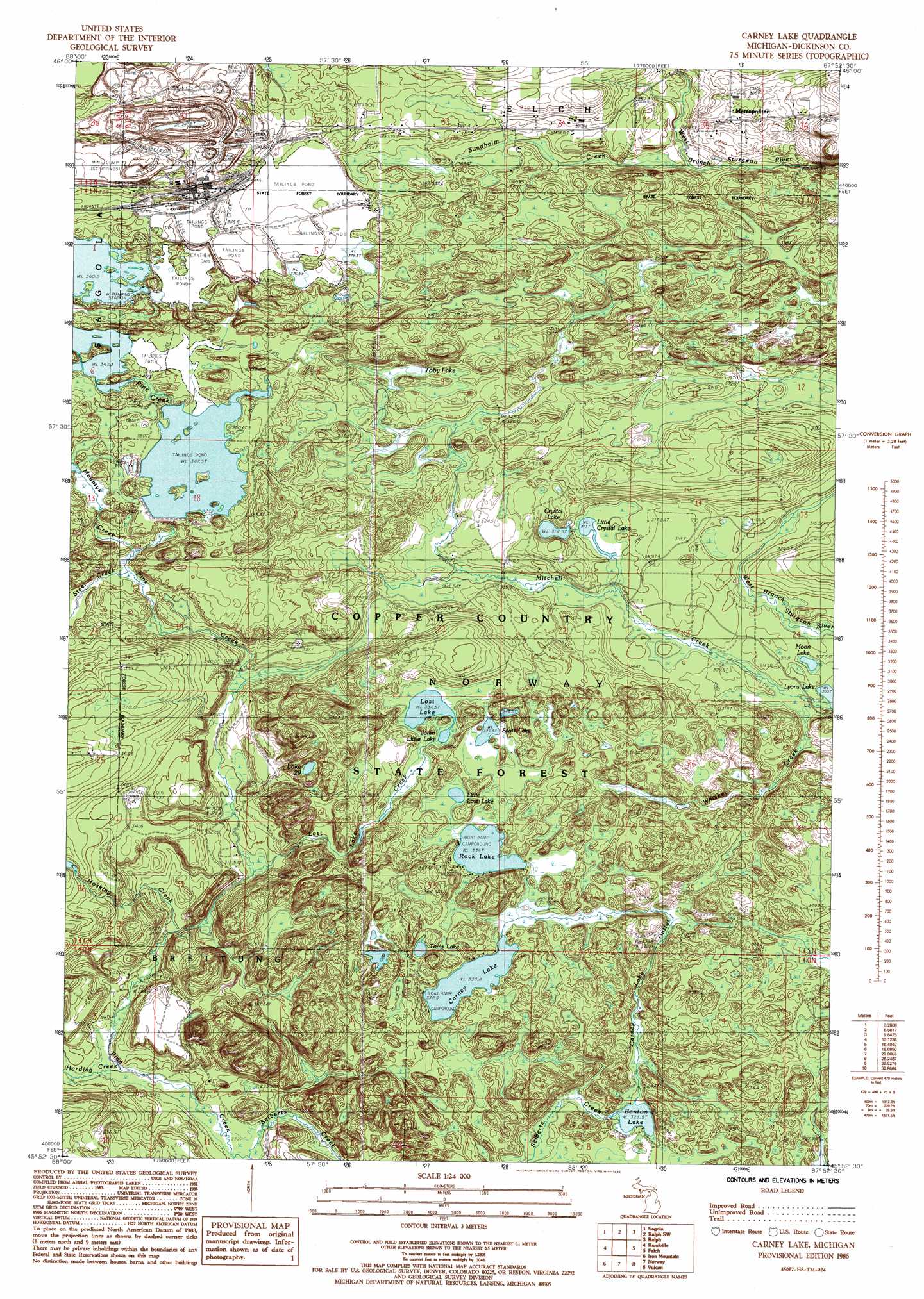
Carney Lake Topo Map Michigan
To zoom in, hover over the map of Carney Lake
USGS Topo Quad 45087h8 - 1:24,000 scale
| Topo Map Name: | Carney Lake |
| USGS Topo Quad ID: | 45087h8 |
| Print Size: | ca. 21 1/4" wide x 27" high |
| Southeast Coordinates: | 45.875° N latitude / 87.875° W longitude |
| Map Center Coordinates: | 45.9375° N latitude / 87.9375° W longitude |
| U.S. State: | MI |
| Filename: | o45087h8.jpg |
| Download Map JPG Image: | Carney Lake topo map 1:24,000 scale |
| Map Type: | Topographic |
| Topo Series: | 7.5´ |
| Map Scale: | 1:24,000 |
| Source of Map Images: | United States Geological Survey (USGS) |
| Alternate Map Versions: |
Carney Lake MI 1986, updated 1992 Download PDF Buy paper map Carney Lake MI 2011 Download PDF Buy paper map Carney Lake MI 2014 Download PDF Buy paper map Carney Lake MI 2016 Download PDF Buy paper map |
1:24,000 Topo Quads surrounding Carney Lake
Kiernan |
Channing |
Ralph Nw |
Ralph Ne |
Northland Nw |
Lake Mary |
Sagola |
Ralph Sw |
Ralph |
Alfred |
Florence East |
Randville |
Carney Lake |
Felch |
Foster City |
Iron Mountain Sw |
Iron Mountain |
Norway |
Vulcan |
Waucedah |
Dunbar |
Dunbar Ne |
Pembine |
Faithorn |
Cunard |
> Back to 45087e1 at 1:100,000 scale
> Back to 45086a1 at 1:250,000 scale
> Back to U.S. Topo Maps home
Carney Lake topo map: Gazetteer
Carney Lake: Lakes
Benton Lake elevation 323m 1059′Carney Lake elevation 337m 1105′
Crystal Lake elevation 314m 1030′
Johns Little Lake elevation 337m 1105′
Lake Twentynine elevation 350m 1148′
Little Crystal Lake elevation 314m 1030′
Little Lost Lake elevation 341m 1118′
Lost Lake elevation 337m 1105′
Moon Lake elevation 309m 1013′
Rock Lake elevation 339m 1112′
Scott Lake elevation 339m 1112′
Toby Lake elevation 331m 1085′
Toms Lake elevation 344m 1128′
Carney Lake: Mines
Groveland Mine elevation 319m 1046′Carney Lake: Populated Places
Metropolitan elevation 381m 1250′Carney Lake: Post Offices
Metropolitan Post Office (historical) elevation 381m 1250′Carney Lake: Streams
Carney Lake Outlet elevation 324m 1062′Harding Creek elevation 294m 964′
Hosking Creek elevation 297m 974′
Lost Lake Creek elevation 309m 1013′
Mitchell Creek elevation 305m 1000′
Steel Creek elevation 325m 1066′
Carney Lake digital topo map on disk
Buy this Carney Lake topo map showing relief, roads, GPS coordinates and other geographical features, as a high-resolution digital map file on DVD: