Promise Topo Map Oregon
To zoom in, hover over the map of Promise
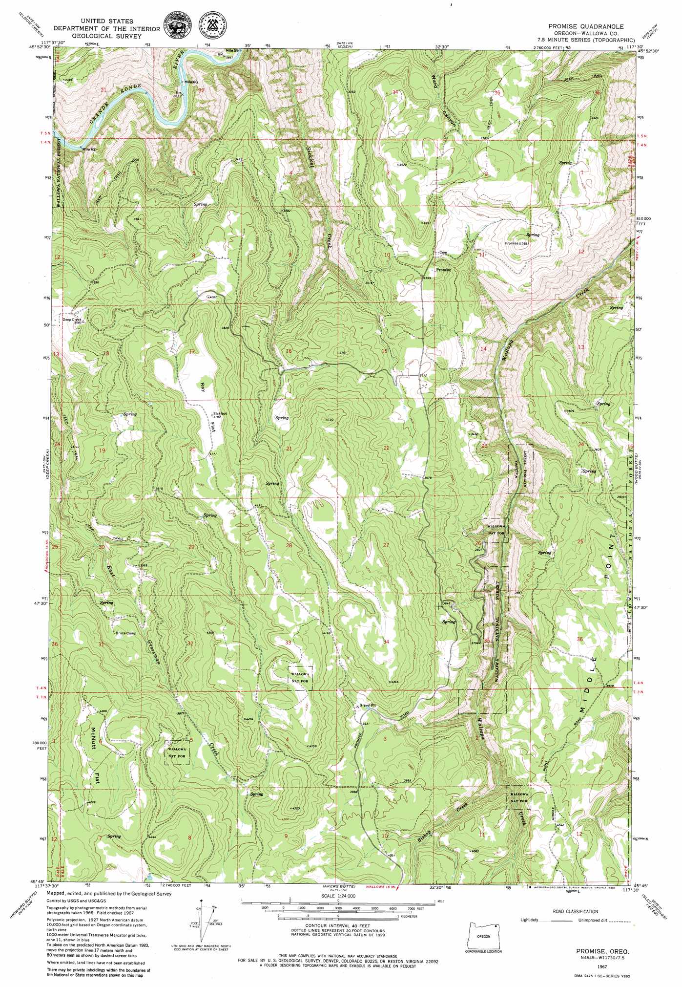
USGS Topo Quad 45117g5 - 1:24,000 scale
| Topo Map Name: | Promise |
| USGS Topo Quad ID: | 45117g5 |
| Print Size: | ca. 21 1/4" wide x 27" high |
| Southeast Coordinates: | 45.75° N latitude / 117.5° W longitude |
| Map Center Coordinates: | 45.8125° N latitude / 117.5625° W longitude |
| U.S. State: | OR |
| Filename: | o45117g5.jpg |
| Download Map JPG Image: | Promise topo map 1:24,000 scale |
| Map Type: | Topographic |
| Topo Series: | 7.5´ |
| Map Scale: | 1:24,000 |
| Source of Map Images: | United States Geological Survey (USGS) |
| Alternate Map Versions: |
Promise OR 1967, updated 1971 Download PDF Buy paper map Promise OR 1995, updated 1998 Download PDF Buy paper map Promise OR 2011 Download PDF Buy paper map Promise OR 2014 Download PDF Buy paper map |
| FStopo: | US Forest Service topo Promise is available: Download FStopo PDF Download FStopo TIF |
1:24,000 Topo Quads surrounding Promise
Godman Spring |
Oregon Butte |
Diamond Peak |
Saddle Butte |
Mountain View |
Wenaha Forks |
Elbow Creek |
Eden |
Troy |
Flora |
Fry Meadow |
Deep Creek |
Promise |
Wood Butte |
Shamrock Creek |
Rondowa |
Howard Butte |
Akers Butte |
Washboard Ridge |
Sled Springs |
Cricket Flat |
Minam |
Wallowa |
Evans |
Hicks Spring |
> Back to 45117e1 at 1:100,000 scale
> Back to 45116a1 at 1:250,000 scale
> Back to U.S. Topo Maps home
Promise topo map: Gazetteer
Promise: Flats
McNutt Flat elevation 1294m 4245′Ray Flat elevation 1274m 4179′
Promise: Lakes
Hendersons Pond elevation 1036m 3398′Promise: Populated Places
Grossman (historical) elevation 1277m 4189′Promise elevation 1095m 3592′
Promise: Post Offices
Grossman Post Office (historical) elevation 1277m 4189′Promise Post Office (historical) elevation 1095m 3592′
Utopia Post Office (historical) elevation 1087m 3566′
Promise: Streams
Bishop Creek elevation 1056m 3464′Promise digital topo map on disk
Buy this Promise topo map showing relief, roads, GPS coordinates and other geographical features, as a high-resolution digital map file on DVD: