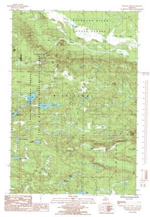
Bulldog Lake Topo Map Michigan
To zoom in, hover over the map of Bulldog Lake
USGS Topo Quad 46087f8 - 1:24,000 scale
| Topo Map Name: | Bulldog Lake |
| USGS Topo Quad ID: | 46087f8 |
| Print Size: | ca. 21 1/4" wide x 27" high |
| Southeast Coordinates: | 46.625° N latitude / 87.875° W longitude |
| Map Center Coordinates: | 46.6875° N latitude / 87.9375° W longitude |
| U.S. State: | MI |
| Filename: | o46087f8.jpg |
| Download Map JPG Image: | Bulldog Lake topo map 1:24,000 scale |
| Map Type: | Topographic |
| Topo Series: | 7.5´ |
| Map Scale: | 1:24,000 |
| Source of Map Images: | United States Geological Survey (USGS) |
| Alternate Map Versions: |
Bulldog Lake MI 1985, updated 1985 Download PDF Buy paper map Bulldog Lake MI 1999, updated 2004 Download PDF Buy paper map Bulldog Lake MI 2011 Download PDF Buy paper map Bulldog Lake MI 2014 Download PDF Buy paper map Bulldog Lake MI 2017 Download PDF Buy paper map |
| FStopo: | US Forest Service topo Bulldog Lake is available: Download FStopo PDF Download FStopo TIF |
1:24,000 Topo Quads surrounding Bulldog Lake
> Back to 46087e1 at 1:100,000 scale
> Back to 46086a1 at 1:250,000 scale
> Back to U.S. Topo Maps home
Bulldog Lake topo map: Gazetteer
Bulldog Lake: Falls
West Branch Yellow Dog Falls elevation 464m 1522′Yellow Dog Falls elevation 490m 1607′
Bulldog Lake: Lakes
Beaver Pond elevation 537m 1761′Bentley Lake elevation 444m 1456′
Bulldog Lake elevation 527m 1729′
Dead River Headwater elevation 554m 1817′
Lake Margaret elevation 541m 1774′
Lake Raymond elevation 549m 1801′
Little Dishno Lake elevation 533m 1748′
Lost Lake elevation 498m 1633′
Section Thirteen Lake elevation 549m 1801′
Bulldog Lake: Streams
Wildcat Canyon Creek elevation 480m 1574′Bulldog Lake: Swamps
Mulligan Swamp elevation 517m 1696′Bulldog Lake: Trails
North Country Trail elevation 561m 1840′Bulldog Lake digital topo map on disk
Buy this Bulldog Lake topo map showing relief, roads, GPS coordinates and other geographical features, as a high-resolution digital map file on DVD:


