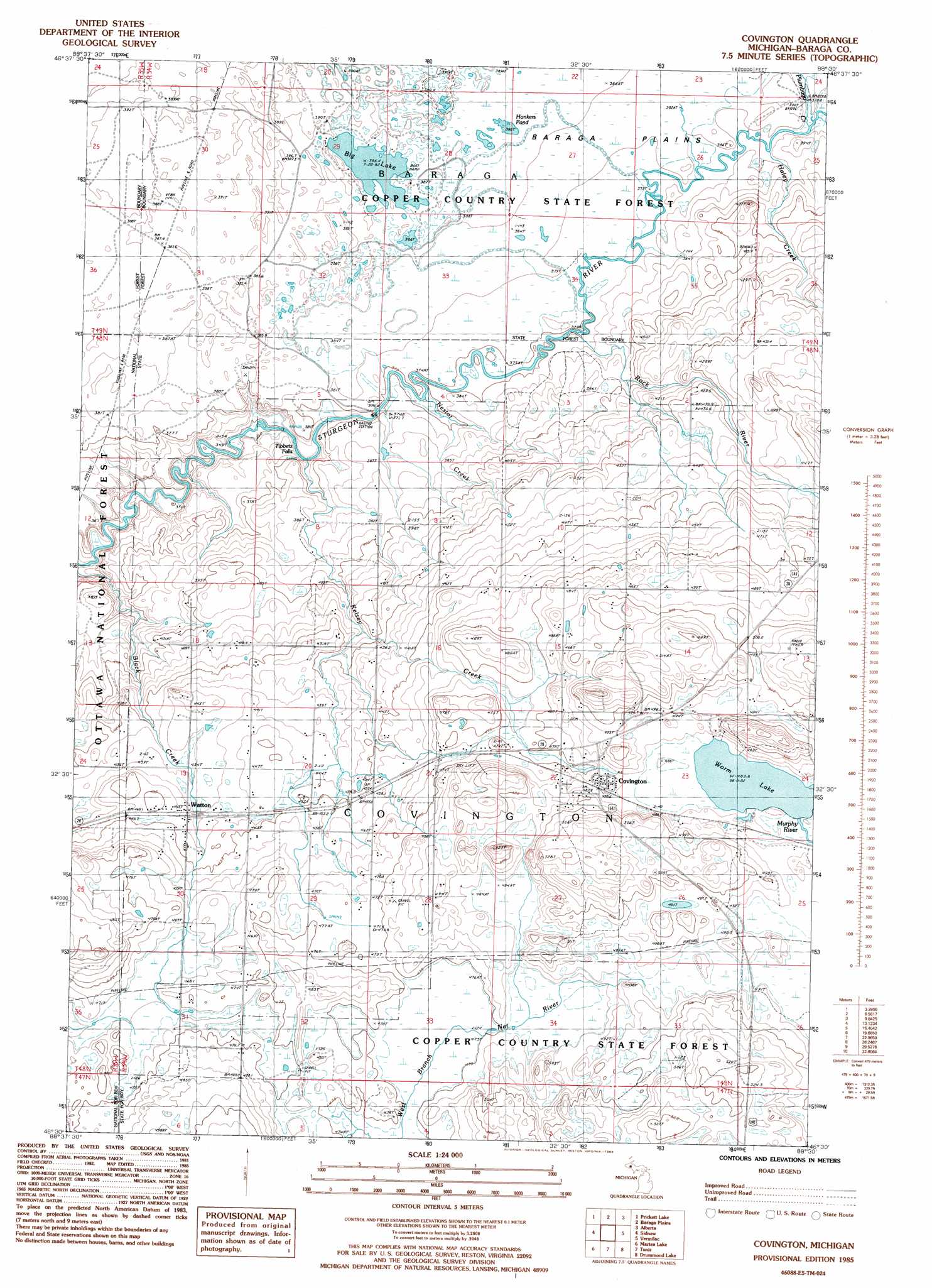
Covington Topo Map Michigan
To zoom in, hover over the map of Covington
USGS Topo Quad 46088e5 - 1:24,000 scale
| Topo Map Name: | Covington |
| USGS Topo Quad ID: | 46088e5 |
| Print Size: | ca. 21 1/4" wide x 27" high |
| Southeast Coordinates: | 46.5° N latitude / 88.5° W longitude |
| Map Center Coordinates: | 46.5625° N latitude / 88.5625° W longitude |
| U.S. State: | MI |
| Filename: | o46088e5.jpg |
| Download Map JPG Image: | Covington topo map 1:24,000 scale |
| Map Type: | Topographic |
| Topo Series: | 7.5´ |
| Map Scale: | 1:24,000 |
| Source of Map Images: | United States Geological Survey (USGS) |
| Alternate Map Versions: |
Covington MI 1985, updated 1986 Download PDF Buy paper map Covington MI 1999, updated 2004 Download PDF Buy paper map Covington MI 2011 Download PDF Buy paper map Covington MI 2014 Download PDF Buy paper map Covington MI 2016 Download PDF Buy paper map |
| FStopo: | US Forest Service topo Covington is available: Download FStopo PDF Download FStopo TIF |
1:24,000 Topo Quads surrounding Covington
Nisula |
Pelkie |
Bear Town |
L'Anse |
Aura |
Vista Falls |
Prickett Lake |
Baraga Plains |
Alberta |
Herman |
Echo Lake |
Sidnaw |
Covington |
Vermilac |
Nestoria |
Glitter Lake |
Marten Lake |
Tunis |
Drummond Lake |
Ned Lake |
Winslow Lake |
Perch Lake |
Porter Lake |
Triangle Ranch |
Neo Lake Se |
> Back to 46088e1 at 1:100,000 scale
> Back to 46088a1 at 1:250,000 scale
> Back to U.S. Topo Maps home
Covington topo map: Gazetteer
Covington: Falls
Tibbets Falls elevation 359m 1177′Covington: Lakes
Big Lake elevation 386m 1266′Covington: Parks
Baraga Plains Waterfowl Management Area elevation 389m 1276′Jacob and Anna Leinonen Homestead Historical Marker elevation 505m 1656′
Covington: Populated Places
Covington elevation 487m 1597′Watton elevation 446m 1463′
Covington: Post Offices
Covington Post Office elevation 488m 1601′Murphy Post Office (historical) elevation 486m 1594′
Watton Post Office elevation 445m 1459′
Covington: Streams
Kelsey Creek elevation 367m 1204′Lateral Creek elevation 444m 1456′
Murphy River elevation 483m 1584′
Plumbago Creek elevation 377m 1236′
Rock River elevation 375m 1230′
Covington digital topo map on disk
Buy this Covington topo map showing relief, roads, GPS coordinates and other geographical features, as a high-resolution digital map file on DVD: