Nisula Topo Map Michigan
To zoom in, hover over the map of Nisula
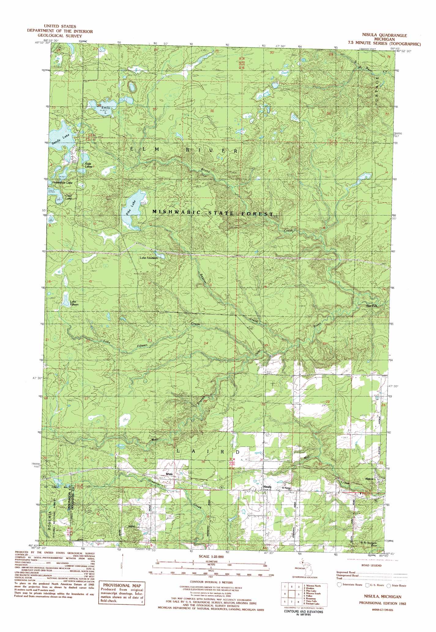
USGS Topo Quad 46088g7 - 1:25,000 scale
| Topo Map Name: | Nisula |
| USGS Topo Quad ID: | 46088g7 |
| Print Size: | ca. 21 1/4" wide x 27" high |
| Southeast Coordinates: | 46.75° N latitude / 88.75° W longitude |
| Map Center Coordinates: | 46.8125° N latitude / 88.8125° W longitude |
| U.S. State: | MI |
| Filename: | l46088g7.jpg |
| Download Map JPG Image: | Nisula topo map 1:25,000 scale |
| Map Type: | Topographic |
| Topo Series: | 7.5´ |
| Map Scale: | 1:25,000 |
| Source of Map Images: | United States Geological Survey (USGS) |
| Alternate Map Versions: |
Nisula MI 1982, updated 1983 Download PDF Buy paper map |
| FStopo: | US Forest Service topo Nisula is available: Download FStopo PDF Download FStopo TIF |
1:24,000 Topo Quads surrounding Nisula
Rockhouse Point |
Graveraet River |
South Range |
Chassell |
|
Four Corners |
Winona North |
Donken |
Pine Lake |
Otter Lake |
Greenland |
Winona South |
Nisula |
Pelkie |
Bear Town |
Mckeever |
Rousseau |
Vista Falls |
Prickett Lake |
Baraga Plains |
Paynesville |
Sparrows Rapids |
Echo Lake |
Sidnaw |
Covington |
> Back to 46088e1 at 1:100,000 scale
> Back to 46088a1 at 1:250,000 scale
> Back to U.S. Topo Maps home
Nisula topo map: Gazetteer
Nisula: Falls
Otter Falls elevation 266m 872′Nisula: Forests
Baraga State Forest elevation 338m 1108′Nisula: Lakes
Clear Lake elevation 366m 1200′Emily Lake elevation 369m 1210′
Kratt Lakes elevation 370m 1213′
Lake Fifteen elevation 352m 1154′
Lake Fourteen elevation 374m 1227′
Pike Lake elevation 352m 1154′
Sandy Lake elevation 372m 1220′
Nisula: Populated Places
Alston elevation 281m 921′Nisula elevation 318m 1043′
White elevation 320m 1049′
Nisula: Post Offices
Alston Post Office (historical) elevation 281m 921′Nisula Post Office elevation 316m 1036′
Nisula: Streams
Beaver Creek elevation 279m 915′Bruno Creek elevation 246m 807′
Lake Fifteen Creek elevation 278m 912′
Nisula digital topo map on disk
Buy this Nisula topo map showing relief, roads, GPS coordinates and other geographical features, as a high-resolution digital map file on DVD: