Chittamo Topo Map Wisconsin
To zoom in, hover over the map of Chittamo
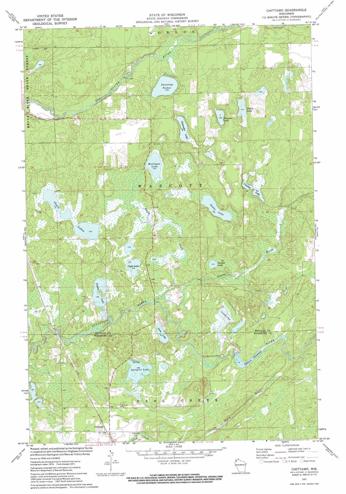
USGS Topo Quad 46091b6 - 1:24,000 scale
| Topo Map Name: | Chittamo |
| USGS Topo Quad ID: | 46091b6 |
| Print Size: | ca. 21 1/4" wide x 27" high |
| Southeast Coordinates: | 46.125° N latitude / 91.625° W longitude |
| Map Center Coordinates: | 46.1875° N latitude / 91.6875° W longitude |
| U.S. State: | WI |
| Filename: | o46091b6.jpg |
| Download Map JPG Image: | Chittamo topo map 1:24,000 scale |
| Map Type: | Topographic |
| Topo Series: | 7.5´ |
| Map Scale: | 1:24,000 |
| Source of Map Images: | United States Geological Survey (USGS) |
| Alternate Map Versions: |
Chittamo WI 1971, updated 1973 Download PDF Buy paper map Chittamo WI 2010 Download PDF Buy paper map Chittamo WI 2013 Download PDF Buy paper map Chittamo WI 2015 Download PDF Buy paper map |
1:24,000 Topo Quads surrounding Chittamo
Lyman Lake |
Bennett |
Lake Minnesuing |
Island Lake |
Drummond Nw |
Buckety Creek |
Solon Springs |
Metzger Lake |
Ellison Lake |
Upper Eau Claire Lake |
Minong Flowage |
Gordon |
Chittamo |
Chittamo Ne |
Totagatic Lake |
Horseshoe Lake |
Minong |
Stanberry West |
Stanberry East |
Hayward |
Dunn Lake |
Trego |
Springbrook |
Bean Lake |
Reserve |
> Back to 46091a1 at 1:100,000 scale
> Back to 46090a1 at 1:250,000 scale
> Back to U.S. Topo Maps home
Chittamo topo map: Gazetteer
Chittamo: Channels
Colton Flowage elevation 336m 1102′Chittamo: Dams
Colton 2WP641 Dam elevation 336m 1102′Chittamo: Lakes
Alexander Lake elevation 329m 1079′Chain Lakes elevation 326m 1069′
Clyde Lake elevation 326m 1069′
Crooked Lake elevation 332m 1089′
Derosier Lake elevation 330m 1082′
Frahm Lake elevation 324m 1062′
Haugen Lake elevation 334m 1095′
Loon Lake elevation 329m 1079′
Mahogany Marsh Lake elevation 337m 1105′
Mulligan Lake elevation 326m 1069′
Sauntrys Pocket Lake elevation 326m 1069′
Sawyer Lake elevation 326m 1069′
Snake Lake elevation 329m 1079′
Thorn Lake elevation 336m 1102′
Chittamo: Populated Places
Chittamo elevation 336m 1102′Chittamo: Reservoirs
Colton Flowage 95 elevation 336m 1102′Chittamo: Streams
Ounce River elevation 323m 1059′Snake Creek elevation 323m 1059′
Chittamo digital topo map on disk
Buy this Chittamo topo map showing relief, roads, GPS coordinates and other geographical features, as a high-resolution digital map file on DVD: